Property Record
1245 Mandy Ln, Astor, FL 32102

Property Detail
1245 Mandy Ln
Deltona-Daytona Beach-Ormond Beach, FL
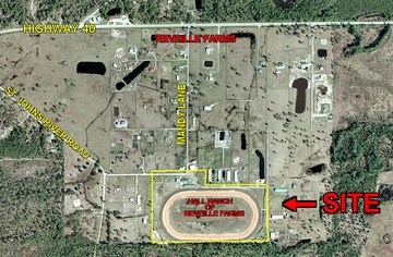
28-15-28 RETENTION AREA & TROTTER TRACK UNNUMBERED LOT REVEILLE FARMS UNREC SUB #1507 PER OR 4588 PG 4514 PER OR 5427 PG 3138 PER OR 6294 PG 1466 PER OR 6294 PG 1469 PER OR 7274 PG 2033
5828-02-00-0230
VOLUSIA
Recreationalacreage
Florida
PUD
18a
B and X Area of moderate flood hazard, usually the area between the limits of the 100-year and 500-year floods.
31.21 AC
2025
NW Volusia County
2026
Deltona/Daytona Beach
090102
NEARBY LISTINGS FOR SALE OR LEASE
DEMOGRAPHICS near 1245 Mandy Ln
1 mile
3 mile
5 mile
2025 Total Population
155
3,830
5,578
2030 Population
170
4,393
6,317
Pop Growth 2025-2030
+ 9.68%
+ 14.70%
+ 13.25%
Average Age
47
48
47
2025 Total Households
67
1,680
2,351
HH Growth 2025-2030
+ 8.96%
+ 14.82%
+ 13.53%
Median Household Inc
$76,786
$59,288
$59,220
Avg Household Size
2.20
2.20
2.30
2025 Avg HH Vehicles
2.00
2.00
2.00
Median Home Value
$418,750
$196,259
$222,128
Median Year Built
1985
1982
1982
Nearby Places
Map Layers
Map Styles
 Street
 Aerial
Transit
 Traffic
 Biking
Places
Listings with unknown addresses are not visible on the map
- Restaurants
- Banks
- Shops
- Fitness
- Groceries
PUBLIC TRANSPORTATION
AIRPORT
Daytona Beach International
Drive
Walk
Distance
Daytona Beach International
49 min
34.2 mi
Freight Ports
Port Canaveral
Drive
Walk
Distance
Port Canaveral
122 min
96.4 mi
Nearby Properties
Address
Land Use
TOTAL SIZE
Lot Size
Zoning
Address
Land Use
TOTAL SIZE
Lot Size
Zoning
3,812 SF
86.64 AC
01B7
Address
Land Use
TOTAL SIZE
Lot Size
Zoning
397.63 AC
A
Address
Land Use
TOTAL SIZE
Lot Size
Zoning
18,998 SF
2.33 AC
B7
Address
Land Use
TOTAL SIZE
Lot Size
Zoning
560.44 AC
A
Address
Land Use
TOTAL SIZE
Lot Size
Zoning
563.26 AC
A
Address
Land Use
TOTAL SIZE
Lot Size
Zoning
14,088 SF
7.10 AC
01B7
Address
Land Use
TOTAL SIZE
Lot Size
Zoning
23,264 SF
2.46 AC
CFD
Address
Land Use
TOTAL SIZE
Lot Size
Zoning
2,247 SF
11.08 AC
A
Address
Land Use
TOTAL SIZE
Lot Size
Zoning
310.01 AC
A
Address
Land Use
TOTAL SIZE
Lot Size
Zoning
1,216 SF
715.69 AC
FR
Address
Land Use
TOTAL SIZE
Lot Size
Zoning
715.31 AC
FR
Address
Land Use
TOTAL SIZE
Lot Size
Zoning
643.98 AC
C
Address
Land Use
TOTAL SIZE
Lot Size
Zoning
633.01 AC
RC
Address
Land Use
TOTAL SIZE
Lot Size
Zoning
205.89 AC
A
Address
Land Use
TOTAL SIZE
Lot Size
Zoning
16,638 SF
125 AC
A1
Address
Land Use
TOTAL SIZE
Lot Size
Zoning
656.86 AC
C
Address
Land Use
TOTAL SIZE
Lot Size
Zoning
472.71 AC
C
Address
Land Use
TOTAL SIZE
Lot Size
Zoning
6,480 SF
0.73 AC
C1
Address
Land Use
TOTAL SIZE
Lot Size
Zoning
6,464 SF
1.02 AC
B4
Address
Land Use
TOTAL SIZE
Lot Size
Zoning
409.45 AC
C
Address
Land Use
TOTAL SIZE
Lot Size
Zoning
16,524 SF
1.31 AC
CP
Address
Land Use
TOTAL SIZE
Lot Size
Zoning
864 SF
0.55 AC
01MH5
Address
Land Use
TOTAL SIZE
Lot Size
Zoning
9,230 SF
4.26 AC
CP
Address
Land Use
TOTAL SIZE
Lot Size
Zoning
365.32 AC
RC
Address
Land Use
TOTAL SIZE
Lot Size
Zoning
509.46 AC
RC
Address
Land Use
TOTAL SIZE
Lot Size
Zoning
463.30 AC
FR
Address
Land Use
TOTAL SIZE
Lot Size
Zoning
347.72 AC
C
Address
Land Use
TOTAL SIZE
Lot Size
Zoning
453.16 AC
FR
Address
Land Use
TOTAL SIZE
Lot Size
Zoning
4,672 SF
1.10 AC
R6
Address
Land Use
TOTAL SIZE
Lot Size
Zoning
1,248 SF
48 AC
A1
The World's #1 Commercial Real Estate Marketplace
Connect with us
© 2026 CoStar Group
The information above has been obtained from sources believed reliable. While we do not doubt its accuracy we have not verified it and make no guarantee, warranty or representation about it. It is your responsibility to independently confirm its accuracy and completeness. Any projections, opinions, assumptions, or estimates used are for example only and do not represent the current or future performance of the property. The value of this transaction to you depends on tax and other factors which should be evaluated by your tax, financial, and legal advisors. You and your advisors should conduct a careful, independent investigation of the property to determine to your satisfaction the suitability of the property for your needs.