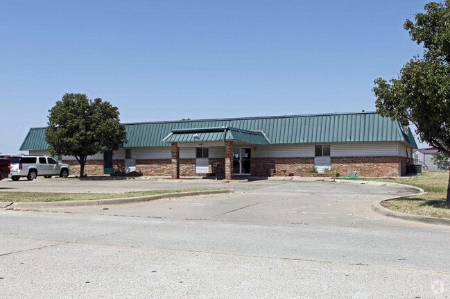
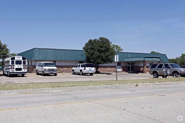
Property Record
1245 N Robinson Ave, Moore, OK 73170

Property Detail
1245 N Robinson Ave
Oklahoma City, OK
JAMESTOWN SQUARE SHOPS LOT A LESS SOUTHERN 1 OF LT A
R0191203
CLEVELAND
Commercialacreage
Oklahoma
C3
a
B and X Area of moderate flood hazard, usually the area between the limits of the 100-year and 500-year floods.
0.95 AC
2025
Moore
2025
Oklahoma City
201612
NEARBY LISTINGS FOR SALE OR LEASE
DEMOGRAPHICS near 1245 N Robinson Ave
1 mile
3 mile
5 mile
2024 Total Population
14,863
92,283
176,782
2029 Population
15,039
93,620
179,548
Pop Growth 2024-2029
+ 1.18%
+ 1.45%
+ 1.56%
Average Age
39
39
38
2024 Total Households
5,837
36,269
67,164
HH Growth 2024-2029
+ 1.30%
+ 1.62%
+ 1.71%
Median Household Inc
$68,321
$71,819
$68,436
Avg Household Size
2.50
2.50
2.60
2024 Avg HH Vehicles
2.00
2.00
2.00
Median Home Value
$176,321
$225,317
$213,411
Median Year Built
1983
1987
1984
Nearby Places
Map Layers
Map Styles
 Street
 Aerial
Transit
 Traffic
 Biking
Places
Listings with unknown addresses are not visible on the map
- Restaurants
- Banks
- Shops
- Fitness
- Groceries
PUBLIC TRANSPORTATION
COMMUTER RAIL
Oklahoma City (Heartland Flyer - Amtrak)
Drive
Walk
Distance
Oklahoma City (Heartland Flyer - Amtrak)
15 min
9.1 mi
AIRPORT
Will Rogers World
Drive
Walk
Distance
Will Rogers World
21 min
10.1 mi
Freight Ports
Tulsa Port Of Catoosa
Drive
Walk
Distance
Tulsa Port Of Catoosa
146 min
132.2 mi
Nearby Properties
Address
Land Use
TOTAL SIZE
Lot Size
Zoning
Address
Land Use
TOTAL SIZE
Lot Size
Zoning
50.08 AC
Address
Land Use
TOTAL SIZE
Lot Size
Zoning
40.15 AC
AA
Address
Land Use
TOTAL SIZE
Lot Size
Zoning
1,600 SF
25 AC
Address
Land Use
TOTAL SIZE
Lot Size
Zoning
Address
Land Use
TOTAL SIZE
Lot Size
Zoning
125,954 SF
11.92 AC
R4
Address
Land Use
TOTAL SIZE
Lot Size
Zoning
2,123 SF
53.41 AC
C3
Address
Land Use
TOTAL SIZE
Lot Size
Zoning
155.94 AC
Address
Land Use
TOTAL SIZE
Lot Size
Zoning
3,246 SF
10 AC
Address
Land Use
TOTAL SIZE
Lot Size
Zoning
Address
Land Use
TOTAL SIZE
Lot Size
Zoning
44,478 SF
2.44 AC
Address
Land Use
TOTAL SIZE
Lot Size
Zoning
Address
Land Use
TOTAL SIZE
Lot Size
Zoning
31,216 SF
10 AC
Address
Land Use
TOTAL SIZE
Lot Size
Zoning
11.36 AC
C4
Address
Land Use
TOTAL SIZE
Lot Size
Zoning
57,536 SF
66.21 AC
R4
Address
Land Use
TOTAL SIZE
Lot Size
Zoning
10.81 AC
Address
Land Use
TOTAL SIZE
Lot Size
Zoning
15.61 AC
C1
Address
Land Use
TOTAL SIZE
Lot Size
Zoning
10 AC
R2
Address
Land Use
TOTAL SIZE
Lot Size
Zoning
Address
Land Use
TOTAL SIZE
Lot Size
Zoning
Address
Land Use
TOTAL SIZE
Lot Size
Zoning
Address
Land Use
TOTAL SIZE
Lot Size
Zoning
347,050 SF
18.56 AC
Address
Land Use
TOTAL SIZE
Lot Size
Zoning
40.90 AC
Address
Land Use
TOTAL SIZE
Lot Size
Zoning
70.01 AC
Address
Land Use
TOTAL SIZE
Lot Size
Zoning
104.87 AC
Address
Land Use
TOTAL SIZE
Lot Size
Zoning
Address
Land Use
TOTAL SIZE
Lot Size
Zoning
29.38 AC
Address
Land Use
TOTAL SIZE
Lot Size
Zoning
58,503 SF
3.63 AC
C1
Address
Land Use
TOTAL SIZE
Lot Size
Zoning
1.85 AC
Address
Land Use
TOTAL SIZE
Lot Size
Zoning
14,714 SF
14.41 AC
Address
Land Use
TOTAL SIZE
Lot Size
Zoning
403,745 SF
26.03 AC
I-3
The World's #1 Commercial Real Estate Marketplace
Connect with us
© 2026 CoStar Group
The information above has been obtained from sources believed reliable. While we do not doubt its accuracy we have not verified it and make no guarantee, warranty or representation about it. It is your responsibility to independently confirm its accuracy and completeness. Any projections, opinions, assumptions, or estimates used are for example only and do not represent the current or future performance of the property. The value of this transaction to you depends on tax and other factors which should be evaluated by your tax, financial, and legal advisors. You and your advisors should conduct a careful, independent investigation of the property to determine to your satisfaction the suitability of the property for your needs.