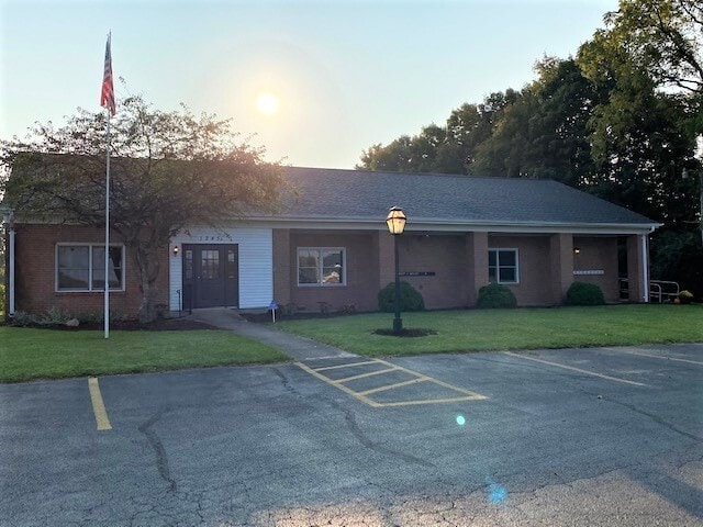
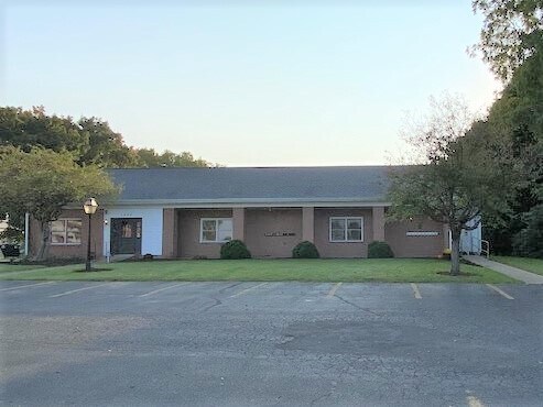
Property Record
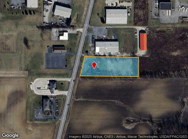
1245 State Route 598, Galion, OH 44833
NEARBY LISTINGS FOR SALE OR LEASE
Property Detail
1245 State Route 598
19-0008511.000
PCL ANNEXED FROM PCL 310008511000 OL 720 BK 1044PG 314 PB PG
Officebuilding
Crawford
X
Ohio
39033C0256E
2.54 AC
2025
Ohio North Area
2024
Other Market Areas
975000
Bucyrus, OH
5,940 SF
DEMOGRAPHICS near 1245 State Route 598
1 Mile
3 Mile
5 Mile
2024 Total Population
3,141
13,550
20,797
2029 Population
3,119
13,476
20,685
Pop Growth 2024-2029
(0.70%)
(0.55%)
(0.54%)
Average Age
43
43
42
2024 Total Households
1,342
5,842
8,929
HH Growth 2024-2029
(0.75%)
(0.55%)
(0.56%)
Median Household Inc
$51,762
$44,735
$48,361
Avg Household Size
2.30
2.20
2.30
2024 Avg HH Vehicles
2.00
2.00
2.00
Median Home Value
$109,868
$95,235
$103,285
Median Year Built
1960
1957
1959
Nearby Places
Map Layers
Map Styles
 Street
 Aerial
- Restaurants
- Banks
- Shops
- Fitness
- Groceries
SALE & LEASE HISTORY
LISTING DATE
SALE/LEASE

Oct 16, 2020
For Sale
Feb 10, 2023
For Lease
Nearby Properties
Address
Land Use
TOTAL SIZE
Lot Size
Zoning
Address
Land Use
TOTAL SIZE
Lot Size
Zoning
29.65 AC
Address
Land Use
TOTAL SIZE
Lot Size
Zoning
9.01 AC
Address
Land Use
TOTAL SIZE
Lot Size
Zoning
22,674 SF
10.44 AC
Address
Land Use
TOTAL SIZE
Lot Size
Zoning
19.16 AC
Address
Land Use
TOTAL SIZE
Lot Size
Zoning
18,703 SF
3.59 AC
Address
Land Use
TOTAL SIZE
Lot Size
Zoning
3.24 AC
Address
Land Use
TOTAL SIZE
Lot Size
Zoning
35,112 SF
4.27 AC
Address
Land Use
TOTAL SIZE
Lot Size
Zoning
41,715 SF
10.43 AC
Address
Land Use
TOTAL SIZE
Lot Size
Zoning
59.77 AC
Address
Land Use
TOTAL SIZE
Lot Size
Zoning
22,607 SF
3.57 AC
Address
Land Use
TOTAL SIZE
Lot Size
Zoning
73.41 AC
Address
Land Use
TOTAL SIZE
Lot Size
Zoning
8.55 AC
Address
Land Use
TOTAL SIZE
Lot Size
Zoning
Address
Land Use
TOTAL SIZE
Lot Size
Zoning
17,734 SF
4.44 AC
Address
Land Use
TOTAL SIZE
Lot Size
Zoning
20,565 SF
0.45 AC
Address
Land Use
TOTAL SIZE
Lot Size
Zoning
16,736 SF
0.41 AC
Address
Land Use
TOTAL SIZE
Lot Size
Zoning
62,400 SF
2.34 AC
Address
Land Use
TOTAL SIZE
Lot Size
Zoning
3.83 AC
Address
Land Use
TOTAL SIZE
Lot Size
Zoning
16.18 AC
Address
Land Use
TOTAL SIZE
Lot Size
Zoning
1.74 AC
Address
Land Use
TOTAL SIZE
Lot Size
Zoning
Address
Land Use
TOTAL SIZE
Lot Size
Zoning
50,460 SF
5.25 AC
Address
Land Use
TOTAL SIZE
Lot Size
Zoning
5.76 AC
Address
Land Use
TOTAL SIZE
Lot Size
Zoning
25,315 SF
0.60 AC
Address
Land Use
TOTAL SIZE
Lot Size
Zoning
0.29 AC
Address
Land Use
TOTAL SIZE
Lot Size
Zoning
18,982 SF
0.30 AC
Address
Land Use
TOTAL SIZE
Lot Size
Zoning
0.29 AC
Address
Land Use
TOTAL SIZE
Lot Size
Zoning
11.24 AC
Address
Land Use
TOTAL SIZE
Lot Size
Zoning
10,220 SF
4.11 AC
Address
Land Use
TOTAL SIZE
Lot Size
Zoning
16,910 SF
1 AC
The World's #1 Commercial Real Estate Marketplace
Connect with us
© 2025 CoStar Group
The information above has been obtained from sources believed reliable. While we do not doubt its accuracy we have not verified it and make no guarantee, warranty or representation about it. It is your responsibility to independently confirm its accuracy and completeness. Any projections, opinions, assumptions, or estimates used are for example only and do not represent the current or future performance of the property. The value of this transaction to you depends on tax and other factors which should be evaluated by your tax, financial, and legal advisors. You and your advisors should conduct a careful, independent investigation of the property to determine to your satisfaction the suitability of the property for your needs.