Property Record
12450 Walker Rd, Lemont, IL 60439
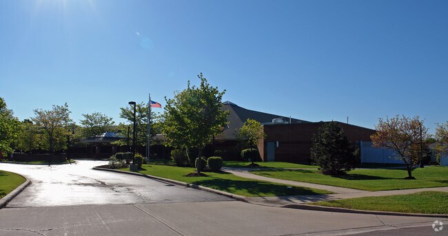

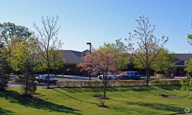

Property Detail
12450 Walker Rd
22-27-300-076-0000
DuPage
Commercialnec
Illinois
B and X Area of moderate flood hazard, usually the area between the limits of the 100-year and 500-year floods.
1
2023
5.15 AC
2025
Joliet/Central Will
824003
Chicago
74,782 SF
Chicago-Naperville-Elgin, IL-IN
NEARBY LISTINGS FOR SALE OR LEASE
DEMOGRAPHICS near 12450 Walker Rd
1 mile
3 mile
5 mile
2025 Total Population
6,183
32,311
81,205
2030 Population
6,281
32,902
82,752
Pop Growth 2025-2030
+ 1.58%
+ 1.83%
+ 1.91%
Average Age
45
44
43
2025 Total Households
2,165
11,593
28,762
HH Growth 2025-2030
+ 1.25%
+ 1.62%
+ 1.83%
Median Household Inc
$118,389
$124,211
$117,674
Avg Household Size
2.70
2.70
2.80
2025 Avg HH Vehicles
2.00
2.00
2.00
Median Home Value
$492,239
$450,505
$424,657
Median Year Built
1995
1990
1989
Nearby Places
Map Layers
Map Styles
 Street
 Aerial
Layers
 Traffic
 Biking
Places
Listings with unknown addresses are not visible on the map
- Restaurants
- Banks
- Shops
- Fitness
- Groceries
PUBLIC TRANSPORTATION
COMMUTER RAIL
Lemont Station (Heritage Corridor Line - Northeast Illinois Regional Commuter Railroad (Metra))
Drive
Walk
Distance
Lemont Station (Heritage Corridor Line - Northeast Illinois Regional Commuter Railroad (Metra))
4 min
2.0 mi
Romeoville (Heritage Corridor - Metra)
Drive
Walk
Distance
Romeoville (Heritage Corridor - Metra)
12 min
5.9 mi
AIRPORT
Chicago Midway International
Drive
Walk
Distance
Chicago Midway International
27 min
18.1 mi
Chicago O'Hare International
Drive
Walk
Distance
Chicago O'Hare International
44 min
29.6 mi
Freight Ports
Port Milwaukee
Drive
Walk
Distance
Port Milwaukee
125 min
101.3 mi
Nearby Properties
Address
Land Use
TOTAL SIZE
Lot Size
Zoning
Address
Land Use
TOTAL SIZE
Lot Size
Zoning
264,310 SF
12.21 AC
I
Address
Land Use
TOTAL SIZE
Lot Size
Zoning
18.82 AC
Address
Land Use
TOTAL SIZE
Lot Size
Zoning
8,577 SF
160 AC
Address
Land Use
TOTAL SIZE
Lot Size
Zoning
119,270 SF
7 AC
I
Address
Land Use
TOTAL SIZE
Lot Size
Zoning
13.73 AC
Address
Land Use
TOTAL SIZE
Lot Size
Zoning
166,107 SF
16.17 AC
Address
Land Use
TOTAL SIZE
Lot Size
Zoning
153,050 SF
8.95 AC
Address
Land Use
TOTAL SIZE
Lot Size
Zoning
24.85 AC
Address
Land Use
TOTAL SIZE
Lot Size
Zoning
89,686 SF
5.50 AC
Address
Land Use
TOTAL SIZE
Lot Size
Zoning
97,113 SF
44.53 AC
Address
Land Use
TOTAL SIZE
Lot Size
Zoning
70,848 SF
8.40 AC
Address
Land Use
TOTAL SIZE
Lot Size
Zoning
15.21 AC
Address
Land Use
TOTAL SIZE
Lot Size
Zoning
67,229 SF
8.83 AC
Address
Land Use
TOTAL SIZE
Lot Size
Zoning
122,052 SF
11.61 AC
Address
Land Use
TOTAL SIZE
Lot Size
Zoning
119,012 SF
10.84 AC
Address
Land Use
TOTAL SIZE
Lot Size
Zoning
38,882 SF
4.79 AC
Address
Land Use
TOTAL SIZE
Lot Size
Zoning
8.24 AC
Address
Land Use
TOTAL SIZE
Lot Size
Zoning
20,068 SF
24.55 AC
Address
Land Use
TOTAL SIZE
Lot Size
Zoning
38,950 SF
4.82 AC
Address
Land Use
TOTAL SIZE
Lot Size
Zoning
1.96 AC
Address
Land Use
TOTAL SIZE
Lot Size
Zoning
74,888 SF
Address
Land Use
TOTAL SIZE
Lot Size
Zoning
86,814 SF
8.91 AC
Address
Land Use
TOTAL SIZE
Lot Size
Zoning
2.07 AC
Address
Land Use
TOTAL SIZE
Lot Size
Zoning
4.19 AC
Address
Land Use
TOTAL SIZE
Lot Size
Zoning
24,707 SF
2.69 AC
I
Address
Land Use
TOTAL SIZE
Lot Size
Zoning
1.09 AC
Address
Land Use
TOTAL SIZE
Lot Size
Zoning
1,625 SF
0.82 AC
Address
Land Use
TOTAL SIZE
Lot Size
Zoning
2,066 SF
2 AC
Address
Land Use
TOTAL SIZE
Lot Size
Zoning
2.33 AC
The World's #1 Commercial Real Estate Marketplace
Connect with us
© 2026 CoStar Group
The information above has been obtained from sources believed reliable. While we do not doubt its accuracy we have not verified it and make no guarantee, warranty or representation about it. It is your responsibility to independently confirm its accuracy and completeness. Any projections, opinions, assumptions, or estimates used are for example only and do not represent the current or future performance of the property. The value of this transaction to you depends on tax and other factors which should be evaluated by your tax, financial, and legal advisors. You and your advisors should conduct a careful, independent investigation of the property to determine to your satisfaction the suitability of the property for your needs.