Property Record
12460 Network Blvd, San Antonio, TX 78249
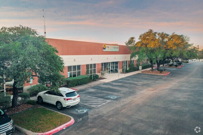

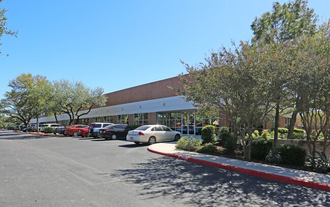
Property Detail
12460 Network Blvd
San Antonio-New Braunfels, TX
NCB 17386 BLK 1 LOT 5 (NETWORK TECH CTR III) 2017-RECOVERED ACCT PER CR #41447 REQ BY A. SOLIS. LR/GIS/4-6-17. 2017-DELETE ACCT PER MERGE PER CR #40152. SEE ACCT: 999387. LR/GIS/10-14-16. PLAT 9562/96
17386-001-0050
BEXAR
Officebuilding
Texas
B and X Area of moderate flood hazard, usually the area between the limits of the 100-year and 500-year floods.
3
2024
3.31 AC
2025
Northwest
181815
San Antonio
34,290 SF
NEARBY LISTINGS FOR SALE OR LEASE
DEMOGRAPHICS near 12460 Network Blvd
1 mile
3 mile
5 mile
2025 Total Population
12,719
133,188
317,601
2030 Population
13,374
140,113
333,589
Pop Growth 2025-2030
+ 5.15%
+ 5.20%
+ 5.03%
Average Age
36
36
37
2025 Total Households
6,175
58,792
136,640
HH Growth 2025-2030
+ 5.44%
+ 5.46%
+ 5.33%
Median Household Inc
$62,510
$65,533
$66,328
Avg Household Size
2.00
2.20
2.30
2025 Avg HH Vehicles
2.00
2.00
2.00
Median Home Value
$329,542
$313,295
$320,903
Median Year Built
1995
1991
1989
Nearby Places
Map Layers
Map Styles
 Street
 Aerial
Layers
 Traffic
 Biking
Places
Listings with unknown addresses are not visible on the map
- Restaurants
- Banks
- Shops
- Fitness
- Groceries
PUBLIC TRANSPORTATION
AIRPORT
San Antonio International
Drive
Walk
Distance
San Antonio International
15 min
9.7 mi
Freight Ports
Calhoun Port
Drive
Walk
Distance
Calhoun Port
197 min
160.5 mi
SALE & LEASE HISTORY
LISTING DATE
SALE/LEASE

Sep 25, 2016
For Lease
Jan 30, 2023
For Sale
Feb 06, 2024
For Sale
Aug 02, 2019
For Lease
Nearby Properties
Address
Land Use
TOTAL SIZE
Lot Size
Zoning
Address
Land Use
TOTAL SIZE
Lot Size
Zoning
4,465,972 SF
231.60 AC
Address
Land Use
TOTAL SIZE
Lot Size
Zoning
940,089 SF
63.74 AC
Address
Land Use
TOTAL SIZE
Lot Size
Zoning
499,480 SF
19.57 AC
Address
Land Use
TOTAL SIZE
Lot Size
Zoning
609,267 SF
30.47 AC
Address
Land Use
TOTAL SIZE
Lot Size
Zoning
227,586 SF
25.46 AC
Address
Land Use
TOTAL SIZE
Lot Size
Zoning
462,227 SF
31.21 AC
Address
Land Use
TOTAL SIZE
Lot Size
Zoning
429,561 SF
25.70 AC
Address
Land Use
TOTAL SIZE
Lot Size
Zoning
300,264 SF
27.81 AC
Address
Land Use
TOTAL SIZE
Lot Size
Zoning
331,715 SF
9.04 AC
Address
Land Use
TOTAL SIZE
Lot Size
Zoning
389,048 SF
16.25 AC
Address
Land Use
TOTAL SIZE
Lot Size
Zoning
320,406 SF
12.11 AC
Address
Land Use
TOTAL SIZE
Lot Size
Zoning
305,497 SF
9.99 AC
Address
Land Use
TOTAL SIZE
Lot Size
Zoning
395,039 SF
31 AC
Address
Land Use
TOTAL SIZE
Lot Size
Zoning
6,809 SF
9.04 AC
Address
Land Use
TOTAL SIZE
Lot Size
Zoning
352,231 SF
19.54 AC
Address
Land Use
TOTAL SIZE
Lot Size
Zoning
238,999 SF
8.43 AC
Address
Land Use
TOTAL SIZE
Lot Size
Zoning
724,148 SF
18.70 AC
Address
Land Use
TOTAL SIZE
Lot Size
Zoning
306,959 SF
15.24 AC
Address
Land Use
TOTAL SIZE
Lot Size
Zoning
152,266 SF
18.72 AC
Address
Land Use
TOTAL SIZE
Lot Size
Zoning
183,249 SF
21.94 AC
Address
Land Use
TOTAL SIZE
Lot Size
Zoning
520,686 SF
53.63 AC
Address
Land Use
TOTAL SIZE
Lot Size
Zoning
349,074 SF
27.84 AC
Address
Land Use
TOTAL SIZE
Lot Size
Zoning
280,198 SF
15.96 AC
Address
Land Use
TOTAL SIZE
Lot Size
Zoning
331,778 SF
20.62 AC
Address
Land Use
TOTAL SIZE
Lot Size
Zoning
301,817 SF
12.22 AC
Address
Land Use
TOTAL SIZE
Lot Size
Zoning
284,890 SF
18.83 AC
Address
Land Use
TOTAL SIZE
Lot Size
Zoning
352,208 SF
13.95 AC
Address
Land Use
TOTAL SIZE
Lot Size
Zoning
121,989 SF
18.03 AC
Address
Land Use
TOTAL SIZE
Lot Size
Zoning
171,316 SF
14.20 AC
Address
Land Use
TOTAL SIZE
Lot Size
Zoning
277,688 SF
16.42 AC
The World's #1 Commercial Real Estate Marketplace
Connect with us
© 2026 CoStar Group
The information above has been obtained from sources believed reliable. While we do not doubt its accuracy we have not verified it and make no guarantee, warranty or representation about it. It is your responsibility to independently confirm its accuracy and completeness. Any projections, opinions, assumptions, or estimates used are for example only and do not represent the current or future performance of the property. The value of this transaction to you depends on tax and other factors which should be evaluated by your tax, financial, and legal advisors. You and your advisors should conduct a careful, independent investigation of the property to determine to your satisfaction the suitability of the property for your needs.