Property Record
1247 Glenn St, Cayce, SC 29033
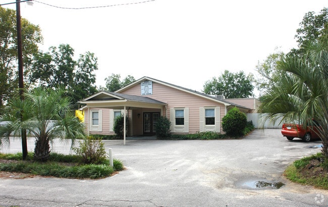

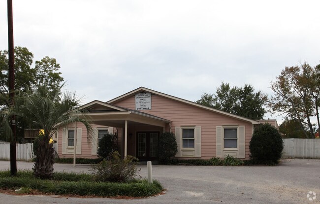
Property Detail
1247 Glenn St
Daycare
Lexington
C3
South Carolina
B and X Area of moderate flood hazard, usually the area between the limits of the 100-year and 500-year floods.
0.50 AC
2025
Cayce/West Columbia
2024
Columbia
020202
Columbia, SC
4,312 SF
005745-06-003
NEARBY LISTINGS FOR SALE OR LEASE
DEMOGRAPHICS near 1247 Glenn St
1 mile
3 mile
5 mile
2025 Total Population
6,107
43,727
114,635
2030 Population
6,377
45,847
119,922
Pop Growth 2025-2030
+ 4.42%
+ 4.85%
+ 4.61%
Average Age
41
38
37
2025 Total Households
2,713
18,844
50,590
HH Growth 2025-2030
+ 4.64%
+ 5.21%
+ 4.98%
Median Household Inc
$44,999
$51,940
$55,209
Avg Household Size
2.20
2.10
2.00
2025 Avg HH Vehicles
2.00
2.00
2.00
Median Home Value
$153,235
$189,121
$222,628
Median Year Built
1966
1973
1977
Nearby Places
Map Layers
Map Styles
 Street
 Aerial
Layers
 Traffic
 Biking
Places
Listings with unknown addresses are not visible on the map
- Restaurants
- Banks
- Shops
- Fitness
- Groceries
PUBLIC TRANSPORTATION
COMMUTER RAIL
Columbia Amtrak Station (Silver Star - Amtrak)
Drive
Walk
Distance
Columbia Amtrak Station (Silver Star - Amtrak)
8 min
4.2 mi
AIRPORT
Columbia Metro
Drive
Walk
Distance
Columbia Metro
15 min
5.5 mi
Freight Ports
North Charleston Terminal
Drive
Walk
Distance
North Charleston Terminal
114 min
101.1 mi
Nearby Properties
Address
Land Use
TOTAL SIZE
Lot Size
Zoning
Address
Land Use
TOTAL SIZE
Lot Size
Zoning
375,417 SF
3.92 AC
INS-GEN
Address
Land Use
TOTAL SIZE
Lot Size
Zoning
311,168 SF
3.98 AC
MC
Address
Land Use
TOTAL SIZE
Lot Size
Zoning
490,633 SF
13.20 AC
RM-2
Address
Land Use
TOTAL SIZE
Lot Size
Zoning
352,672 SF
5.16 AC
MC
Address
Land Use
TOTAL SIZE
Lot Size
Zoning
155,883 SF
2.74 AC
MC
Address
Land Use
TOTAL SIZE
Lot Size
Zoning
22,802 SF
2.64 AC
MC
Address
Land Use
TOTAL SIZE
Lot Size
Zoning
4.85 AC
MC
Address
Land Use
TOTAL SIZE
Lot Size
Zoning
121,560 SF
8.46 AC
RM-2
Address
Land Use
TOTAL SIZE
Lot Size
Zoning
196,800 SF
5.83 AC
HI
Address
Land Use
TOTAL SIZE
Lot Size
Zoning
12.50 AC
PD
Address
Land Use
TOTAL SIZE
Lot Size
Zoning
99,720 SF
3.81 AC
MC
Address
Land Use
TOTAL SIZE
Lot Size
Zoning
103,476 SF
2.04 AC
MC
Address
Land Use
TOTAL SIZE
Lot Size
Zoning
152,064 SF
9.58 AC
RM-2
Address
Land Use
TOTAL SIZE
Lot Size
Zoning
158,976 SF
11.28 AC
RM-2
Address
Land Use
TOTAL SIZE
Lot Size
Zoning
686,209 SF
1.73 AC
RM-2
Address
Land Use
TOTAL SIZE
Lot Size
Zoning
237 AC
HI
Address
Land Use
TOTAL SIZE
Lot Size
Zoning
0.46 AC
C-1
Address
Land Use
TOTAL SIZE
Lot Size
Zoning
100,548 SF
1.76 AC
PD
Address
Land Use
TOTAL SIZE
Lot Size
Zoning
58,179 SF
2.63 AC
RAC
Address
Land Use
TOTAL SIZE
Lot Size
Zoning
100 SF
9.14 AC
C-1
Address
Land Use
TOTAL SIZE
Lot Size
Zoning
123,381 SF
1.59 AC
PD
Address
Land Use
TOTAL SIZE
Lot Size
Zoning
8,002 SF
2.43 AC
PD
Address
Land Use
TOTAL SIZE
Lot Size
Zoning
56,245 SF
2.75 AC
RM-2
Address
Land Use
TOTAL SIZE
Lot Size
Zoning
96,857 SF
3.84 AC
PD
Address
Land Use
TOTAL SIZE
Lot Size
Zoning
31,130 SF
2.16 AC
RAC
Address
Land Use
TOTAL SIZE
Lot Size
Zoning
55,640 SF
2.57 AC
MC
Address
Land Use
TOTAL SIZE
Lot Size
Zoning
39,172 SF
2.30 AC
RG-2
Address
Land Use
TOTAL SIZE
Lot Size
Zoning
14.88 AC
PD
Address
Land Use
TOTAL SIZE
Lot Size
Zoning
4.13 AC
M-1
Address
Land Use
TOTAL SIZE
Lot Size
Zoning
15,350 SF
1.06 AC
RS-3
The World's #1 Commercial Real Estate Marketplace
Connect with us
© 2026 CoStar Group
The information above has been obtained from sources believed reliable. While we do not doubt its accuracy we have not verified it and make no guarantee, warranty or representation about it. It is your responsibility to independently confirm its accuracy and completeness. Any projections, opinions, assumptions, or estimates used are for example only and do not represent the current or future performance of the property. The value of this transaction to you depends on tax and other factors which should be evaluated by your tax, financial, and legal advisors. You and your advisors should conduct a careful, independent investigation of the property to determine to your satisfaction the suitability of the property for your needs.