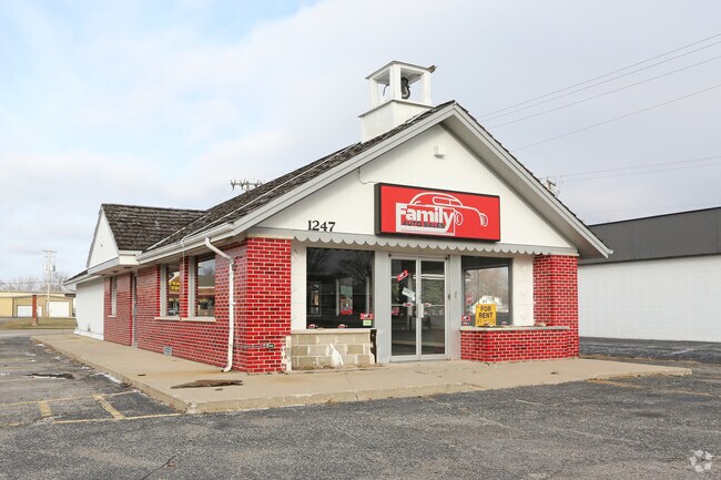
Property Record
1247 Milton Ave, Janesville, WI 53545

NEARBY LISTINGS FOR SALE OR LEASE
Property Detail
1247 Milton Ave
Janesville-Beloit, WI
Northgate Park
023-0100106
NORTHGATE PARK ADD. LOT 20JC510089400006
Sfr
Rock
X
Wisconsin
55105C0184E
20
2024
0.55 AC
2024
Rock County
000600
Milwaukee/Madison
1,820 SF
DEMOGRAPHICS near 1247 Milton Ave
1 Mile
3 Mile
5 Mile
2024 Total Population
9,331
53,357
69,777
2029 Population
9,421
53,909
70,498
Pop Growth 2024-2029
+ 0.96%
+ 1.03%
+ 1.03%
Average Age
41
41
41
2024 Total Households
4,063
22,478
28,808
HH Growth 2024-2029
+ 0.96%
+ 1.07%
+ 1.06%
Median Household Inc
$60,476
$64,485
$67,415
Avg Household Size
2.20
2.30
2.30
2024 Avg HH Vehicles
2.00
2.00
2.00
Median Home Value
$156,997
$185,377
$190,287
Median Year Built
1958
1970
1972
Nearby Places
Map Layers
Map Styles
 Street
 Aerial
- Restaurants
- Banks
- Shops
- Fitness
- Groceries
PUBLIC TRANSPORTATION
AIRPORT
Dane County Regional/Truax Field
DRIVE
WALK
Distance
Dane County Regional/Truax Field
50 min
40.6 mi
Chicago/Rockford International
DRIVE
WALK
Distance
Chicago/Rockford International
59 min
44.8 mi
Nearby Properties
Address
Land Use
TOTAL SIZE
Lot Size
Zoning
Address
Land Use
TOTAL SIZE
Lot Size
Zoning
32,518 SF
26.74 AC
B4
Address
Land Use
TOTAL SIZE
Lot Size
Zoning
31,064 SF
11.57 AC
R3
Address
Land Use
TOTAL SIZE
Lot Size
Zoning
12,620 SF
8.05 AC
R3
Address
Land Use
TOTAL SIZE
Lot Size
Zoning
48,110 SF
13.04 AC
R3
Address
Land Use
TOTAL SIZE
Lot Size
Zoning
16,959 SF
47.11 AC
M1
Address
Land Use
TOTAL SIZE
Lot Size
Zoning
135,322 SF
18.41 AC
B2
Address
Land Use
TOTAL SIZE
Lot Size
Zoning
2,800 SF
69 AC
M1
Address
Land Use
TOTAL SIZE
Lot Size
Zoning
18,480 SF
14.50 AC
O1
Address
Land Use
TOTAL SIZE
Lot Size
Zoning
70,000 SF
63.05 AC
M1
Address
Land Use
TOTAL SIZE
Lot Size
Zoning
183,339 SF
9.97 AC
B4
Address
Land Use
TOTAL SIZE
Lot Size
Zoning
77,811 SF
8.74 AC
B4
Address
Land Use
TOTAL SIZE
Lot Size
Zoning
98,370 SF
8.64 AC
B4
Address
Land Use
TOTAL SIZE
Lot Size
Zoning
175,991 SF
26.17 AC
B4
Address
Land Use
TOTAL SIZE
Lot Size
Zoning
7.52 AC
R3
Address
Land Use
TOTAL SIZE
Lot Size
Zoning
161,640 SF
20.71 AC
B4
Address
Land Use
TOTAL SIZE
Lot Size
Zoning
Address
Land Use
TOTAL SIZE
Lot Size
Zoning
14,580 SF
28.75 AC
M1
Address
Land Use
TOTAL SIZE
Lot Size
Zoning
42.07 AC
Address
Land Use
TOTAL SIZE
Lot Size
Zoning
134,515 SF
16.08 AC
B4
Address
Land Use
TOTAL SIZE
Lot Size
Zoning
17,183 SF
6.65 AC
B3
Address
Land Use
TOTAL SIZE
Lot Size
Zoning
24,960 SF
8.85 AC
B4
Address
Land Use
TOTAL SIZE
Lot Size
Zoning
12.42 AC
M1
Address
Land Use
TOTAL SIZE
Lot Size
Zoning
200,500 SF
22.73 AC
M1
Address
Land Use
TOTAL SIZE
Lot Size
Zoning
110,820 SF
10.62 AC
B4
Address
Land Use
TOTAL SIZE
Lot Size
Zoning
17.14 AC
M1
Address
Land Use
TOTAL SIZE
Lot Size
Zoning
111,847 SF
11.72 AC
B4
Address
Land Use
TOTAL SIZE
Lot Size
Zoning
1,020 SF
9.77 AC
B4
Address
Land Use
TOTAL SIZE
Lot Size
Zoning
2.30 AC
Address
Land Use
TOTAL SIZE
Lot Size
Zoning
10,534 SF
9.14 AC
B4
Address
Land Use
TOTAL SIZE
Lot Size
Zoning
101,195 SF
1.40 AC
B6
The World's #1 Commercial Real Estate Marketplace
Connect with us
© 2026 CoStar Group
The information above has been obtained from sources believed reliable. While we do not doubt its accuracy we have not verified it and make no guarantee, warranty or representation about it. It is your responsibility to independently confirm its accuracy and completeness. Any projections, opinions, assumptions, or estimates used are for example only and do not represent the current or future performance of the property. The value of this transaction to you depends on tax and other factors which should be evaluated by your tax, financial, and legal advisors. You and your advisors should conduct a careful, independent investigation of the property to determine to your satisfaction the suitability of the property for your needs.