Property Record
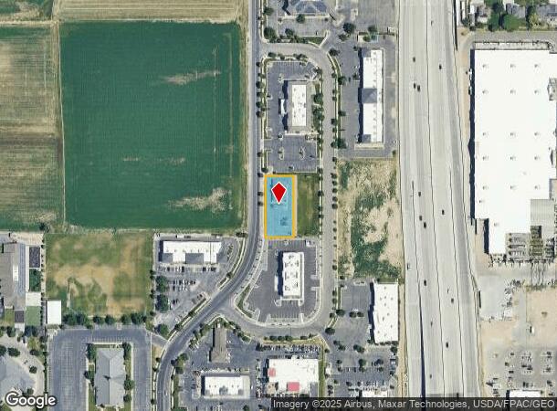
12487 S Pasture Rd, Riverton, UT 84096


NEARBY LISTINGS FOR SALE OR LEASE
Property Detail
12487 S Pasture Rd
Salt Lake City, UT
Riverton Crossing Commercial Subdivision
27-29-352-003-0000
LOT 13, RIVERTON CROSSING COMMERCIAL SUBDIVISION. 9258-6734 9270-4794
Restaurantbuilding
Salt Lake
X
Utah
49035C0438H
13
2024
0.42 AC
2025
Southwest Valley
113013
Salt Lake City
3,193 SF
DEMOGRAPHICS near 12487 S Pasture Rd
1 Mile
3 Mile
5 Mile
2024 Total Population
9,656
125,446
222,058
2029 Population
9,801
127,716
226,210
Pop Growth 2024-2029
+ 1.50%
+ 1.81%
+ 1.87%
Average Age
33
33
34
2024 Total Households
2,595
36,217
64,665
HH Growth 2024-2029
+ 1.43%
+ 1.79%
+ 1.85%
Median Household Inc
$126,502
$106,784
$107,506
Avg Household Size
3.70
3.40
3.40
2024 Avg HH Vehicles
2.00
2.00
2.00
Median Home Value
$514,352
$499,663
$529,903
Median Year Built
2005
2009
2007
Nearby Places
Map Layers
Map Styles
 Street
 Aerial
- Restaurants
- Banks
- Shops
- Fitness
- Groceries
PUBLIC TRANSPORTATION
COMMUTER RAIL
Draper Station (FrontRunner - Utah Transit Authority (UTA))
DRIVE
WALK
Distance
Draper Station (FrontRunner - Utah Transit Authority (UTA))
11 min
5.4 mi
South Jordan Station (FrontRunner - Utah Transit Authority (UTA))
DRIVE
WALK
Distance
South Jordan Station (FrontRunner - Utah Transit Authority (UTA))
14 min
7.5 mi
AIRPORT
Salt Lake City International
DRIVE
WALK
Distance
Salt Lake City International
28 min
18.8 mi
Provo Municipal
DRIVE
WALK
Distance
Provo Municipal
46 min
33.9 mi
Freight Ports
Port of Stockton
DRIVE
WALK
Distance
Port of Stockton
724 min
701.8 mi
SALE & LEASE HISTORY
LISTING DATE
SALE/LEASE

Mar 16, 2022
For Sale
Nearby Properties
Address
Land Use
TOTAL SIZE
Lot Size
Zoning
Address
Land Use
TOTAL SIZE
Lot Size
Zoning
540,554 SF
63.03 AC
C-R
Address
Land Use
TOTAL SIZE
Lot Size
Zoning
285,200 SF
55.78 AC
1210
Address
Land Use
TOTAL SIZE
Lot Size
Zoning
284,727 SF
26.33 AC
4144
Address
Land Use
TOTAL SIZE
Lot Size
Zoning
554,682 SF
30.25 AC
SLR-SP
Address
Land Use
TOTAL SIZE
Lot Size
Zoning
126,150 SF
25.43 AC
RM
Address
Land Use
TOTAL SIZE
Lot Size
Zoning
152,800 SF
85.55 AC
MU2
Address
Land Use
TOTAL SIZE
Lot Size
Zoning
591,044 SF
13.87 AC
C-2
Address
Land Use
TOTAL SIZE
Lot Size
Zoning
702,100 SF
13.83 AC
P-C
Address
Land Use
TOTAL SIZE
Lot Size
Zoning
73,318 SF
1.36 AC
PC
Address
Land Use
TOTAL SIZE
Lot Size
Zoning
269,342 SF
12.68 AC
MU-2
Address
Land Use
TOTAL SIZE
Lot Size
Zoning
323,922 SF
30.86 AC
PCC
Address
Land Use
TOTAL SIZE
Lot Size
Zoning
137,750 SF
12.64 AC
1210
Address
Land Use
TOTAL SIZE
Lot Size
Zoning
59,711 SF
4.77 AC
C-2
Address
Land Use
TOTAL SIZE
Lot Size
Zoning
425,753 SF
2.28 AC
PC
Address
Land Use
TOTAL SIZE
Lot Size
Zoning
398,447 SF
11.04 AC
BMHU
Address
Land Use
TOTAL SIZE
Lot Size
Zoning
333,331 SF
10.13 AC
MU-2
Address
Land Use
TOTAL SIZE
Lot Size
Zoning
348,043 SF
5.35 AC
PC
Address
Land Use
TOTAL SIZE
Lot Size
Zoning
100,474 SF
12.99 AC
R-M-18
Address
Land Use
TOTAL SIZE
Lot Size
Zoning
348,917 SF
6.23 AC
PC
Address
Land Use
TOTAL SIZE
Lot Size
Zoning
456,759 SF
28.63 AC
C-R
Address
Land Use
TOTAL SIZE
Lot Size
Zoning
311,093 SF
39.70 AC
C-2
Address
Land Use
TOTAL SIZE
Lot Size
Zoning
4.76 AC
PC
Address
Land Use
TOTAL SIZE
Lot Size
Zoning
232,874 SF
7.04 AC
RM-18
Address
Land Use
TOTAL SIZE
Lot Size
Zoning
227,345 SF
34.06 AC
M-1
Address
Land Use
TOTAL SIZE
Lot Size
Zoning
228,360 SF
41 AC
PCC
Address
Land Use
TOTAL SIZE
Lot Size
Zoning
272,200 SF
10.66 AC
SPRM18
Address
Land Use
TOTAL SIZE
Lot Size
Zoning
118.74 AC
4180
Address
Land Use
TOTAL SIZE
Lot Size
Zoning
292,006 SF
29.40 AC
1122
Address
Land Use
TOTAL SIZE
Lot Size
Zoning
335,803 SF
8.63 AC
C-D
Address
Land Use
TOTAL SIZE
Lot Size
Zoning
153,375 SF
23.23 AC
1144
The World's #1 Commercial Real Estate Marketplace
Connect with us
© 2025 CoStar Group
The information above has been obtained from sources believed reliable. While we do not doubt its accuracy we have not verified it and make no guarantee, warranty or representation about it. It is your responsibility to independently confirm its accuracy and completeness. Any projections, opinions, assumptions, or estimates used are for example only and do not represent the current or future performance of the property. The value of this transaction to you depends on tax and other factors which should be evaluated by your tax, financial, and legal advisors. You and your advisors should conduct a careful, independent investigation of the property to determine to your satisfaction the suitability of the property for your needs.