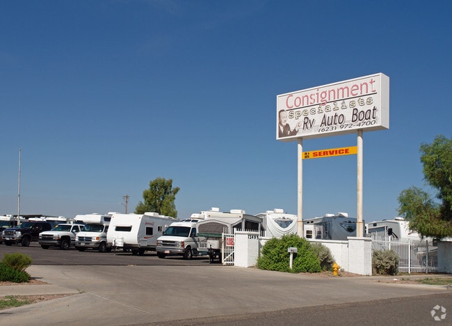
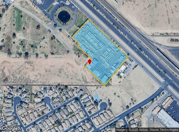
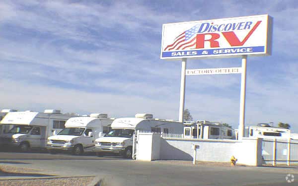
Property Record
12495 Nw Grand Ave, El Mirage, AZ 85335

NEARBY LISTINGS FOR SALE OR LEASE
Property Detail
12495 Nw Grand Ave
501-33-116D
TH POR NE4 SEC 11 DAF COM AT N4 COR SD SEC 11 TH E 607.24F TO PT ON W R/W LN GRAND ABE TH S 47D 07M E ALG SD R/W 862F TO POB TH S 47D 06M E 600.40F TH S 38D 23M W 414.84F TH N 47D 11M W 305.93F TH N 4 2D 19M E 114.80F TH N 47D 16M W 214.85F TH N 42D
Vehiclerentalsvehiclesales
Maricopa
X
Arizona
04013C1680L
4.92 AC
2025
Sun City
2025
Phoenix
060901
Phoenix-Mesa-Scottsdale, AZ
8,701 SF
DEMOGRAPHICS near 12495 Nw Grand Ave
1 Mile
3 Mile
5 Mile
2024 Total Population
18,425
101,490
241,359
2029 Population
19,941
110,169
262,071
Pop Growth 2024-2029
+ 8.23%
+ 8.55%
+ 8.58%
Average Age
34
44
49
2024 Total Households
5,365
39,724
103,101
HH Growth 2024-2029
+ 8.20%
+ 8.82%
+ 8.84%
Median Household Inc
$60,411
$61,365
$64,430
Avg Household Size
3.30
2.50
2.30
2024 Avg HH Vehicles
2.00
2.00
2.00
Median Home Value
$245,197
$277,456
$299,285
Median Year Built
2002
1995
1993
Nearby Places
Map Layers
Map Styles
 Street
 Aerial
- Restaurants
- Banks
- Shops
- Fitness
- Groceries
PUBLIC TRANSPORTATION
AIRPORT
Phoenix Sky Harbor International
DRIVE
WALK
Distance
Phoenix Sky Harbor International
43 min
31.4 mi
Freight Ports
Port of San Diego
DRIVE
WALK
Distance
Port of San Diego
395 min
350.3 mi
Nearby Properties
Address
Land Use
TOTAL SIZE
Lot Size
Zoning
Address
Land Use
TOTAL SIZE
Lot Size
Zoning
1,010,365 SF
29.94 AC
C2
Address
Land Use
TOTAL SIZE
Lot Size
Zoning
53.02 AC
Address
Land Use
TOTAL SIZE
Lot Size
Zoning
16,341 SF
174.45 AC
R-43
Address
Land Use
TOTAL SIZE
Lot Size
Zoning
575,121 SF
73.01 AC
PAD
Address
Land Use
TOTAL SIZE
Lot Size
Zoning
225,457 SF
70.07 AC
PAD
Address
Land Use
TOTAL SIZE
Lot Size
Zoning
20,948 SF
2.39 AC
R-6
Address
Land Use
TOTAL SIZE
Lot Size
Zoning
67,417 SF
12.16 AC
PAD
Address
Land Use
TOTAL SIZE
Lot Size
Zoning
418,305 SF
24.06 AC
PAD
Address
Land Use
TOTAL SIZE
Lot Size
Zoning
333,066 SF
16.33 AC
PAD
Address
Land Use
TOTAL SIZE
Lot Size
Zoning
38,400 SF
4.97 AC
I-2
Address
Land Use
TOTAL SIZE
Lot Size
Zoning
247,178 SF
33.92 AC
PAD
Address
Land Use
TOTAL SIZE
Lot Size
Zoning
106,356 SF
14.16 AC
PAD
Address
Land Use
TOTAL SIZE
Lot Size
Zoning
236,026 SF
6.66 AC
PAD
Address
Land Use
TOTAL SIZE
Lot Size
Zoning
77,400 SF
20.34 AC
PAD
Address
Land Use
TOTAL SIZE
Lot Size
Zoning
145,491 SF
37.61 AC
PAD
Address
Land Use
TOTAL SIZE
Lot Size
Zoning
104,619 SF
11.45 AC
PAD
Address
Land Use
TOTAL SIZE
Lot Size
Zoning
707,380 SF
46.26 AC
I-2
Address
Land Use
TOTAL SIZE
Lot Size
Zoning
67,932 SF
14.90 AC
PAD
Address
Land Use
TOTAL SIZE
Lot Size
Zoning
199,390 SF
24.59 AC
C-C
Address
Land Use
TOTAL SIZE
Lot Size
Zoning
65,749 SF
14.58 AC
PAD
Address
Land Use
TOTAL SIZE
Lot Size
Zoning
270,000 SF
16.26 AC
PAD
Address
Land Use
TOTAL SIZE
Lot Size
Zoning
65,711 SF
8.62 AC
PAD
Address
Land Use
TOTAL SIZE
Lot Size
Zoning
134,477 SF
18.55 AC
C-C
Address
Land Use
TOTAL SIZE
Lot Size
Zoning
153,525 SF
14.48 AC
PAD
Address
Land Use
TOTAL SIZE
Lot Size
Zoning
112,957 SF
17.40 AC
PAD
Address
Land Use
TOTAL SIZE
Lot Size
Zoning
151,598 SF
9.89 AC
PAD
Address
Land Use
TOTAL SIZE
Lot Size
Zoning
123,820 SF
4.53 AC
C-C
Address
Land Use
TOTAL SIZE
Lot Size
Zoning
229,221 SF
19.51 AC
PAD
Address
Land Use
TOTAL SIZE
Lot Size
Zoning
19,858 SF
0.64 AC
C-2
Address
Land Use
TOTAL SIZE
Lot Size
Zoning
296,540 SF
11 AC
The World's #1 Commercial Real Estate Marketplace
Connect with us
© 2025 CoStar Group
The information above has been obtained from sources believed reliable. While we do not doubt its accuracy we have not verified it and make no guarantee, warranty or representation about it. It is your responsibility to independently confirm its accuracy and completeness. Any projections, opinions, assumptions, or estimates used are for example only and do not represent the current or future performance of the property. The value of this transaction to you depends on tax and other factors which should be evaluated by your tax, financial, and legal advisors. You and your advisors should conduct a careful, independent investigation of the property to determine to your satisfaction the suitability of the property for your needs.