Property Record
Riverside Beach C/E, Fort Myers, FL 33919


This Property Is For Sale
NEARBY LISTINGS FOR SALE OR LEASE
Property Detail
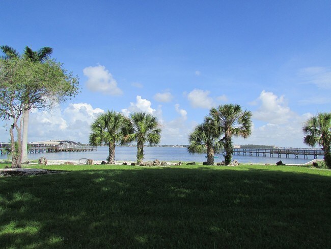
Riverside Beach C/E
Cape Coral-Fort Myers, FL
Mcgregor Caloosa Y & R Club
17-45-24-01-00000.00CE
COMMONS ELEMENTS LAND & POOL AREA DESC OR 2376 PG 2445
Commercialacreage
Lee
AE
Florida
12071C0416G
8.12 AC
0
S Ft Myers/San Carlos
2025
Southwest Florida
001701
DEMOGRAPHICS near Riverside Beach C/E
1 Mile
3 Mile
5 Mile
2024 Total Population
4,909
71,209
177,059
2029 Population
5,834
84,472
209,730
Pop Growth 2024-2029
+ 18.84%
+ 18.63%
+ 18.45%
Average Age
57
50
49
2024 Total Households
2,581
34,578
81,899
HH Growth 2024-2029
+ 18.52%
+ 18.32%
+ 18.17%
Median Household Inc
$67,949
$58,920
$60,533
Avg Household Size
1.90
2.00
2.10
2024 Avg HH Vehicles
2.00
2.00
2.00
Median Home Value
$342,885
$278,139
$281,517
Median Year Built
1983
1984
1987
Nearby Places
Map Layers
Map Styles
 Street
 Aerial
- Restaurants
- Banks
- Shops
- Fitness
- Groceries
PUBLIC TRANSPORTATION
AIRPORT
Southwest Florida International
DRIVE
WALK
Distance
Southwest Florida International
24 min
12.0 mi
Punta Gorda
DRIVE
WALK
Distance
Punta Gorda
50 min
30.4 mi
Freight Ports
Port Manatee
DRIVE
WALK
Distance
Port Manatee
130 min
102.1 mi
Nearby Properties
Address
Land Use
TOTAL SIZE
Lot Size
Zoning
Address
Land Use
TOTAL SIZE
Lot Size
Zoning
1,001,577 SF
140.54 AC
AG-2
Address
Land Use
TOTAL SIZE
Lot Size
Zoning
539,207 SF
61.09 AC
AG-2
Address
Land Use
TOTAL SIZE
Lot Size
Zoning
331,738 SF
39.51 AC
RM-10
Address
Land Use
TOTAL SIZE
Lot Size
Zoning
446,205 SF
28.90 AC
CC
Address
Land Use
TOTAL SIZE
Lot Size
Zoning
423,044 SF
37.11 AC
C-1
Address
Land Use
TOTAL SIZE
Lot Size
Zoning
441,655 SF
33.09 AC
RM-2
Address
Land Use
TOTAL SIZE
Lot Size
Zoning
347,746 SF
29.74 AC
RM-10
Address
Land Use
TOTAL SIZE
Lot Size
Zoning
381,135 SF
15.07 AC
MPD
Address
Land Use
TOTAL SIZE
Lot Size
Zoning
1,446 SF
9.81 AC
RS-6
Address
Land Use
TOTAL SIZE
Lot Size
Zoning
261,136 SF
11.68 AC
AG-2
Address
Land Use
TOTAL SIZE
Lot Size
Zoning
173,069 SF
34.58 AC
RS-6
Address
Land Use
TOTAL SIZE
Lot Size
Zoning
206,290 SF
31.37 AC
CFPD
Address
Land Use
TOTAL SIZE
Lot Size
Zoning
153,907 SF
22.03 AC
TFC2
Address
Land Use
TOTAL SIZE
Lot Size
Zoning
211,588 SF
14.89 AC
MPD
Address
Land Use
TOTAL SIZE
Lot Size
Zoning
74,747 SF
2.76 AC
CPD
Address
Land Use
TOTAL SIZE
Lot Size
Zoning
89,650 SF
6.72 AC
C-1A
Address
Land Use
TOTAL SIZE
Lot Size
Zoning
469,746 SF
89.45 AC
RPD
Address
Land Use
TOTAL SIZE
Lot Size
Zoning
112,292 SF
22.69 AC
PO
Address
Land Use
TOTAL SIZE
Lot Size
Zoning
66,486 SF
0.56 AC
C-1A
Address
Land Use
TOTAL SIZE
Lot Size
Zoning
301,212 SF
5.28 AC
Address
Land Use
TOTAL SIZE
Lot Size
Zoning
85,745 SF
10.22 AC
CPD
Address
Land Use
TOTAL SIZE
Lot Size
Zoning
63,328 SF
5.26 AC
C-1
Address
Land Use
TOTAL SIZE
Lot Size
Zoning
346,481 SF
11.41 AC
CPD
Address
Land Use
TOTAL SIZE
Lot Size
Zoning
92,000 SF
7.15 AC
C-1
Address
Land Use
TOTAL SIZE
Lot Size
Zoning
113,239 SF
12.62 AC
R1-D
Address
Land Use
TOTAL SIZE
Lot Size
Zoning
26,337 SF
11.54 AC
C-1
Address
Land Use
TOTAL SIZE
Lot Size
Zoning
106,452 SF
1.53 AC
CPD
Address
Land Use
TOTAL SIZE
Lot Size
Zoning
98,980 SF
8.93 AC
CPD
Address
Land Use
TOTAL SIZE
Lot Size
Zoning
57,192 SF
7 AC
C-1
Address
Land Use
TOTAL SIZE
Lot Size
Zoning
6,910 SF
7.37 AC
AG-2
The World's #1 Commercial Real Estate Marketplace
Connect with us
© 2025 CoStar Group
The information above has been obtained from sources believed reliable. While we do not doubt its accuracy we have not verified it and make no guarantee, warranty or representation about it. It is your responsibility to independently confirm its accuracy and completeness. Any projections, opinions, assumptions, or estimates used are for example only and do not represent the current or future performance of the property. The value of this transaction to you depends on tax and other factors which should be evaluated by your tax, financial, and legal advisors. You and your advisors should conduct a careful, independent investigation of the property to determine to your satisfaction the suitability of the property for your needs.