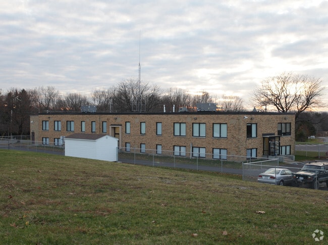
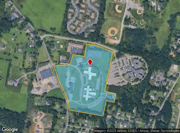
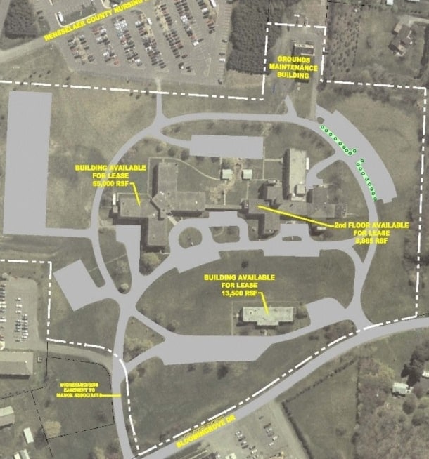
Property Record
125 Bloomingrove Dr, Troy, NY 12180
NEARBY LISTINGS FOR SALE OR LEASE
Property Detail
125 Bloomingrove Dr
Albany-Schenectady-Troy, NY
WELFARE HOME
3200-123-3-21.111
Rensselaer
Commercialbuilding
New York
ARE
21.111
36083C0245D
26.69 AC
2025
Greater Troy
2024
Albany/Schenectady/Troy
041300
DEMOGRAPHICS near 125 Bloomingrove Dr
1 Mile
3 Mile
5 Mile
2024 Total Population
4,334
46,724
137,932
2029 Population
4,380
46,276
136,571
Pop Growth 2024-2029
+ 1.06%
(0.96%)
(0.99%)
Average Age
46
39
39
2024 Total Households
1,797
19,817
58,981
HH Growth 2024-2029
+ 1.17%
(1.02%)
(0.96%)
Median Household Inc
$84,091
$71,695
$62,094
Avg Household Size
2.20
2.20
2.10
2024 Avg HH Vehicles
2.00
2.00
1.00
Median Home Value
$257,091
$205,950
$231,467
Median Year Built
1986
1960
1958
Nearby Places
- Restaurants
- Banks
- Shops
- Fitness
- Groceries
PUBLIC TRANSPORTATION
COMMUTER RAIL
Albany-Rensselaer Amtrak Station (Adirondack - Amtrak, Empire Service - Amtrak, Ethan Allen Express - Amtrak, Lake Shore Limited - Amtrak, Maple Leaf - Amtrak, Toronto - New York - Amtrak)
DRIVE
WALK
Distance
Albany-Rensselaer Amtrak Station (Adirondack - Amtrak, Empire Service - Amtrak, Ethan Allen Express - Amtrak, Lake Shore Limited - Amtrak, Maple Leaf - Amtrak, Toronto - New York - Amtrak)
13 min
6.1 mi
AIRPORT
Albany International
DRIVE
WALK
Distance
Albany International
20 min
11.8 mi
Freight Ports
Albany, NY Port
DRIVE
WALK
Distance
Albany, NY Port
16 min
8.3 mi
Nearby Properties
Address
Land Use
TOTAL SIZE
Lot Size
Zoning
Address
Land Use
TOTAL SIZE
Lot Size
Zoning
34,971 SF
108.68 AC
CI
Address
Land Use
TOTAL SIZE
Lot Size
Zoning
120,579 SF
49.20 AC
CI
Address
Land Use
TOTAL SIZE
Lot Size
Zoning
326,350 SF
11.11 AC
I
Address
Land Use
TOTAL SIZE
Lot Size
Zoning
35,392 SF
73.57 AC
CI
Address
Land Use
TOTAL SIZE
Lot Size
Zoning
413,006 SF
37.94 AC
CI
Address
Land Use
TOTAL SIZE
Lot Size
Zoning
11,900 SF
28.60 AC
86
Address
Land Use
TOTAL SIZE
Lot Size
Zoning
3,214 SF
412.83 AC
18
Address
Land Use
TOTAL SIZE
Lot Size
Zoning
Address
Land Use
TOTAL SIZE
Lot Size
Zoning
70,548 SF
2.71 AC
DMU
Address
Land Use
TOTAL SIZE
Lot Size
Zoning
82,154 SF
3.62 AC
DMU
Address
Land Use
TOTAL SIZE
Lot Size
Zoning
11,264 SF
34.83 AC
MF
Address
Land Use
TOTAL SIZE
Lot Size
Zoning
85.40 AC
M1
Address
Land Use
TOTAL SIZE
Lot Size
Zoning
19,274 SF
24.80 AC
84
Address
Land Use
TOTAL SIZE
Lot Size
Zoning
63,992 SF
20 AC
CM
Address
Land Use
TOTAL SIZE
Lot Size
Zoning
34.12 AC
Address
Land Use
TOTAL SIZE
Lot Size
Zoning
3,168 SF
21.70 AC
78
Address
Land Use
TOTAL SIZE
Lot Size
Zoning
105,094 SF
3.38 AC
MF
Address
Land Use
TOTAL SIZE
Lot Size
Zoning
96,552 SF
0.67 AC
DMU
Address
Land Use
TOTAL SIZE
Lot Size
Zoning
136,218 SF
15.39 AC
CC
Address
Land Use
TOTAL SIZE
Lot Size
Zoning
93,657 SF
0.96 AC
DMU
Address
Land Use
TOTAL SIZE
Lot Size
Zoning
33.38 AC
Address
Land Use
TOTAL SIZE
Lot Size
Zoning
16,230 SF
17.60 AC
78
Address
Land Use
TOTAL SIZE
Lot Size
Zoning
295,545 SF
9.40 AC
85
Address
Land Use
TOTAL SIZE
Lot Size
Zoning
228,288 SF
10.20 AC
83
Address
Land Use
TOTAL SIZE
Lot Size
Zoning
67,107 SF
24.70 AC
73
Address
Land Use
TOTAL SIZE
Lot Size
Zoning
116,015 SF
2.32 AC
DMU
Address
Land Use
TOTAL SIZE
Lot Size
Zoning
17,076 SF
2 AC
DMU
Address
Land Use
TOTAL SIZE
Lot Size
Zoning
102,000 SF
0.86 AC
DMU
Address
Land Use
TOTAL SIZE
Lot Size
Zoning
97,884 SF
0.75 AC
DMU
The World's #1 Commercial Real Estate Marketplace
Connect with us
© 2025 CoStar Group
The information above has been obtained from sources believed reliable. While we do not doubt its accuracy we have not verified it and make no guarantee, warranty or representation about it. It is your responsibility to independently confirm its accuracy and completeness. Any projections, opinions, assumptions, or estimates used are for example only and do not represent the current or future performance of the property. The value of this transaction to you depends on tax and other factors which should be evaluated by your tax, financial, and legal advisors. You and your advisors should conduct a careful, independent investigation of the property to determine to your satisfaction the suitability of the property for your needs.