Property Record
125 Bridge St, Pelham, NH 03076


Property Detail
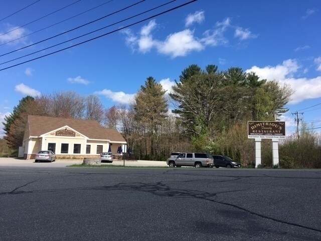
125 Bridge St
Restaurantbuilding
Hillsborough
B
New Hampshire
AE The base floodplain where base flood elevations are provided. AE Zones are now used on new format FIRMs instead of A1-A30 Zones.
10.92 AC
2025
Hillsborough
2025
Boston
200201
Manchester-Nashua, NH
2,492 SF
PLHM-000029-000000-000007-000114-1
NEARBY LISTINGS FOR SALE OR LEASE
DEMOGRAPHICS near 125 Bridge St
1 mile
3 mile
5 mile
2025 Total Population
2,441
21,099
96,668
2030 Population
2,505
21,751
99,433
Pop Growth 2025-2030
+ 2.62%
+ 3.09%
+ 2.86%
Average Age
43
42
40
2025 Total Households
869
7,313
34,164
HH Growth 2025-2030
+ 2.76%
+ 3.12%
+ 2.95%
Median Household Inc
$139,687
$127,960
$107,621
Avg Household Size
2.80
2.80
2.70
2025 Avg HH Vehicles
3.00
2.00
2.00
Median Home Value
$495,489
$527,911
$502,375
Median Year Built
1978
1981
1974
Nearby Places
Map Layers
Map Styles
 Street
 Aerial
Layers
 Traffic
 Biking
Places
Listings with unknown addresses are not visible on the map
- Restaurants
- Banks
- Shops
- Fitness
- Groceries
PUBLIC TRANSPORTATION
COMMUTER RAIL
Lowell (Lowell Line - Massachusetts Bay Transportation Authority Commuter Rail (Purple Line))
Drive
Walk
Distance
Lowell (Lowell Line - Massachusetts Bay Transportation Authority Commuter Rail (Purple Line))
16 min
6.7 mi
AIRPORT
Manchester Boston Regional
Drive
Walk
Distance
Manchester Boston Regional
44 min
24.1 mi
General Edward Lawrence Logan International
Drive
Walk
Distance
General Edward Lawrence Logan International
56 min
36.5 mi
Portsmouth International at Pease
Drive
Walk
Distance
Portsmouth International at Pease
68 min
47.1 mi
SALE & LEASE HISTORY
LISTING DATE
SALE/LEASE

Oct 05, 2017
For Sale
Aug 10, 2017
For Sale
Nearby Properties
Address
Land Use
TOTAL SIZE
Lot Size
Zoning
Address
Land Use
TOTAL SIZE
Lot Size
Zoning
803 SF
3.29 AC
R1
Address
Land Use
TOTAL SIZE
Lot Size
Zoning
Address
Land Use
TOTAL SIZE
Lot Size
Zoning
50 AC
R
Address
Land Use
TOTAL SIZE
Lot Size
Zoning
2.15 AC
R
Address
Land Use
TOTAL SIZE
Lot Size
Zoning
76 AC
R
Address
Land Use
TOTAL SIZE
Lot Size
Zoning
12.21 AC
B
Address
Land Use
TOTAL SIZE
Lot Size
Zoning
171,166 SF
11 AC
I
Address
Land Use
TOTAL SIZE
Lot Size
Zoning
8.76 AC
I
Address
Land Use
TOTAL SIZE
Lot Size
Zoning
19 AC
MUZD
Address
Land Use
TOTAL SIZE
Lot Size
Zoning
Address
Land Use
TOTAL SIZE
Lot Size
Zoning
42,659 SF
23 AC
R
Address
Land Use
TOTAL SIZE
Lot Size
Zoning
86,561 SF
2.40 AC
B4
Address
Land Use
TOTAL SIZE
Lot Size
Zoning
46,324 SF
19 AC
B
Address
Land Use
TOTAL SIZE
Lot Size
Zoning
69,523 SF
25 AC
I
Address
Land Use
TOTAL SIZE
Lot Size
Zoning
27,057 SF
3.38 AC
MUZD
Address
Land Use
TOTAL SIZE
Lot Size
Zoning
16.30 AC
R
Address
Land Use
TOTAL SIZE
Lot Size
Zoning
30,060 SF
1.43 AC
R1
Address
Land Use
TOTAL SIZE
Lot Size
Zoning
15,294 SF
5.50 AC
B
Address
Land Use
TOTAL SIZE
Lot Size
Zoning
27,277 SF
4.76 AC
R
Address
Land Use
TOTAL SIZE
Lot Size
Zoning
290.73 AC
R
Address
Land Use
TOTAL SIZE
Lot Size
Zoning
40,320 SF
3.79 AC
B
Address
Land Use
TOTAL SIZE
Lot Size
Zoning
4 AC
B
Address
Land Use
TOTAL SIZE
Lot Size
Zoning
1,600 SF
53.50 AC
B4
Address
Land Use
TOTAL SIZE
Lot Size
Zoning
17,456 SF
3.15 AC
I
Address
Land Use
TOTAL SIZE
Lot Size
Zoning
4.44 AC
MUZD
Address
Land Use
TOTAL SIZE
Lot Size
Zoning
4.26 AC
B
Address
Land Use
TOTAL SIZE
Lot Size
Zoning
11,186 SF
3.48 AC
R
Address
Land Use
TOTAL SIZE
Lot Size
Zoning
18,940 SF
11.37 AC
B
Address
Land Use
TOTAL SIZE
Lot Size
Zoning
18,900 SF
4.72 AC
B
Address
Land Use
TOTAL SIZE
Lot Size
Zoning
13.73 AC
R
The World's #1 Commercial Real Estate Marketplace
Connect with us
© 2026 CoStar Group
The information above has been obtained from sources believed reliable. While we do not doubt its accuracy we have not verified it and make no guarantee, warranty or representation about it. It is your responsibility to independently confirm its accuracy and completeness. Any projections, opinions, assumptions, or estimates used are for example only and do not represent the current or future performance of the property. The value of this transaction to you depends on tax and other factors which should be evaluated by your tax, financial, and legal advisors. You and your advisors should conduct a careful, independent investigation of the property to determine to your satisfaction the suitability of the property for your needs.