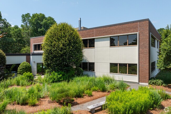
Property Record
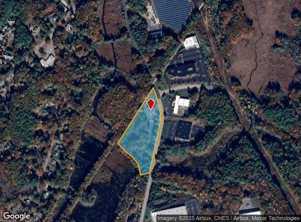
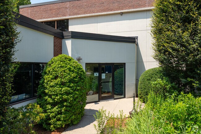
125 Hopping Brook Rd, Holliston, MA 01746
NEARBY LISTINGS FOR SALE OR LEASE
Property Detail
125 Hopping Brook Rd
HOLL-000004-000005-000310
Middlesex
Publicschool
Massachusetts
A
310
25021C0137F
5.96 AC
0
Hopkinton/Holliston
2025
Boston
387100
Boston-Cambridge-Newton, MA-NH
15,222 SF
DEMOGRAPHICS near 125 Hopping Brook Rd
1 Mile
3 Mile
5 Mile
2024 Total Population
2,055
24,699
88,315
2029 Population
2,042
24,563
87,840
Pop Growth 2024-2029
(0.63%)
(0.55%)
(0.54%)
Average Age
43
42
41
2024 Total Households
732
9,074
32,248
HH Growth 2024-2029
(0.68%)
(0.61%)
(0.60%)
Median Household Inc
$177,702
$137,261
$128,441
Avg Household Size
2.80
2.70
2.70
2024 Avg HH Vehicles
2.00
2.00
2.00
Median Home Value
$655,555
$536,982
$484,948
Median Year Built
1989
1977
1973
Nearby Places
Map Layers
Map Styles
 Street
 Aerial
- Restaurants
- Banks
- Shops
- Fitness
- Groceries
PUBLIC TRANSPORTATION
COMMUTER RAIL
Forge Park/Route 495 (Franklin Line - Massachusetts Bay Transportation Authority Commuter Rail (Purple Line))
DRIVE
WALK
Distance
Forge Park/Route 495 (Franklin Line - Massachusetts Bay Transportation Authority Commuter Rail (Purple Line))
14 min
8.5 mi
Ashland (Framingham/Worcester Line - Massachusetts Bay Transportation Authority Commuter Rail (Purple Line))
DRIVE
WALK
Distance
Ashland (Framingham/Worcester Line - Massachusetts Bay Transportation Authority Commuter Rail (Purple Line))
20 min
8.8 mi
AIRPORT
Worcester Regional
DRIVE
WALK
Distance
Worcester Regional
49 min
30.6 mi
General Edward Lawrence Logan International
DRIVE
WALK
Distance
General Edward Lawrence Logan International
56 min
33.7 mi
Rhode Island Tf Green International
DRIVE
WALK
Distance
Rhode Island Tf Green International
57 min
36.2 mi
Freight Ports
Port of Boston
DRIVE
WALK
Distance
Port of Boston
54 min
32.1 mi
Nearby Properties
Address
Land Use
TOTAL SIZE
Lot Size
Zoning
Address
Land Use
TOTAL SIZE
Lot Size
Zoning
16.82 AC
BP
Address
Land Use
TOTAL SIZE
Lot Size
Zoning
239,156 SF
33.83 AC
AR-I
Address
Land Use
TOTAL SIZE
Lot Size
Zoning
24.81 AC
IB
Address
Land Use
TOTAL SIZE
Lot Size
Zoning
27.32 AC
IB
Address
Land Use
TOTAL SIZE
Lot Size
Zoning
347,012 SF
29.23 AC
IB
Address
Land Use
TOTAL SIZE
Lot Size
Zoning
19.14 AC
IB
Address
Land Use
TOTAL SIZE
Lot Size
Zoning
165,132 SF
24.49 AC
IN3
Address
Land Use
TOTAL SIZE
Lot Size
Zoning
106.49 AC
IB
Address
Land Use
TOTAL SIZE
Lot Size
Zoning
21.69 AC
IB
Address
Land Use
TOTAL SIZE
Lot Size
Zoning
169,461 SF
32.30 AC
40
Address
Land Use
TOTAL SIZE
Lot Size
Zoning
14 AC
IB
Address
Land Use
TOTAL SIZE
Lot Size
Zoning
85,200 SF
35.18 AC
IB
Address
Land Use
TOTAL SIZE
Lot Size
Zoning
351,209 SF
42.16 AC
I
Address
Land Use
TOTAL SIZE
Lot Size
Zoning
135,579 SF
15.97 AC
IB
Address
Land Use
TOTAL SIZE
Lot Size
Zoning
11 AC
IB
Address
Land Use
TOTAL SIZE
Lot Size
Zoning
27.79 AC
IB
Address
Land Use
TOTAL SIZE
Lot Size
Zoning
14.75 AC
IB
Address
Land Use
TOTAL SIZE
Lot Size
Zoning
61,100 SF
15.24 AC
I
Address
Land Use
TOTAL SIZE
Lot Size
Zoning
14.83 AC
CC
Address
Land Use
TOTAL SIZE
Lot Size
Zoning
142,594 SF
13.74 AC
IB
Address
Land Use
TOTAL SIZE
Lot Size
Zoning
69,139 SF
4.57 AC
CB
Address
Land Use
TOTAL SIZE
Lot Size
Zoning
167,299 SF
9.07 AC
IB
Address
Land Use
TOTAL SIZE
Lot Size
Zoning
44,772 SF
4.02 AC
I
Address
Land Use
TOTAL SIZE
Lot Size
Zoning
5.28 AC
IB
Address
Land Use
TOTAL SIZE
Lot Size
Zoning
16.43 AC
IB
Address
Land Use
TOTAL SIZE
Lot Size
Zoning
109.15 AC
AR-I
Address
Land Use
TOTAL SIZE
Lot Size
Zoning
1,440 SF
6.97 AC
ARII
Address
Land Use
TOTAL SIZE
Lot Size
Zoning
7.03 AC
IB
Address
Land Use
TOTAL SIZE
Lot Size
Zoning
143,249 SF
7.22 AC
IB
Address
Land Use
TOTAL SIZE
Lot Size
Zoning
130,004 SF
15.28 AC
IB
The World's #1 Commercial Real Estate Marketplace
Connect with us
© 2025 CoStar Group
The information above has been obtained from sources believed reliable. While we do not doubt its accuracy we have not verified it and make no guarantee, warranty or representation about it. It is your responsibility to independently confirm its accuracy and completeness. Any projections, opinions, assumptions, or estimates used are for example only and do not represent the current or future performance of the property. The value of this transaction to you depends on tax and other factors which should be evaluated by your tax, financial, and legal advisors. You and your advisors should conduct a careful, independent investigation of the property to determine to your satisfaction the suitability of the property for your needs.