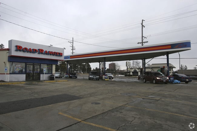
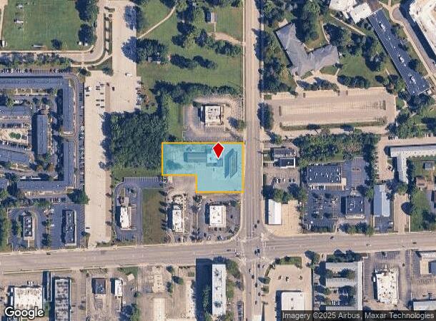
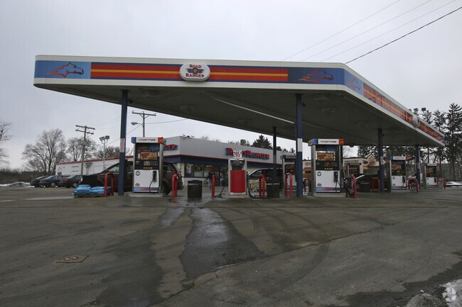
Property Record
125 N Annie Glidden Rd, Dekalb, IL 60115

NEARBY LISTINGS FOR SALE OR LEASE
Property Detail
125 N Annie Glidden Rd
Chicago-Naperville-Elgin, IL-IN-WI
Willard Orchard Sub
08-21-276-027
WILLARD ORCHARD SUB - PT LOT 5
Commercialnec
DeKalb
X
Illinois
17037C0242E
5
2023
1.30 AC
2024
Western East/West Corr
001002
Chicago
DEMOGRAPHICS near 125 N Annie Glidden Rd
1 Mile
3 Mile
5 Mile
2024 Total Population
16,700
41,718
52,631
2029 Population
16,882
41,718
52,593
Pop Growth 2024-2029
+ 1.09%
0.00%
(0.07%)
Average Age
28
33
35
2024 Total Households
6,223
15,974
20,218
HH Growth 2024-2029
+ 1.74%
+ 0.18%
+ 0.01%
Median Household Inc
$32,746
$46,671
$52,106
Avg Household Size
2.10
2.30
2.30
2024 Avg HH Vehicles
2.00
2.00
2.00
Median Home Value
$202,328
$176,037
$176,504
Median Year Built
1981
1976
1977
Nearby Places
Map Layers
Map Styles
 Street
 Aerial
- Restaurants
- Banks
- Shops
- Fitness
- Groceries
PUBLIC TRANSPORTATION
AIRPORT
Chicago/Rockford International
DRIVE
WALK
Distance
Chicago/Rockford International
51 min
35.2 mi
Freight Ports
Port Milwaukee
DRIVE
WALK
Distance
Port Milwaukee
145 min
103.9 mi
Nearby Properties
Address
Land Use
TOTAL SIZE
Lot Size
Zoning
Address
Land Use
TOTAL SIZE
Lot Size
Zoning
71.90 AC
Address
Land Use
TOTAL SIZE
Lot Size
Zoning
49.71 AC
Address
Land Use
TOTAL SIZE
Lot Size
Zoning
49.73 AC
Address
Land Use
TOTAL SIZE
Lot Size
Zoning
98.56 AC
Address
Land Use
TOTAL SIZE
Lot Size
Zoning
43.10 AC
Address
Land Use
TOTAL SIZE
Lot Size
Zoning
94.65 AC
Address
Land Use
TOTAL SIZE
Lot Size
Zoning
47.87 AC
Address
Land Use
TOTAL SIZE
Lot Size
Zoning
21.61 AC
Address
Land Use
TOTAL SIZE
Lot Size
Zoning
15.79 AC
Address
Land Use
TOTAL SIZE
Lot Size
Zoning
25.70 AC
Address
Land Use
TOTAL SIZE
Lot Size
Zoning
20.83 AC
Address
Land Use
TOTAL SIZE
Lot Size
Zoning
9.39 AC
Address
Land Use
TOTAL SIZE
Lot Size
Zoning
21.35 AC
Address
Land Use
TOTAL SIZE
Lot Size
Zoning
9.04 AC
Address
Land Use
TOTAL SIZE
Lot Size
Zoning
9.88 AC
Address
Land Use
TOTAL SIZE
Lot Size
Zoning
8.70 AC
A1
Address
Land Use
TOTAL SIZE
Lot Size
Zoning
11.50 AC
Address
Land Use
TOTAL SIZE
Lot Size
Zoning
0.05 AC
Address
Land Use
TOTAL SIZE
Lot Size
Zoning
57.46 AC
Address
Land Use
TOTAL SIZE
Lot Size
Zoning
13.48 AC
Address
Land Use
TOTAL SIZE
Lot Size
Zoning
9.56 AC
RC2
Address
Land Use
TOTAL SIZE
Lot Size
Zoning
8.14 AC
Address
Land Use
TOTAL SIZE
Lot Size
Zoning
21.35 AC
Address
Land Use
TOTAL SIZE
Lot Size
Zoning
24.39 AC
Address
Land Use
TOTAL SIZE
Lot Size
Zoning
23.25 AC
Address
Land Use
TOTAL SIZE
Lot Size
Zoning
7.41 AC
Address
Land Use
TOTAL SIZE
Lot Size
Zoning
5.59 AC
Address
Land Use
TOTAL SIZE
Lot Size
Zoning
5.77 AC
RC2
Address
Land Use
TOTAL SIZE
Lot Size
Zoning
8.78 AC
Address
Land Use
TOTAL SIZE
Lot Size
Zoning
The World's #1 Commercial Real Estate Marketplace
Connect with us
© 2025 CoStar Group
The information above has been obtained from sources believed reliable. While we do not doubt its accuracy we have not verified it and make no guarantee, warranty or representation about it. It is your responsibility to independently confirm its accuracy and completeness. Any projections, opinions, assumptions, or estimates used are for example only and do not represent the current or future performance of the property. The value of this transaction to you depends on tax and other factors which should be evaluated by your tax, financial, and legal advisors. You and your advisors should conduct a careful, independent investigation of the property to determine to your satisfaction the suitability of the property for your needs.