Property Record
125 N Davis Ln, Defuniak Springs, FL 32433
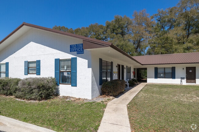

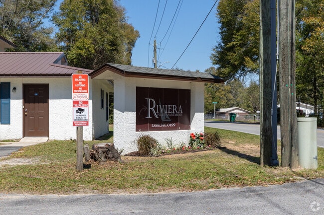
This Property Is For Sale
NEARBY LISTINGS FOR SALE OR LEASE
-
-
View all Defuniak Springs listings for sale on LoopNet.com
Property Detail
125 N Davis Ln
Crestview-Fort Walton Beach-Destin, FL
Town Of Defuniak Springs
25-3N-19-19070-001-536A
1/10TH INT IN N2 OF BLK 1536 SEC 25-3N-19W LESS COM WHERE N LINE BLK 1536 INTERSECTS W ROW DAVIS LANE,S 00 DEG 3501E ALG ROW 167.64 FT FOR POB,S 88 DEG 5824W 559.78 FT RADIUS POINT OF CUL-DE-SAC DELTA 286 DEG 15 46 ARC 248.81 FT TO POB. OR 399-680 OR
Multifamilydwelling
Walton
X
Florida
12131C0280G
536a
2025
4.34 AC
2025
Florida Panhandle Area
950202
Other Market Areas
42,240 SF
DEMOGRAPHICS near 125 N Davis Ln
1 Mile
3 Mile
5 Mile
2024 Total Population
2,557
7,187
11,552
2029 Population
3,052
8,595
13,852
Pop Growth 2024-2029
+ 19.36%
+ 19.59%
+ 19.91%
Average Age
39
39
39
2024 Total Households
627
2,152
3,703
HH Growth 2024-2029
+ 18.66%
+ 19.33%
+ 19.85%
Median Household Inc
$43,888
$42,904
$39,944
Avg Household Size
2.40
2.50
2.50
2024 Avg HH Vehicles
2.00
2.00
2.00
Median Home Value
$74,896
$93,250
$93,179
Median Year Built
1986
1985
1990
Nearby Places
Map Layers
Map Styles
 Street
 Aerial
- Restaurants
- Banks
- Shops
- Fitness
- Groceries
Nearby Properties
Address
Land Use
TOTAL SIZE
Lot Size
Zoning
Address
Land Use
TOTAL SIZE
Lot Size
Zoning
461,058 SF
45.55 AC
Address
Land Use
TOTAL SIZE
Lot Size
Zoning
174,929 SF
9.32 AC
HD1
Address
Land Use
TOTAL SIZE
Lot Size
Zoning
96,057 SF
10.37 AC
W END
Address
Land Use
TOTAL SIZE
Lot Size
Zoning
54,534 SF
7.33 AC
MUNI
Address
Land Use
TOTAL SIZE
Lot Size
Zoning
160,339 SF
19.76 AC
3310
Address
Land Use
TOTAL SIZE
Lot Size
Zoning
37,731 SF
15.96 AC
Address
Land Use
TOTAL SIZE
Lot Size
Zoning
53,201 SF
14.45 AC
Address
Land Use
TOTAL SIZE
Lot Size
Zoning
101,840 SF
11.04 AC
3310
Address
Land Use
TOTAL SIZE
Lot Size
Zoning
126,076 SF
11.38 AC
3310
Address
Land Use
TOTAL SIZE
Lot Size
Zoning
10,655 SF
163.72 AC
MUNI
Address
Land Use
TOTAL SIZE
Lot Size
Zoning
3,729 SF
98.46 AC
MUNI
Address
Land Use
TOTAL SIZE
Lot Size
Zoning
109,921 SF
2.25 AC
Address
Land Use
TOTAL SIZE
Lot Size
Zoning
52,428 SF
4.66 AC
3310
Address
Land Use
TOTAL SIZE
Lot Size
Zoning
68,153 SF
9.65 AC
3310
Address
Land Use
TOTAL SIZE
Lot Size
Zoning
15,264 SF
3.24 AC
3310
Address
Land Use
TOTAL SIZE
Lot Size
Zoning
15,587 SF
5.54 AC
Address
Land Use
TOTAL SIZE
Lot Size
Zoning
48,394 SF
8.79 AC
3310
Address
Land Use
TOTAL SIZE
Lot Size
Zoning
Address
Land Use
TOTAL SIZE
Lot Size
Zoning
104,680 SF
10 AC
Address
Land Use
TOTAL SIZE
Lot Size
Zoning
32,375 SF
6.46 AC
HWY90
Address
Land Use
TOTAL SIZE
Lot Size
Zoning
17,310 SF
13.26 AC
3310
Address
Land Use
TOTAL SIZE
Lot Size
Zoning
35,967 SF
4.11 AC
Address
Land Use
TOTAL SIZE
Lot Size
Zoning
14,525 SF
0.90 AC
HWY90
Address
Land Use
TOTAL SIZE
Lot Size
Zoning
17,376 SF
79.90 AC
HD1
Address
Land Use
TOTAL SIZE
Lot Size
Zoning
40,583 SF
2 AC
Address
Land Use
TOTAL SIZE
Lot Size
Zoning
31,585 SF
2.33 AC
3310
Address
Land Use
TOTAL SIZE
Lot Size
Zoning
35,050 SF
3.98 AC
MUNI
Address
Land Use
TOTAL SIZE
Lot Size
Zoning
9,064 SF
25.86 AC
3310
Address
Land Use
TOTAL SIZE
Lot Size
Zoning
37,138 SF
8.10 AC
HWY90
The World's #1 Commercial Real Estate Marketplace
Connect with us
© 2026 CoStar Group
The information above has been obtained from sources believed reliable. While we do not doubt its accuracy we have not verified it and make no guarantee, warranty or representation about it. It is your responsibility to independently confirm its accuracy and completeness. Any projections, opinions, assumptions, or estimates used are for example only and do not represent the current or future performance of the property. The value of this transaction to you depends on tax and other factors which should be evaluated by your tax, financial, and legal advisors. You and your advisors should conduct a careful, independent investigation of the property to determine to your satisfaction the suitability of the property for your needs.