Property Record
125 Nehalem Blvd, Wheeler, OR 97147
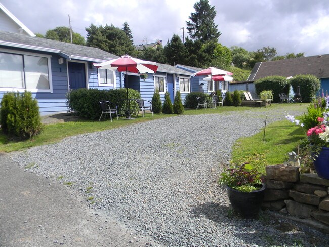

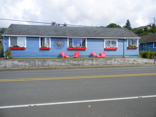
Property Detail
125 Nehalem Blvd
Multifamilydwelling
Tillamook
R-1
Oregon
B and X Area of moderate flood hazard, usually the area between the limits of the 100-year and 500-year floods.
0.16 AC
2025
Oregon West Area
2025
Other Market Areas
960102
R0000368
1,958 SF
NEARBY LISTINGS FOR SALE OR LEASE
-
-
View all Wheeler listings for sale on LoopNet.com
DEMOGRAPHICS near 125 Nehalem Blvd
1 mile
3 mile
5 mile
2025 Total Population
241
3,207
5,775
2030 Population
248
3,293
6,017
Pop Growth 2025-2030
+ 2.90%
+ 2.68%
+ 4.19%
Average Age
50
51
51
2025 Total Households
113
1,516
2,738
HH Growth 2025-2030
+ 2.65%
+ 2.18%
+ 3.83%
Median Household Inc
$57,499
$72,815
$72,336
Avg Household Size
2.10
2.10
2.10
2025 Avg HH Vehicles
2.00
2.00
2.00
Median Home Value
$453,703
$570,153
$561,434
Median Year Built
1977
1990
1987
Nearby Places
Map Layers
Map Styles
 Street
 Aerial
Layers
 Traffic
 Biking
Places
Listings with unknown addresses are not visible on the map
- Restaurants
- Banks
- Shops
- Fitness
- Groceries
SALE & LEASE HISTORY
LISTING DATE
SALE/LEASE

Oct 04, 2019
For Sale
Aug 01, 2017
For Sale
Nearby Properties
Address
Land Use
TOTAL SIZE
Lot Size
Zoning
Address
Land Use
TOTAL SIZE
Lot Size
Zoning
1,782 SF
298.65 AC
RM
Address
Land Use
TOTAL SIZE
Lot Size
Zoning
4,063 SF
0.80 AC
C-1
Address
Land Use
TOTAL SIZE
Lot Size
Zoning
14,786 SF
0.93 AC
R-3
Address
Land Use
TOTAL SIZE
Lot Size
Zoning
25,802 SF
2.61 AC
R1
Address
Land Use
TOTAL SIZE
Lot Size
Zoning
10 SF
44.34 AC
F-1
Address
Land Use
TOTAL SIZE
Lot Size
Zoning
27,802 SF
1.73 AC
R-2
Address
Land Use
TOTAL SIZE
Lot Size
Zoning
30,443 SF
1.72 AC
RM
Address
Land Use
TOTAL SIZE
Lot Size
Zoning
21,164 SF
1.38 AC
GC
Address
Land Use
TOTAL SIZE
Lot Size
Zoning
3,721 SF
2.99 AC
NH-R3
Address
Land Use
TOTAL SIZE
Lot Size
Zoning
10 SF
2.85 AC
RR
Address
Land Use
TOTAL SIZE
Lot Size
Zoning
2,540 SF
50.90 AC
MZ-SR-R
Address
Land Use
TOTAL SIZE
Lot Size
Zoning
7,041 SF
0.71 AC
C-1
Address
Land Use
TOTAL SIZE
Lot Size
Zoning
32,596 SF
1.85 AC
C
Address
Land Use
TOTAL SIZE
Lot Size
Zoning
15,130 SF
1.23 AC
R1
Address
Land Use
TOTAL SIZE
Lot Size
Zoning
10,434 SF
0.44 AC
R-2
Address
Land Use
TOTAL SIZE
Lot Size
Zoning
21,658 SF
1.62 AC
NH-R3
Address
Land Use
TOTAL SIZE
Lot Size
Zoning
2,446 SF
0.11 AC
C-1
Address
Land Use
TOTAL SIZE
Lot Size
Zoning
10,328 SF
2.01 AC
RMD
Address
Land Use
TOTAL SIZE
Lot Size
Zoning
9,039 SF
0.23 AC
C-1
Address
Land Use
TOTAL SIZE
Lot Size
Zoning
6,304 SF
0.89 AC
WH-R-1
Address
Land Use
TOTAL SIZE
Lot Size
Zoning
10 SF
21.91 AC
R-2
Address
Land Use
TOTAL SIZE
Lot Size
Zoning
23,450 SF
1.37 AC
NH-C
Address
Land Use
TOTAL SIZE
Lot Size
Zoning
2,218 SF
6.99 AC
GC
Address
Land Use
TOTAL SIZE
Lot Size
Zoning
22,547 SF
1.59 AC
NH-R3
Address
Land Use
TOTAL SIZE
Lot Size
Zoning
6,607 SF
26.76 AC
F-1
Address
Land Use
TOTAL SIZE
Lot Size
Zoning
3,943 SF
1.90 AC
MZ-R-2,NH-
Address
Land Use
TOTAL SIZE
Lot Size
Zoning
7,914 SF
9.18 AC
MZ-R-2,MZ-
Address
Land Use
TOTAL SIZE
Lot Size
Zoning
2,984 SF
3.37 AC
RR
Address
Land Use
TOTAL SIZE
Lot Size
Zoning
13,623 SF
44.81 AC
F-1
Address
Land Use
TOTAL SIZE
Lot Size
Zoning
9,834 SF
1 AC
CC
The World's #1 Commercial Real Estate Marketplace
Connect with us
© 2026 CoStar Group
The information above has been obtained from sources believed reliable. While we do not doubt its accuracy we have not verified it and make no guarantee, warranty or representation about it. It is your responsibility to independently confirm its accuracy and completeness. Any projections, opinions, assumptions, or estimates used are for example only and do not represent the current or future performance of the property. The value of this transaction to you depends on tax and other factors which should be evaluated by your tax, financial, and legal advisors. You and your advisors should conduct a careful, independent investigation of the property to determine to your satisfaction the suitability of the property for your needs.