Property Record
125 Oakland Ave, Rock Hill, SC 29730


NEARBY LISTINGS FOR SALE OR LEASE
Property Detail
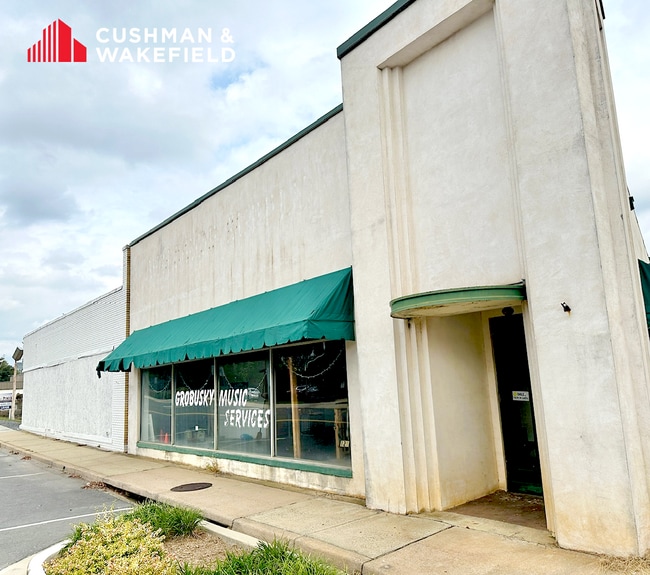
125 Oakland Ave
6271402003
Rs
Commercialnec
125 S OAKLAND
X
York
45091C0317F
South Carolina
2025
0.44 AC
2025
York County
060300
Charlotte
8,580 SF
Charlotte-Concord-Gastonia, NC-SC
DEMOGRAPHICS near 125 Oakland Ave
1 Mile
3 Mile
5 Mile
2024 Total Population
13,809
53,500
96,290
2029 Population
15,436
59,377
106,639
Pop Growth 2024-2029
+ 11.78%
+ 10.99%
+ 10.75%
Average Age
35
39
40
2024 Total Households
5,209
21,662
39,061
HH Growth 2024-2029
+ 14.30%
+ 11.79%
+ 11.33%
Median Household Inc
$32,650
$46,467
$57,420
Avg Household Size
2.10
2.30
2.30
2024 Avg HH Vehicles
1.00
2.00
2.00
Median Home Value
$133,986
$174,321
$217,919
Median Year Built
1968
1983
1992
Nearby Places
Map Layers
Map Styles
 Street
 Aerial
- Restaurants
- Banks
- Shops
- Fitness
- Groceries
PUBLIC TRANSPORTATION
AIRPORT
Charlotte/Douglas International
DRIVE
WALK
Distance
Charlotte/Douglas International
39 min
23.6 mi
Concord-Padgett Regional
DRIVE
WALK
Distance
Concord-Padgett Regional
58 min
40.7 mi
SALE & LEASE HISTORY
LISTING DATE
SALE/LEASE

Nov 18, 2024
For Sale
Nearby Properties
Address
Land Use
TOTAL SIZE
Lot Size
Zoning
Address
Land Use
TOTAL SIZE
Lot Size
Zoning
13,556 SF
10.86 AC
MF15
Address
Land Use
TOTAL SIZE
Lot Size
Zoning
267,338 SF
Address
Land Use
TOTAL SIZE
Lot Size
Zoning
215.20 AC
UD
Address
Land Use
TOTAL SIZE
Lot Size
Zoning
5,380 SF
5.62 AC
MF15
Address
Land Use
TOTAL SIZE
Lot Size
Zoning
8,512 SF
7.73 AC
MF15
Address
Land Use
TOTAL SIZE
Lot Size
Zoning
45,426 SF
6 AC
MF15
Address
Land Use
TOTAL SIZE
Lot Size
Zoning
28,848 SF
1.04 AC
PUD
Address
Land Use
TOTAL SIZE
Lot Size
Zoning
252,312 SF
1.25 AC
Address
Land Use
TOTAL SIZE
Lot Size
Zoning
10,232 SF
4.50 AC
MF15
Address
Land Use
TOTAL SIZE
Lot Size
Zoning
28,660 SF
19.95 AC
OI
Address
Land Use
TOTAL SIZE
Lot Size
Zoning
554,100 SF
21.58 AC
OI
Address
Land Use
TOTAL SIZE
Lot Size
Zoning
163,085 SF
6.84 AC
Address
Land Use
TOTAL SIZE
Lot Size
Zoning
113,490 SF
7 AC
Address
Land Use
TOTAL SIZE
Lot Size
Zoning
84,995 SF
5.09 AC
DTWN
Address
Land Use
TOTAL SIZE
Lot Size
Zoning
225,936 SF
2.87 AC
Address
Land Use
TOTAL SIZE
Lot Size
Zoning
219,972 SF
29.74 AC
IG
Address
Land Use
TOTAL SIZE
Lot Size
Zoning
471,456 SF
26 AC
ID
Address
Land Use
TOTAL SIZE
Lot Size
Zoning
22,278 SF
4.92 AC
Address
Land Use
TOTAL SIZE
Lot Size
Zoning
98,813 SF
3.34 AC
Address
Land Use
TOTAL SIZE
Lot Size
Zoning
28,956 SF
17.89 AC
MF15
Address
Land Use
TOTAL SIZE
Lot Size
Zoning
14,178 SF
1.81 AC
OI
Address
Land Use
TOTAL SIZE
Lot Size
Zoning
22 AC
OI
Address
Land Use
TOTAL SIZE
Lot Size
Zoning
127,028 SF
1.28 AC
Address
Land Use
TOTAL SIZE
Lot Size
Zoning
342,804 SF
23.99 AC
NMU
Address
Land Use
TOTAL SIZE
Lot Size
Zoning
38,000 SF
4.28 AC
LC
Address
Land Use
TOTAL SIZE
Lot Size
Zoning
23,898 SF
19.65 AC
OI
Address
Land Use
TOTAL SIZE
Lot Size
Zoning
207,492 SF
6.66 AC
IH
Address
Land Use
TOTAL SIZE
Lot Size
Zoning
162,641 SF
1.31 AC
Address
Land Use
TOTAL SIZE
Lot Size
Zoning
231,000 SF
31.72 AC
The World's #1 Commercial Real Estate Marketplace
Connect with us
© 2026 CoStar Group
The information above has been obtained from sources believed reliable. While we do not doubt its accuracy we have not verified it and make no guarantee, warranty or representation about it. It is your responsibility to independently confirm its accuracy and completeness. Any projections, opinions, assumptions, or estimates used are for example only and do not represent the current or future performance of the property. The value of this transaction to you depends on tax and other factors which should be evaluated by your tax, financial, and legal advisors. You and your advisors should conduct a careful, independent investigation of the property to determine to your satisfaction the suitability of the property for your needs.