Property Record
125 S Gaillard Rd, Moncks Corner, SC 29461

Save to a Folder
{{folder.Name}}
{{folder.ListingIds.length}} Properties
{{folder.ListingIds.length}} Property
Create a New Folder
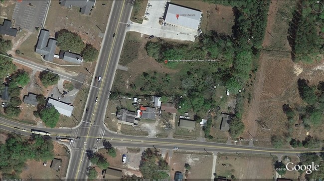
Property Detail
125 S Gaillard Rd
161-15-00-033
6.14 AC
Commercialnec
BERKELEY
BERKELEY C
South Carolina
B and X Area of moderate flood hazard, usually the area between the limits of the 100-year and 500-year floods.
b
2025
6.14 AC
2025
Outlying Berkeley County
020506
Charleston/N Charleston
6,308 SF
Charleston-North Charleston, SC
NEARBY LISTINGS FOR SALE OR LEASE
DEMOGRAPHICS near 125 S Gaillard Rd
1 mile
3 mile
5 mile
2025 Total Population
1,613
18,182
52,496
2030 Population
1,827
20,841
60,168
Pop Growth 2025-2030
+ 13.27%
+ 14.62%
+ 14.61%
Average Age
37
38
38
2025 Total Households
565
6,255
18,444
HH Growth 2025-2030
+ 13.81%
+ 14.93%
+ 14.90%
Median Household Inc
$69,428
$89,809
$93,562
Avg Household Size
2.80
2.90
2.80
2025 Avg HH Vehicles
2.00
2.00
2.00
Median Home Value
$272,377
$345,592
$363,513
Median Year Built
2002
2010
2010
Nearby Places
Map Layers
Map Styles
 Street
 Aerial
Layers
 Traffic
 Biking
Places
Listings with unknown addresses are not visible on the map
- Restaurants
- Banks
- Shops
- Fitness
- Groceries
PUBLIC TRANSPORTATION
AIRPORT
Charleston AFB/International
Drive
Walk
Distance
Charleston AFB/International
35 min
22.9 mi
Freight Ports
North Charleston Terminal
Drive
Walk
Distance
North Charleston Terminal
29 min
21.2 mi
SALE & LEASE HISTORY
LISTING DATE
SALE/LEASE

Apr 01, 2019
For Sale
Nearby Properties
Address
Land Use
TOTAL SIZE
Lot Size
Zoning
Address
Land Use
TOTAL SIZE
Lot Size
Zoning
615,000 SF
85.05 AC
Address
Land Use
TOTAL SIZE
Lot Size
Zoning
96,375 SF
49.17 AC
MONCKS COR
Address
Land Use
TOTAL SIZE
Lot Size
Zoning
93,800 SF
15 AC
BERKELEY C
Address
Land Use
TOTAL SIZE
Lot Size
Zoning
3,000 SF
130.80 AC
Address
Land Use
TOTAL SIZE
Lot Size
Zoning
4,000 SF
12.83 AC
BERKELEY C
Address
Land Use
TOTAL SIZE
Lot Size
Zoning
46.59 AC
BERKELEY C
Address
Land Use
TOTAL SIZE
Lot Size
Zoning
219.80 AC
BERKELEY C
Address
Land Use
TOTAL SIZE
Lot Size
Zoning
46.46 AC
BERKELEY C
Address
Land Use
TOTAL SIZE
Lot Size
Zoning
20,730 SF
12.58 AC
BERKELEY C
Address
Land Use
TOTAL SIZE
Lot Size
Zoning
1,131 SF
22 AC
Address
Land Use
TOTAL SIZE
Lot Size
Zoning
3,000 SF
154.36 AC
MONCKS COR
Address
Land Use
TOTAL SIZE
Lot Size
Zoning
31,920 SF
9.71 AC
BERKELEY C
Address
Land Use
TOTAL SIZE
Lot Size
Zoning
17.60 AC
MONCKS COR
Address
Land Use
TOTAL SIZE
Lot Size
Zoning
265.88 AC
BERKELEY C
Address
Land Use
TOTAL SIZE
Lot Size
Zoning
19,166 SF
177.36 AC
BERKELEY C
Address
Land Use
TOTAL SIZE
Lot Size
Zoning
7,529 SF
2.95 AC
BERKELEY C
Address
Land Use
TOTAL SIZE
Lot Size
Zoning
17,536 SF
4.89 AC
BERKELEY C
Address
Land Use
TOTAL SIZE
Lot Size
Zoning
8,050 SF
154.50 AC
BERKELEY C
Address
Land Use
TOTAL SIZE
Lot Size
Zoning
16,605 SF
2.06 AC
BERKELEY C
Address
Land Use
TOTAL SIZE
Lot Size
Zoning
10.01 AC
BERKELEY C
Address
Land Use
TOTAL SIZE
Lot Size
Zoning
8,397 SF
4.58 AC
BERKELEY C
Address
Land Use
TOTAL SIZE
Lot Size
Zoning
57.59 AC
MONCKS COR
Address
Land Use
TOTAL SIZE
Lot Size
Zoning
9,040 SF
1.79 AC
BERKELEY C
Address
Land Use
TOTAL SIZE
Lot Size
Zoning
896 SF
5.62 AC
BERKELEY C
Address
Land Use
TOTAL SIZE
Lot Size
Zoning
4,298 SF
29.08 AC
BERKELEY C
Address
Land Use
TOTAL SIZE
Lot Size
Zoning
924 SF
1.32 AC
BERKELEY C
Address
Land Use
TOTAL SIZE
Lot Size
Zoning
15,350 SF
12.70 AC
BERKELEY C
Address
Land Use
TOTAL SIZE
Lot Size
Zoning
10,064 SF
2.85 AC
BERKELEY C
The World's #1 Commercial Real Estate Marketplace
Connect with us
© 2026 CoStar Group
The information above has been obtained from sources believed reliable. While we do not doubt its accuracy we have not verified it and make no guarantee, warranty or representation about it. It is your responsibility to independently confirm its accuracy and completeness. Any projections, opinions, assumptions, or estimates used are for example only and do not represent the current or future performance of the property. The value of this transaction to you depends on tax and other factors which should be evaluated by your tax, financial, and legal advisors. You and your advisors should conduct a careful, independent investigation of the property to determine to your satisfaction the suitability of the property for your needs.