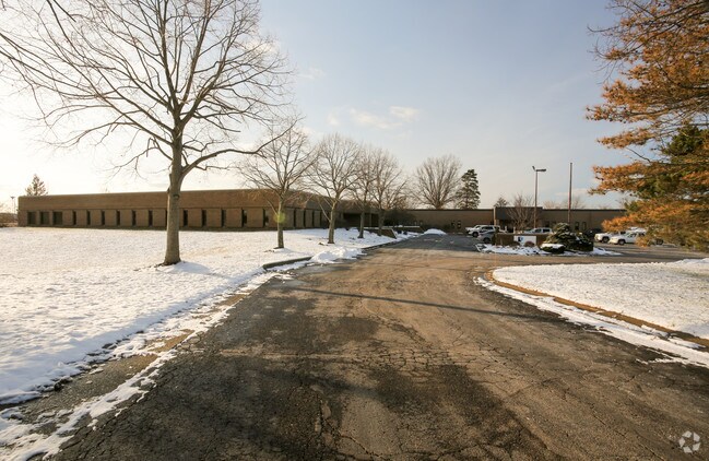
Property Record
125 State Route 43, Hartville, OH 44632

NEARBY LISTINGS FOR SALE OR LEASE
Property Detail
125 State Route 43
Akron, OH
Suffield
36-030-00-00-006-001
LOT 30 S
Scientificpharmaceuticalmedicalresearchfacility
Portage
X
Ohio
39151C0076E
30
2024
9.28 AC
2024
Portage County
602102
Cleveland
33,060 SF
DEMOGRAPHICS near 125 State Route 43
1 Mile
3 Mile
5 Mile
2024 Total Population
656
14,975
44,721
2029 Population
653
14,854
44,248
Pop Growth 2024-2029
(0.46%)
(0.81%)
(1.06%)
Average Age
44
43
43
2024 Total Households
266
5,827
17,742
HH Growth 2024-2029
(0.75%)
(0.88%)
(1.08%)
Median Household Inc
$81,771
$76,816
$75,252
Avg Household Size
2.50
2.50
2.50
2024 Avg HH Vehicles
2.00
2.00
2.00
Median Home Value
$220,930
$210,328
$192,326
Median Year Built
1976
1975
1972
Nearby Places
Map Layers
Map Styles
 Street
 Aerial
- Restaurants
- Banks
- Shops
- Fitness
- Groceries
PUBLIC TRANSPORTATION
AIRPORT
Akron-Canton Regional
DRIVE
WALK
Distance
Akron-Canton Regional
22 min
11.3 mi
Freight Ports
Port of Toledo
DRIVE
WALK
Distance
Port of Toledo
180 min
150.0 mi
SALE & LEASE HISTORY
LISTING DATE
SALE/LEASE

Sep 15, 2017
For Sale
May 19, 2017
For Sale
Mar 03, 2017
For Sale
Jan 27, 2020
For Sale
Feb 03, 2017
For Sale
Apr 10, 2018
For Sale
Apr 04, 2017
For Sale
Nearby Properties
Address
Land Use
TOTAL SIZE
Lot Size
Zoning
Address
Land Use
TOTAL SIZE
Lot Size
Zoning
220,250 SF
15.78 AC
Address
Land Use
TOTAL SIZE
Lot Size
Zoning
166,070 SF
5.50 AC
Address
Land Use
TOTAL SIZE
Lot Size
Zoning
Address
Land Use
TOTAL SIZE
Lot Size
Zoning
146,057 SF
37.51 AC
Address
Land Use
TOTAL SIZE
Lot Size
Zoning
128,922 SF
17.84 AC
Address
Land Use
TOTAL SIZE
Lot Size
Zoning
286,697 SF
18.04 AC
Address
Land Use
TOTAL SIZE
Lot Size
Zoning
162,939 SF
14.22 AC
Address
Land Use
TOTAL SIZE
Lot Size
Zoning
127,106 SF
20.28 AC
Address
Land Use
TOTAL SIZE
Lot Size
Zoning
Address
Land Use
TOTAL SIZE
Lot Size
Zoning
137,493 SF
11.61 AC
Address
Land Use
TOTAL SIZE
Lot Size
Zoning
103,645 SF
29.83 AC
Address
Land Use
TOTAL SIZE
Lot Size
Zoning
53,454 SF
3.78 AC
Address
Land Use
TOTAL SIZE
Lot Size
Zoning
46,002 SF
10.21 AC
Address
Land Use
TOTAL SIZE
Lot Size
Zoning
154,148 SF
15.85 AC
Address
Land Use
TOTAL SIZE
Lot Size
Zoning
23,797 SF
2.86 AC
Address
Land Use
TOTAL SIZE
Lot Size
Zoning
74,418 SF
396.24 AC
Address
Land Use
TOTAL SIZE
Lot Size
Zoning
5.85 AC
Address
Land Use
TOTAL SIZE
Lot Size
Zoning
133,300 SF
30.63 AC
Address
Land Use
TOTAL SIZE
Lot Size
Zoning
Address
Land Use
TOTAL SIZE
Lot Size
Zoning
30,820 SF
5.59 AC
Address
Land Use
TOTAL SIZE
Lot Size
Zoning
30,389 SF
5.58 AC
Address
Land Use
TOTAL SIZE
Lot Size
Zoning
Address
Land Use
TOTAL SIZE
Lot Size
Zoning
4,128 SF
257.85 AC
Address
Land Use
TOTAL SIZE
Lot Size
Zoning
14,921 SF
308.17 AC
Address
Land Use
TOTAL SIZE
Lot Size
Zoning
42,805 SF
26.69 AC
Address
Land Use
TOTAL SIZE
Lot Size
Zoning
22,836 SF
4.15 AC
Address
Land Use
TOTAL SIZE
Lot Size
Zoning
24,749 SF
6.21 AC
Address
Land Use
TOTAL SIZE
Lot Size
Zoning
2,446 SF
170.40 AC
Address
Land Use
TOTAL SIZE
Lot Size
Zoning
57,620 SF
2.62 AC
Address
Land Use
TOTAL SIZE
Lot Size
Zoning
17,894 SF
4.11 AC
The World's #1 Commercial Real Estate Marketplace
Connect with us
© 2025 CoStar Group
The information above has been obtained from sources believed reliable. While we do not doubt its accuracy we have not verified it and make no guarantee, warranty or representation about it. It is your responsibility to independently confirm its accuracy and completeness. Any projections, opinions, assumptions, or estimates used are for example only and do not represent the current or future performance of the property. The value of this transaction to you depends on tax and other factors which should be evaluated by your tax, financial, and legal advisors. You and your advisors should conduct a careful, independent investigation of the property to determine to your satisfaction the suitability of the property for your needs.