Property Record
125 W Boeger Dr, Arlington Heights, IL 60004


NEARBY LISTINGS FOR SALE OR LEASE
Property Detail
125 W Boeger Dr
Chicago-Naperville-Elgin, IL-IN-WI
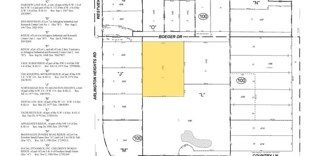
Schurtzs Sub
03-08-100-038-0000
T (SCHURTZS) SUB OF PT OF NW SEC 08-42-11
Industrialgeneral
Cook
X
Illinois
17097C0263K
1
2023
2.20 AC
2025
Northwest Cook
803005
Chicago
23,190 SF
DEMOGRAPHICS near 125 W Boeger Dr
1 Mile
3 Mile
5 Mile
2024 Total Population
13,784
139,944
271,231
2029 Population
13,335
136,331
264,506
Pop Growth 2024-2029
(3.26%)
(2.58%)
(2.48%)
Average Age
44
42
42
2024 Total Households
5,649
53,014
105,868
HH Growth 2024-2029
(3.59%)
(2.91%)
(2.76%)
Median Household Inc
$102,003
$94,308
$99,070
Avg Household Size
2.40
2.60
2.50
2024 Avg HH Vehicles
2.00
2.00
2.00
Median Home Value
$345,277
$332,427
$347,345
Median Year Built
1977
1977
1976
Nearby Places
Map Layers
Map Styles
 Street
 Aerial
- Restaurants
- Banks
- Shops
- Fitness
- Groceries
PUBLIC TRANSPORTATION
COMMUTER RAIL
Wheeling Station (North Central Service - Northeast Illinois Regional Commuter Railroad (Metra))
DRIVE
WALK
Distance
Wheeling Station (North Central Service - Northeast Illinois Regional Commuter Railroad (Metra))
7 min
3.3 mi
Arlington Heights Station (Union Pacific Northwest Line - Northeast Illinois Regional Commuter Railroad (Metra))
DRIVE
WALK
Distance
Arlington Heights Station (Union Pacific Northwest Line - Northeast Illinois Regional Commuter Railroad (Metra))
11 min
4.3 mi
AIRPORT
Chicago O'Hare International
DRIVE
WALK
Distance
Chicago O'Hare International
28 min
15.2 mi
Chicago Midway International
DRIVE
WALK
Distance
Chicago Midway International
52 min
36.5 mi
SALE & LEASE HISTORY
LISTING DATE
SALE/LEASE

Feb 10, 2025
For Lease
Nearby Properties
Address
Land Use
TOTAL SIZE
Lot Size
Zoning
Address
Land Use
TOTAL SIZE
Lot Size
Zoning
622,896 SF
3.94 AC
Address
Land Use
TOTAL SIZE
Lot Size
Zoning
366,052 SF
32.18 AC
Address
Land Use
TOTAL SIZE
Lot Size
Zoning
Address
Land Use
TOTAL SIZE
Lot Size
Zoning
510,569 SF
3.55 AC
Address
Land Use
TOTAL SIZE
Lot Size
Zoning
197,097 SF
21.80 AC
Address
Land Use
TOTAL SIZE
Lot Size
Zoning
20.95 AC
Address
Land Use
TOTAL SIZE
Lot Size
Zoning
295,685 SF
27.21 AC
Address
Land Use
TOTAL SIZE
Lot Size
Zoning
18.34 AC
Address
Land Use
TOTAL SIZE
Lot Size
Zoning
Address
Land Use
TOTAL SIZE
Lot Size
Zoning
Address
Land Use
TOTAL SIZE
Lot Size
Zoning
214,428 SF
17.29 AC
Address
Land Use
TOTAL SIZE
Lot Size
Zoning
392,574 SF
25.82 AC
Address
Land Use
TOTAL SIZE
Lot Size
Zoning
Address
Land Use
TOTAL SIZE
Lot Size
Zoning
14,099 SF
2.01 AC
Address
Land Use
TOTAL SIZE
Lot Size
Zoning
493,632 SF
31.51 AC
Address
Land Use
TOTAL SIZE
Lot Size
Zoning
195,269 SF
11.07 AC
Address
Land Use
TOTAL SIZE
Lot Size
Zoning
49,539 SF
1.57 AC
Address
Land Use
TOTAL SIZE
Lot Size
Zoning
561,594 SF
29.88 AC
Address
Land Use
TOTAL SIZE
Lot Size
Zoning
Address
Land Use
TOTAL SIZE
Lot Size
Zoning
102,425 SF
9.38 AC
Address
Land Use
TOTAL SIZE
Lot Size
Zoning
Address
Land Use
TOTAL SIZE
Lot Size
Zoning
51,028 SF
4.20 AC
Address
Land Use
TOTAL SIZE
Lot Size
Zoning
Address
Land Use
TOTAL SIZE
Lot Size
Zoning
151,643 SF
11.18 AC
Address
Land Use
TOTAL SIZE
Lot Size
Zoning
Address
Land Use
TOTAL SIZE
Lot Size
Zoning
365,127 SF
16.31 AC
Address
Land Use
TOTAL SIZE
Lot Size
Zoning
399,179 SF
13.70 AC
Address
Land Use
TOTAL SIZE
Lot Size
Zoning
176,325 SF
18.20 AC
Address
Land Use
TOTAL SIZE
Lot Size
Zoning
152,838 SF
10.05 AC
Address
Land Use
TOTAL SIZE
Lot Size
Zoning
63,969 SF
3.16 AC
The World's #1 Commercial Real Estate Marketplace
Connect with us
© 2026 CoStar Group
The information above has been obtained from sources believed reliable. While we do not doubt its accuracy we have not verified it and make no guarantee, warranty or representation about it. It is your responsibility to independently confirm its accuracy and completeness. Any projections, opinions, assumptions, or estimates used are for example only and do not represent the current or future performance of the property. The value of this transaction to you depends on tax and other factors which should be evaluated by your tax, financial, and legal advisors. You and your advisors should conduct a careful, independent investigation of the property to determine to your satisfaction the suitability of the property for your needs.