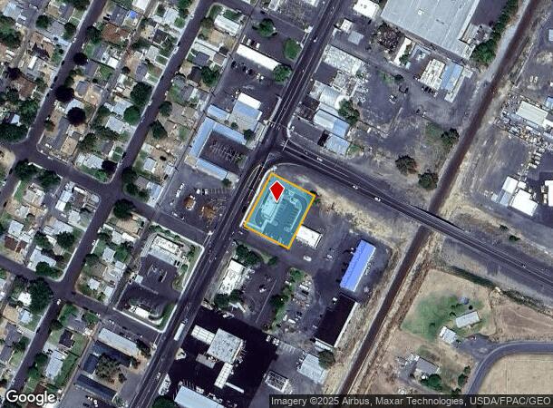
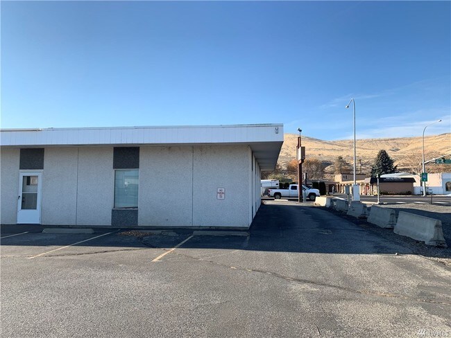
Property Record
1250 Basin St Sw, Ephrata, WA 98823


NEARBY LISTINGS FOR SALE OR LEASE
Property Detail
1250 Basin St Sw
Moses Lake, WA
Second Les Parr Sp 7-73
311869000
LOT 1 SECOND LES PARR SP 7-73
Storebuilding
Grant
AO
Washington
53025C0766C
1
2025
0.56 AC
2025
Washington State Area
010402
Other Market Areas
6,600 SF
DEMOGRAPHICS near 1250 Basin St Sw
1 Mile
3 Mile
5 Mile
2024 Total Population
3,572
9,879
10,806
2029 Population
3,815
10,534
11,519
Pop Growth 2024-2029
+ 6.80%
+ 6.63%
+ 6.60%
Average Age
38
37
37
2024 Total Households
1,320
3,622
3,932
HH Growth 2024-2029
+ 6.97%
+ 6.76%
+ 6.77%
Median Household Inc
$75,363
$66,707
$66,764
Avg Household Size
2.60
2.70
2.70
2024 Avg HH Vehicles
2.00
2.00
2.00
Median Home Value
$227,832
$229,006
$233,038
Median Year Built
1962
1967
1970
Nearby Places
Map Layers
Map Styles
 Street
 Aerial
- Restaurants
- Banks
- Shops
- Fitness
- Groceries
PUBLIC TRANSPORTATION
COMMUTER RAIL
DRIVE
WALK
Distance
4 min
1.2 mi
AIRPORT
Pangborn Memorial
DRIVE
WALK
Distance
Pangborn Memorial
62 min
43.9 mi
SALE & LEASE HISTORY
LISTING DATE
SALE/LEASE

Nov 12, 2019
For Sale
Jan 10, 2024
For Sale
Aug 08, 2023
For Sale
Aug 07, 2023
For Sale
Apr 11, 2023
For Sale
Nearby Properties
Address
Land Use
TOTAL SIZE
Lot Size
Zoning
Address
Land Use
TOTAL SIZE
Lot Size
Zoning
85,225 SF
5 AC
Address
Land Use
TOTAL SIZE
Lot Size
Zoning
153,927 SF
17.86 AC
Address
Land Use
TOTAL SIZE
Lot Size
Zoning
52,650 SF
2.40 AC
Address
Land Use
TOTAL SIZE
Lot Size
Zoning
42,197 SF
7.92 AC
Address
Land Use
TOTAL SIZE
Lot Size
Zoning
24,966 SF
2.72 AC
Address
Land Use
TOTAL SIZE
Lot Size
Zoning
47,747 SF
15.04 AC
Address
Land Use
TOTAL SIZE
Lot Size
Zoning
102,897 SF
0.78 AC
Address
Land Use
TOTAL SIZE
Lot Size
Zoning
49,824 SF
0.88 AC
Address
Land Use
TOTAL SIZE
Lot Size
Zoning
43,112 SF
4.60 AC
Address
Land Use
TOTAL SIZE
Lot Size
Zoning
23,160 SF
35.35 AC
Address
Land Use
TOTAL SIZE
Lot Size
Zoning
16,158 SF
3.94 AC
Address
Land Use
TOTAL SIZE
Lot Size
Zoning
23,536 SF
1.12 AC
Address
Land Use
TOTAL SIZE
Lot Size
Zoning
34,993 SF
7.07 AC
Address
Land Use
TOTAL SIZE
Lot Size
Zoning
28,872 SF
8.51 AC
Address
Land Use
TOTAL SIZE
Lot Size
Zoning
40,121 SF
7.55 AC
Address
Land Use
TOTAL SIZE
Lot Size
Zoning
7,540 SF
187.73 AC
Address
Land Use
TOTAL SIZE
Lot Size
Zoning
24,874 SF
3 AC
Address
Land Use
TOTAL SIZE
Lot Size
Zoning
31,537 SF
5.07 AC
Address
Land Use
TOTAL SIZE
Lot Size
Zoning
60,000 SF
0.60 AC
Address
Land Use
TOTAL SIZE
Lot Size
Zoning
17,568 SF
2 AC
Address
Land Use
TOTAL SIZE
Lot Size
Zoning
30,651 SF
2 AC
Address
Land Use
TOTAL SIZE
Lot Size
Zoning
14,276 SF
4.70 AC
Address
Land Use
TOTAL SIZE
Lot Size
Zoning
18,682 SF
7.67 AC
Address
Land Use
TOTAL SIZE
Lot Size
Zoning
27,849 SF
2 AC
Address
Land Use
TOTAL SIZE
Lot Size
Zoning
23,344 SF
6 AC
Address
Land Use
TOTAL SIZE
Lot Size
Zoning
47,770 SF
10.91 AC
Address
Land Use
TOTAL SIZE
Lot Size
Zoning
30,250 SF
3.65 AC
Address
Land Use
TOTAL SIZE
Lot Size
Zoning
33,040 SF
0.57 AC
Address
Land Use
TOTAL SIZE
Lot Size
Zoning
9,602 SF
0.33 AC
The World's #1 Commercial Real Estate Marketplace
Connect with us
© 2026 CoStar Group
The information above has been obtained from sources believed reliable. While we do not doubt its accuracy we have not verified it and make no guarantee, warranty or representation about it. It is your responsibility to independently confirm its accuracy and completeness. Any projections, opinions, assumptions, or estimates used are for example only and do not represent the current or future performance of the property. The value of this transaction to you depends on tax and other factors which should be evaluated by your tax, financial, and legal advisors. You and your advisors should conduct a careful, independent investigation of the property to determine to your satisfaction the suitability of the property for your needs.