Property Record
1250 Beecher Rd E, Bristol, IL 60512
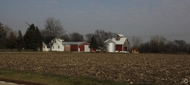

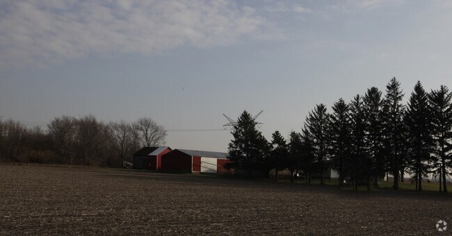
Property Detail
1250 Beecher Rd E
02-08-100-003
SEC 8-37-7
Industrialgeneral
KENDALL
B and X Area of moderate flood hazard, usually the area between the limits of the 100-year and 500-year floods.
Illinois
2024
28.69 AC
2024
I-88 West
890401
Chicago
18,112 SF
Chicago-Naperville-Elgin, IL-IN
NEARBY LISTINGS FOR SALE OR LEASE
DEMOGRAPHICS near 1250 Beecher Rd E
1 mile
3 mile
5 mile
2025 Total Population
42
12,335
58,319
2030 Population
46
13,310
62,342
Pop Growth 2025-2030
+ 9.52%
+ 7.90%
+ 6.90%
Average Age
39
36
37
2025 Total Households
13
4,019
19,351
HH Growth 2025-2030
+ 7.69%
+ 7.79%
+ 6.84%
Median Household Inc
$149,999
$103,245
$103,364
Avg Household Size
3.00
3.00
3.00
2025 Avg HH Vehicles
2.00
2.00
2.00
Median Home Value
$342,857
$292,173
$295,303
Median Year Built
2006
2005
2002
Nearby Places
Map Layers
Map Styles
 Street
 Aerial
Transit
 Traffic
 Biking
Places
Listings with unknown addresses are not visible on the map
- Restaurants
- Banks
- Shops
- Fitness
- Groceries
PUBLIC TRANSPORTATION
COMMUTER RAIL
Plano Amtrak Station (Carl Sandburg - Amtrak, Illinois Zephyr - Amtrak)
Drive
Walk
Distance
Plano Amtrak Station (Carl Sandburg - Amtrak, Illinois Zephyr - Amtrak)
13 min
7.0 mi
Freight Ports
Port Milwaukee
Drive
Walk
Distance
Port Milwaukee
148 min
120.1 mi
Nearby Properties
Address
Land Use
TOTAL SIZE
Lot Size
Zoning
Address
Land Use
TOTAL SIZE
Lot Size
Zoning
1,703,170 SF
266.50 AC
Address
Land Use
TOTAL SIZE
Lot Size
Zoning
64,667 SF
6.15 AC
Address
Land Use
TOTAL SIZE
Lot Size
Zoning
184,454 SF
8.05 AC
Address
Land Use
TOTAL SIZE
Lot Size
Zoning
0.13 AC
Address
Land Use
TOTAL SIZE
Lot Size
Zoning
211,068 SF
13.09 AC
Address
Land Use
TOTAL SIZE
Lot Size
Zoning
120.35 AC
Address
Land Use
TOTAL SIZE
Lot Size
Zoning
177,481 SF
14.11 AC
Address
Land Use
TOTAL SIZE
Lot Size
Zoning
15,913 SF
31.25 AC
Address
Land Use
TOTAL SIZE
Lot Size
Zoning
108,848 SF
5.79 AC
Address
Land Use
TOTAL SIZE
Lot Size
Zoning
102,020 SF
6 AC
Address
Land Use
TOTAL SIZE
Lot Size
Zoning
Address
Land Use
TOTAL SIZE
Lot Size
Zoning
107,162 SF
10.49 AC
Address
Land Use
TOTAL SIZE
Lot Size
Zoning
16,100 SF
5.14 AC
Address
Land Use
TOTAL SIZE
Lot Size
Zoning
90,533 SF
7.18 AC
Address
Land Use
TOTAL SIZE
Lot Size
Zoning
121,275 SF
15.67 AC
Address
Land Use
TOTAL SIZE
Lot Size
Zoning
15,632 SF
2.83 AC
Address
Land Use
TOTAL SIZE
Lot Size
Zoning
133,396 SF
8.51 AC
Address
Land Use
TOTAL SIZE
Lot Size
Zoning
0.06 AC
Address
Land Use
TOTAL SIZE
Lot Size
Zoning
229,190 SF
16.76 AC
Address
Land Use
TOTAL SIZE
Lot Size
Zoning
14,292 SF
15.48 AC
Address
Land Use
TOTAL SIZE
Lot Size
Zoning
9,304 SF
1.55 AC
Address
Land Use
TOTAL SIZE
Lot Size
Zoning
14,360 SF
1.30 AC
Address
Land Use
TOTAL SIZE
Lot Size
Zoning
32,671 SF
5.23 AC
Address
Land Use
TOTAL SIZE
Lot Size
Zoning
17,920 SF
1.56 AC
Address
Land Use
TOTAL SIZE
Lot Size
Zoning
12.29 AC
Address
Land Use
TOTAL SIZE
Lot Size
Zoning
57,769 SF
3.42 AC
Address
Land Use
TOTAL SIZE
Lot Size
Zoning
20,700 SF
0.76 AC
Address
Land Use
TOTAL SIZE
Lot Size
Zoning
3,583 SF
2.53 AC
Address
Land Use
TOTAL SIZE
Lot Size
Zoning
31,632 SF
3.99 AC
Address
Land Use
TOTAL SIZE
Lot Size
Zoning
3,022 SF
1.11 AC
The World's #1 Commercial Real Estate Marketplace
Connect with us
© 2026 CoStar Group
The information above has been obtained from sources believed reliable. While we do not doubt its accuracy we have not verified it and make no guarantee, warranty or representation about it. It is your responsibility to independently confirm its accuracy and completeness. Any projections, opinions, assumptions, or estimates used are for example only and do not represent the current or future performance of the property. The value of this transaction to you depends on tax and other factors which should be evaluated by your tax, financial, and legal advisors. You and your advisors should conduct a careful, independent investigation of the property to determine to your satisfaction the suitability of the property for your needs.