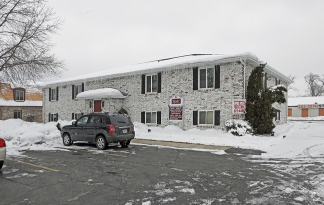
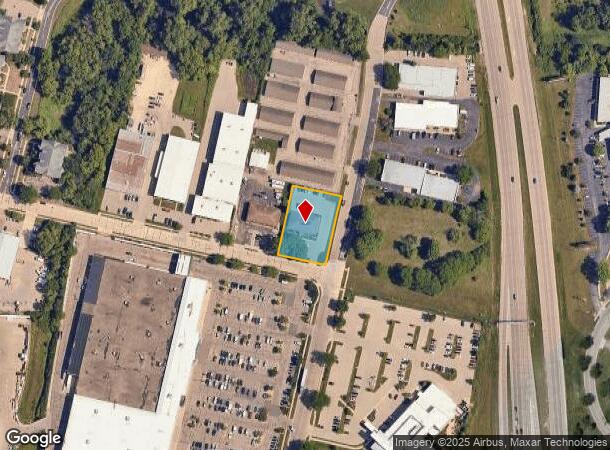
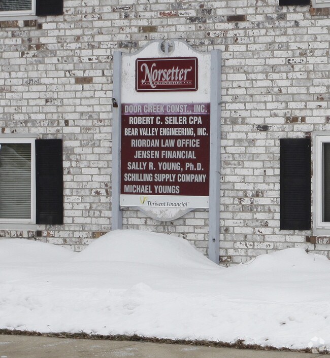
Property Record
1250 Femrite Dr, Monona, WI 53716
NEARBY LISTINGS FOR SALE OR LEASE
Property Detail
1250 Femrite Dr
Madison, WI
Certified Surv Map 3336
0710-214-6751-7
LOT 1 CSM 3336 CS13/109-10/19/79 F/K/A CSM 3268 CS12/392-8/9/79 & F/K/A PRT LOT 1 CSM 2107 CS8/313-7/27/76 F/K/A ASSESSORS PLAT 2 B G PRT OUTLOT 35 DESCR AS SE C 21-7-10 PRT SE1/4
Commercialnec
Dane
X
Wisconsin
55025C0441H
1
2024
0.64 AC
2024
Southeast Madison
002900
Milwaukee/Madison
DEMOGRAPHICS near 1250 Femrite Dr
1 Mile
3 Mile
5 Mile
2024 Total Population
3,786
41,512
151,622
2029 Population
3,906
43,010
156,579
Pop Growth 2024-2029
+ 3.17%
+ 3.61%
+ 3.27%
Average Age
43
41
36
2024 Total Households
1,818
18,160
68,422
HH Growth 2024-2029
+ 3.25%
+ 3.73%
+ 3.48%
Median Household Inc
$66,300
$80,632
$63,650
Avg Household Size
2.00
2.20
2.00
2024 Avg HH Vehicles
2.00
2.00
1.00
Median Home Value
$267,735
$291,264
$298,390
Median Year Built
1967
1975
1975
Nearby Places
Map Layers
Map Styles
 Street
 Aerial
- Restaurants
- Banks
- Shops
- Fitness
- Groceries
PUBLIC TRANSPORTATION
AIRPORT
Dane County Regional/Truax Field
DRIVE
WALK
Distance
Dane County Regional/Truax Field
15 min
8.4 mi
SALE & LEASE HISTORY
LISTING DATE
SALE/LEASE

Nov 01, 2016
For Lease
Nearby Properties
Address
Land Use
TOTAL SIZE
Lot Size
Zoning
Address
Land Use
TOTAL SIZE
Lot Size
Zoning
168,685 SF
14.05 AC
IL
Address
Land Use
TOTAL SIZE
Lot Size
Zoning
13,440 SF
10.98 AC
IL
Address
Land Use
TOTAL SIZE
Lot Size
Zoning
2.03 AC
Address
Land Use
TOTAL SIZE
Lot Size
Zoning
13.40 AC
Address
Land Use
TOTAL SIZE
Lot Size
Zoning
3.59 AC
Address
Land Use
TOTAL SIZE
Lot Size
Zoning
12,450 SF
9.40 AC
SE
Address
Land Use
TOTAL SIZE
Lot Size
Zoning
2.38 AC
Address
Land Use
TOTAL SIZE
Lot Size
Zoning
225,108 SF
2 AC
PD
Address
Land Use
TOTAL SIZE
Lot Size
Zoning
19.81 AC
Address
Land Use
TOTAL SIZE
Lot Size
Zoning
149,897 SF
17.72 AC
IL
Address
Land Use
TOTAL SIZE
Lot Size
Zoning
5.53 AC
Address
Land Use
TOTAL SIZE
Lot Size
Zoning
3.49 AC
Address
Land Use
TOTAL SIZE
Lot Size
Zoning
6,868 SF
18.35 AC
IL
Address
Land Use
TOTAL SIZE
Lot Size
Zoning
202,800 SF
13.05 AC
IL
Address
Land Use
TOTAL SIZE
Lot Size
Zoning
94,290 SF
21.31 AC
SR-V2
Address
Land Use
TOTAL SIZE
Lot Size
Zoning
154,403 SF
1.21 AC
PD
Address
Land Use
TOTAL SIZE
Lot Size
Zoning
176,496 SF
3.51 AC
PD
Address
Land Use
TOTAL SIZE
Lot Size
Zoning
95,909 SF
1 AC
TE
Address
Land Use
TOTAL SIZE
Lot Size
Zoning
156,368 SF
4.01 AC
PD
Address
Land Use
TOTAL SIZE
Lot Size
Zoning
117,606 SF
1.85 AC
TR-U2
Address
Land Use
TOTAL SIZE
Lot Size
Zoning
16.40 AC
IL
Address
Land Use
TOTAL SIZE
Lot Size
Zoning
280,000 SF
15.01 AC
IL
Address
Land Use
TOTAL SIZE
Lot Size
Zoning
10.45 AC
IL
Address
Land Use
TOTAL SIZE
Lot Size
Zoning
49,562 SF
4.42 AC
SE
Address
Land Use
TOTAL SIZE
Lot Size
Zoning
17,980 SF
6.25 AC
SR-V2
Address
Land Use
TOTAL SIZE
Lot Size
Zoning
134,814 SF
3.79 AC
SR-V2
Address
Land Use
TOTAL SIZE
Lot Size
Zoning
9,030 SF
6.59 AC
SR-V2
Address
Land Use
TOTAL SIZE
Lot Size
Zoning
42,967 SF
5.25 AC
SR-V2
Address
Land Use
TOTAL SIZE
Lot Size
Zoning
1.99 AC
Address
Land Use
TOTAL SIZE
Lot Size
Zoning
95,009 SF
2.04 AC
SR-V2
The World's #1 Commercial Real Estate Marketplace
Connect with us
© 2025 CoStar Group
The information above has been obtained from sources believed reliable. While we do not doubt its accuracy we have not verified it and make no guarantee, warranty or representation about it. It is your responsibility to independently confirm its accuracy and completeness. Any projections, opinions, assumptions, or estimates used are for example only and do not represent the current or future performance of the property. The value of this transaction to you depends on tax and other factors which should be evaluated by your tax, financial, and legal advisors. You and your advisors should conduct a careful, independent investigation of the property to determine to your satisfaction the suitability of the property for your needs.