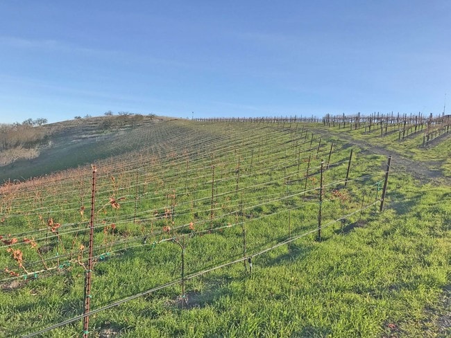
Property Record
1250 Kiler Canyon Rd, Paso Robles, CA 93446


NEARBY LISTINGS FOR SALE OR LEASE
Property Detail
1250 Kiler Canyon Rd
San Luis Obispo-Paso Robles-Arroyo Grande, CA
Parcel Map Coal 00 0140
018-211-022
PM 60/41-42 PAR 3
Agriculturalland
San Luis Obispo
X
California
06079C0602G
38.63 AC
2024
North 101 Corridor
2025
San Luis Obispo/Paso Robles
010206
DEMOGRAPHICS near 1250 Kiler Canyon Rd
1 Mile
3 Mile
5 Mile
2024 Total Population
956
25,395
41,200
2029 Population
958
25,197
40,797
Pop Growth 2024-2029
+ 0.21%
(0.78%)
(0.98%)
Average Age
45
40
40
2024 Total Households
405
9,371
15,197
HH Growth 2024-2029
0.00%
(0.94%)
(1.16%)
Median Household Inc
$96,499
$75,491
$83,691
Avg Household Size
2.40
2.70
2.60
2024 Avg HH Vehicles
2.00
2.00
2.00
Median Home Value
$824,324
$632,015
$640,637
Median Year Built
1981
1985
1987
Nearby Places
Map Layers
Map Styles
 Street
 Aerial
- Restaurants
- Banks
- Shops
- Fitness
- Groceries
PUBLIC TRANSPORTATION
COMMUTER RAIL
Paso Robles Amtrak Station (Coast Starlight - Amtrak)
DRIVE
WALK
Distance
Paso Robles Amtrak Station (Coast Starlight - Amtrak)
5 min
1.6 mi
AIRPORT
San Luis County Regional
DRIVE
WALK
Distance
San Luis County Regional
48 min
34.4 mi
Freight Ports
The Port of Hueneme
DRIVE
WALK
Distance
The Port of Hueneme
205 min
161.5 mi
SALE & LEASE HISTORY
LISTING DATE
SALE/LEASE

Sep 06, 2017
For Sale
Nearby Properties
Address
Land Use
TOTAL SIZE
Lot Size
Zoning
Address
Land Use
TOTAL SIZE
Lot Size
Zoning
197,140 SF
11.87 AC
R3
Address
Land Use
TOTAL SIZE
Lot Size
Zoning
23,092 SF
1.38 AC
Address
Land Use
TOTAL SIZE
Lot Size
Zoning
282,906 SF
10 AC
R4
Address
Land Use
TOTAL SIZE
Lot Size
Zoning
18,400 SF
2.42 AC
TC1
Address
Land Use
TOTAL SIZE
Lot Size
Zoning
72,406 SF
4.87 AC
OP
Address
Land Use
TOTAL SIZE
Lot Size
Zoning
4.27 AC
PM
Address
Land Use
TOTAL SIZE
Lot Size
Zoning
330,848 SF
30.24 AC
R315
Address
Land Use
TOTAL SIZE
Lot Size
Zoning
42,617 SF
4.79 AC
PM
Address
Land Use
TOTAL SIZE
Lot Size
Zoning
4.25 AC
Address
Land Use
TOTAL SIZE
Lot Size
Zoning
11,224 SF
4.21 AC
RC
Address
Land Use
TOTAL SIZE
Lot Size
Zoning
48.88 AC
R1
Address
Land Use
TOTAL SIZE
Lot Size
Zoning
92,102 SF
2.79 AC
R4
Address
Land Use
TOTAL SIZE
Lot Size
Zoning
221,386 SF
10.45 AC
M
Address
Land Use
TOTAL SIZE
Lot Size
Zoning
73,236 SF
2.45 AC
TC2
Address
Land Use
TOTAL SIZE
Lot Size
Zoning
82,249 SF
6.67 AC
Address
Land Use
TOTAL SIZE
Lot Size
Zoning
49,520 SF
1.57 AC
C2
Address
Land Use
TOTAL SIZE
Lot Size
Zoning
58,884 SF
2.34 AC
T4N
Address
Land Use
TOTAL SIZE
Lot Size
Zoning
1,448 SF
3.17 AC
C2
Address
Land Use
TOTAL SIZE
Lot Size
Zoning
89,417 SF
3.13 AC
T4N
Address
Land Use
TOTAL SIZE
Lot Size
Zoning
12.56 AC
CR
Address
Land Use
TOTAL SIZE
Lot Size
Zoning
1.59 AC
C3
Address
Land Use
TOTAL SIZE
Lot Size
Zoning
5.94 AC
R2
Address
Land Use
TOTAL SIZE
Lot Size
Zoning
74,710 SF
7.79 AC
R3
Address
Land Use
TOTAL SIZE
Lot Size
Zoning
46,269 SF
2.30 AC
C2
Address
Land Use
TOTAL SIZE
Lot Size
Zoning
89,400 SF
7.97 AC
RC
Address
Land Use
TOTAL SIZE
Lot Size
Zoning
64,323 SF
2.56 AC
T4N
Address
Land Use
TOTAL SIZE
Lot Size
Zoning
4.60 AC
CP
Address
Land Use
TOTAL SIZE
Lot Size
Zoning
44,636 SF
2.81 AC
TC2
Address
Land Use
TOTAL SIZE
Lot Size
Zoning
64,748 SF
5.41 AC
RMF
Address
Land Use
TOTAL SIZE
Lot Size
Zoning
32,698 SF
3.45 AC
R1
The World's #1 Commercial Real Estate Marketplace
Connect with us
© 2025 CoStar Group
The information above has been obtained from sources believed reliable. While we do not doubt its accuracy we have not verified it and make no guarantee, warranty or representation about it. It is your responsibility to independently confirm its accuracy and completeness. Any projections, opinions, assumptions, or estimates used are for example only and do not represent the current or future performance of the property. The value of this transaction to you depends on tax and other factors which should be evaluated by your tax, financial, and legal advisors. You and your advisors should conduct a careful, independent investigation of the property to determine to your satisfaction the suitability of the property for your needs.