Property Record
1250 Randall St, Denton, TX 76209
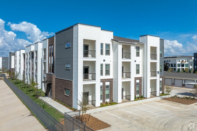

Property Detail
1250 Randall St
Dallas-Fort Worth-Arlington, TX
SHERMAN CROSSING ADDITION PHASE 1 BLK B LOT 1
R744898
DENTON
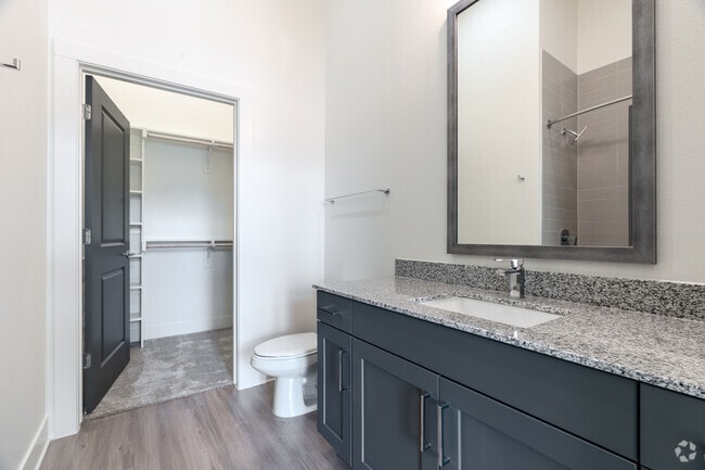
Apartment
Texas
B and X Area of moderate flood hazard, usually the area between the limits of the 100-year and 500-year floods.
1
2024
11.81 AC
2025
Denton
020601
Dallas/Ft Worth
336,342 SF
NEARBY LISTINGS FOR SALE OR LEASE
DEMOGRAPHICS near 1250 Randall St
1 mile
3 mile
5 mile
2025 Total Population
11,011
55,053
112,566
2030 Population
12,562
62,161
127,133
Pop Growth 2025-2030
+ 14.09%
+ 12.91%
+ 12.94%
Average Age
37
37
35
2025 Total Households
3,913
21,190
45,435
HH Growth 2025-2030
+ 14.06%
+ 13.20%
+ 13.29%
Median Household Inc
$91,571
$76,742
$57,992
Avg Household Size
2.70
2.40
2.30
2025 Avg HH Vehicles
2.00
2.00
2.00
Median Home Value
$298,995
$297,917
$306,147
Median Year Built
1996
1987
1988
Nearby Places
Map Layers
Map Styles
 Street
 Aerial
Transit
 Traffic
 Biking
Places
Listings with unknown addresses are not visible on the map
- Restaurants
- Banks
- Shops
- Fitness
- Groceries
PUBLIC TRANSPORTATION
COMMUTER RAIL
Drive
Walk
Distance
9 min
4.0 mi
Drive
Walk
Distance
12 min
6.3 mi
AIRPORT
Dallas-Fort Worth International
Drive
Walk
Distance
Dallas-Fort Worth International
40 min
29.4 mi
Dallas Love Field
Drive
Walk
Distance
Dallas Love Field
52 min
38.5 mi
Nearby Properties
Address
Land Use
TOTAL SIZE
Lot Size
Zoning
Address
Land Use
TOTAL SIZE
Lot Size
Zoning
490,000 SF
27.69 AC
Address
Land Use
TOTAL SIZE
Lot Size
Zoning
337,730 SF
65.39 AC
Address
Land Use
TOTAL SIZE
Lot Size
Zoning
347,844 SF
14.09 AC
Address
Land Use
TOTAL SIZE
Lot Size
Zoning
576,664 SF
189.26 AC
Address
Land Use
TOTAL SIZE
Lot Size
Zoning
361,731 SF
15.96 AC
Address
Land Use
TOTAL SIZE
Lot Size
Zoning
347,845 SF
15.53 AC
Address
Land Use
TOTAL SIZE
Lot Size
Zoning
298,744 SF
32.12 AC
Address
Land Use
TOTAL SIZE
Lot Size
Zoning
149,145 SF
31.45 AC
Address
Land Use
TOTAL SIZE
Lot Size
Zoning
216,314 SF
22.10 AC
Address
Land Use
TOTAL SIZE
Lot Size
Zoning
300,000 SF
11.31 AC
Address
Land Use
TOTAL SIZE
Lot Size
Zoning
378,000 SF
14.94 AC
Address
Land Use
TOTAL SIZE
Lot Size
Zoning
213,040 SF
11.59 AC
Address
Land Use
TOTAL SIZE
Lot Size
Zoning
203,238 SF
15.98 AC
14E
Address
Land Use
TOTAL SIZE
Lot Size
Zoning
219,059 SF
11.41 AC
19G
Address
Land Use
TOTAL SIZE
Lot Size
Zoning
352,129 SF
19.02 AC
Address
Land Use
TOTAL SIZE
Lot Size
Zoning
150,162 SF
40.40 AC
Address
Land Use
TOTAL SIZE
Lot Size
Zoning
265,448 SF
6.67 AC
Address
Land Use
TOTAL SIZE
Lot Size
Zoning
175,943 SF
5.88 AC
Address
Land Use
TOTAL SIZE
Lot Size
Zoning
282,960 SF
21.97 AC
Address
Land Use
TOTAL SIZE
Lot Size
Zoning
211,160 SF
10.99 AC
19G
Address
Land Use
TOTAL SIZE
Lot Size
Zoning
178,596 SF
9.71 AC
19G
Address
Land Use
TOTAL SIZE
Lot Size
Zoning
261,360 SF
19.51 AC
Address
Land Use
TOTAL SIZE
Lot Size
Zoning
162,500 SF
11.04 AC
Address
Land Use
TOTAL SIZE
Lot Size
Zoning
127,128 SF
9.35 AC
Address
Land Use
TOTAL SIZE
Lot Size
Zoning
17,417 SF
143.72 AC
Address
Land Use
TOTAL SIZE
Lot Size
Zoning
190,380 SF
26.31 AC
Address
Land Use
TOTAL SIZE
Lot Size
Zoning
102,626 SF
17.39 AC
Address
Land Use
TOTAL SIZE
Lot Size
Zoning
198,750 SF
22.44 AC
17G
Address
Land Use
TOTAL SIZE
Lot Size
Zoning
412,656 SF
43.71 AC
The World's #1 Commercial Real Estate Marketplace
Connect with us
© 2026 CoStar Group
The information above has been obtained from sources believed reliable. While we do not doubt its accuracy we have not verified it and make no guarantee, warranty or representation about it. It is your responsibility to independently confirm its accuracy and completeness. Any projections, opinions, assumptions, or estimates used are for example only and do not represent the current or future performance of the property. The value of this transaction to you depends on tax and other factors which should be evaluated by your tax, financial, and legal advisors. You and your advisors should conduct a careful, independent investigation of the property to determine to your satisfaction the suitability of the property for your needs.