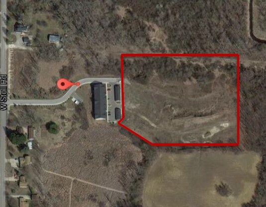
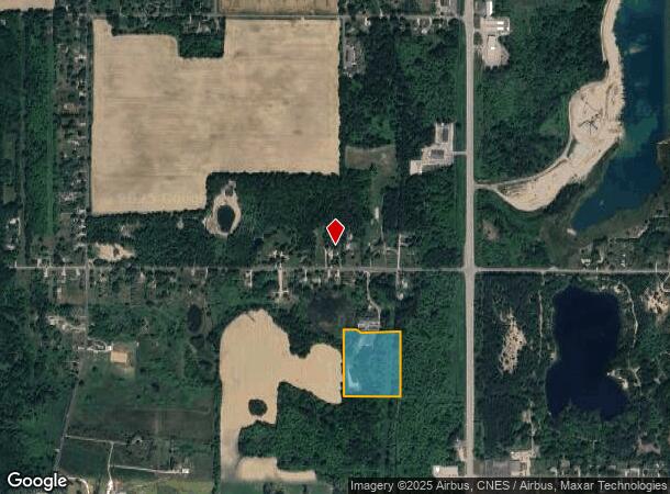
Property Record
1250 W Stoll Rd, Dewitt, MI 48820
NEARBY LISTINGS FOR SALE OR LEASE
-
-
-
-
-
No Photo
-
-
-
View all Dewitt listings for sale on LoopNet.com
Property Detail
1250 W Stoll Rd
Lansing-East Lansing, MI
Is Sub
050-028-100-035-50
BEG AT THE NE COR SEC 28, T5NR2W, TH S 1,319 FT, W 742.88 FT, N 1,009.34 FT, THE 140 FT, N 311.14 FT, TH E 595.9 FT TO POB.
Residentialacreage
Clinton
AE
Michigan
26065C0020D
9.27 AC
0
Central Lansing
2025
West Michigan
010201
DEMOGRAPHICS near 1250 W Stoll Rd
1 Mile
3 Mile
5 Mile
2024 Total Population
1,884
21,476
98,340
2029 Population
1,928
21,919
99,117
Pop Growth 2024-2029
+ 2.34%
+ 2.06%
+ 0.79%
Average Age
46
41
38
2024 Total Households
807
8,859
43,470
HH Growth 2024-2029
+ 2.23%
+ 1.99%
+ 0.72%
Median Household Inc
$59,254
$67,347
$56,494
Avg Household Size
2.20
2.40
2.20
2024 Avg HH Vehicles
2.00
2.00
2.00
Median Home Value
$154,825
$180,165
$170,960
Median Year Built
1963
1976
1968
Nearby Places
Map Layers
Map Styles
 Street
 Aerial
- Restaurants
- Banks
- Shops
- Fitness
- Groceries
PUBLIC TRANSPORTATION
COMMUTER RAIL
East Lansing Amtrak Station (Blue Water - Amtrak)
DRIVE
WALK
Distance
East Lansing Amtrak Station (Blue Water - Amtrak)
16 min
8.3 mi
AIRPORT
Capital Region International
DRIVE
WALK
Distance
Capital Region International
12 min
5.5 mi
Freight Ports
Port of Toledo
DRIVE
WALK
Distance
Port of Toledo
154 min
119.5 mi
SALE & LEASE HISTORY
LISTING DATE
SALE/LEASE

Sep 24, 2016
For Sale
Nearby Properties
Address
Land Use
TOTAL SIZE
Lot Size
Zoning
Address
Land Use
TOTAL SIZE
Lot Size
Zoning
7,579 SF
83.53 AC
PD
Address
Land Use
TOTAL SIZE
Lot Size
Zoning
66.43 AC
Address
Land Use
TOTAL SIZE
Lot Size
Zoning
2,137 SF
12.72 AC
H LT IN
Address
Land Use
TOTAL SIZE
Lot Size
Zoning
183,047 SF
24.36 AC
B4
Address
Land Use
TOTAL SIZE
Lot Size
Zoning
142,152 SF
47.56 AC
B4
Address
Land Use
TOTAL SIZE
Lot Size
Zoning
4,312 SF
30.47 AC
M3
Address
Land Use
TOTAL SIZE
Lot Size
Zoning
63.94 AC
Address
Land Use
TOTAL SIZE
Lot Size
Zoning
61,194 SF
0.55 AC
F COMME
Address
Land Use
TOTAL SIZE
Lot Size
Zoning
2,000 SF
0.91 AC
PD
Address
Land Use
TOTAL SIZE
Lot Size
Zoning
5,180 SF
16.94 AC
M2
Address
Land Use
TOTAL SIZE
Lot Size
Zoning
3,252 SF
10.16 AC
M3
Address
Land Use
TOTAL SIZE
Lot Size
Zoning
77,044 SF
15.94 AC
B4
Address
Land Use
TOTAL SIZE
Lot Size
Zoning
2,092 SF
152.25 AC
MHP
Address
Land Use
TOTAL SIZE
Lot Size
Zoning
35,078 SF
9.15 AC
Address
Land Use
TOTAL SIZE
Lot Size
Zoning
4,976 SF
6.23 AC
MF-N
Address
Land Use
TOTAL SIZE
Lot Size
Zoning
80,562 SF
1.05 AC
PD
Address
Land Use
TOTAL SIZE
Lot Size
Zoning
8,270 SF
13.15 AC
M3
Address
Land Use
TOTAL SIZE
Lot Size
Zoning
61,106 SF
0.47 AC
Address
Land Use
TOTAL SIZE
Lot Size
Zoning
61,194 SF
2.33 AC
Address
Land Use
TOTAL SIZE
Lot Size
Zoning
20,000 SF
25.53 AC
BC
Address
Land Use
TOTAL SIZE
Lot Size
Zoning
4,590 SF
69.64 AC
MHP
Address
Land Use
TOTAL SIZE
Lot Size
Zoning
16,600 SF
19.22 AC
IL
Address
Land Use
TOTAL SIZE
Lot Size
Zoning
22.47 AC
PD
Address
Land Use
TOTAL SIZE
Lot Size
Zoning
14,276 SF
6.42 AC
M3
Address
Land Use
TOTAL SIZE
Lot Size
Zoning
141,514 SF
191.51 AC
PD
Address
Land Use
TOTAL SIZE
Lot Size
Zoning
207,565 SF
11.50 AC
BC
Address
Land Use
TOTAL SIZE
Lot Size
Zoning
15,340 SF
2.89 AC
B1
Address
Land Use
TOTAL SIZE
Lot Size
Zoning
10,992 SF
10.43 AC
M3
Address
Land Use
TOTAL SIZE
Lot Size
Zoning
34,480 SF
4.87 AC
F COMME
Address
Land Use
TOTAL SIZE
Lot Size
Zoning
11.76 AC
PD
The World's #1 Commercial Real Estate Marketplace
Connect with us
© 2025 CoStar Group
The information above has been obtained from sources believed reliable. While we do not doubt its accuracy we have not verified it and make no guarantee, warranty or representation about it. It is your responsibility to independently confirm its accuracy and completeness. Any projections, opinions, assumptions, or estimates used are for example only and do not represent the current or future performance of the property. The value of this transaction to you depends on tax and other factors which should be evaluated by your tax, financial, and legal advisors. You and your advisors should conduct a careful, independent investigation of the property to determine to your satisfaction the suitability of the property for your needs.