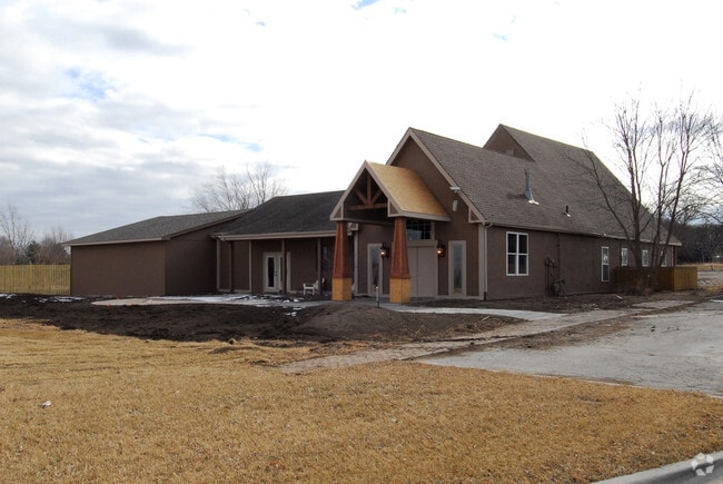
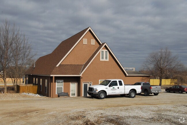
Property Record
12501 W 151St St, Overland Park, KS 66221
NEARBY LISTINGS FOR SALE OR LEASE
Property Detail
12501 W 151St St
Kansas City, MO-KS
Morse Village Pt
NP50400006-0012A
MORSE VILLAGE PT LT 12 13 & 14BLK 6 BG NW CR LT 13 S 730 TO SW CR LT 12 E 300 N 729 TO PT ON N/L OF LT 14 21.23 E NW CR LT 14 W 300 TO POB EXPT IN ST OPC 278 6 12A
Storebuilding
Johnson
X
Kansas
20091C0096G
12
2024
4.81 AC
2024
South Johnson County
053423
Kansas City
4,474 SF
DEMOGRAPHICS near 12501 W 151St St
1 Mile
3 Mile
5 Mile
2024 Total Population
4,665
78,679
198,284
2029 Population
4,884
81,994
206,628
Pop Growth 2024-2029
+ 4.69%
+ 4.21%
+ 4.21%
Average Age
38
38
38
2024 Total Households
1,471
26,283
74,234
HH Growth 2024-2029
+ 4.83%
+ 4.28%
+ 4.31%
Median Household Inc
$162,500
$137,394
$106,705
Avg Household Size
3.10
2.90
2.60
2024 Avg HH Vehicles
3.00
2.00
2.00
Median Home Value
$441,724
$407,802
$361,230
Median Year Built
2001
1999
1995
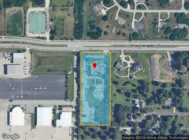
Nearby Places
Map Layers
Map Styles
 Street
 Aerial
- Restaurants
- Banks
- Shops
- Fitness
- Groceries
PUBLIC TRANSPORTATION
AIRPORT
Kansas City International
DRIVE
WALK
Distance
Kansas City International
54 min
41.7 mi
Nearby Properties
Address
Land Use
TOTAL SIZE
Lot Size
Zoning
Address
Land Use
TOTAL SIZE
Lot Size
Zoning
316,630 SF
62.18 AC
RE
Address
Land Use
TOTAL SIZE
Lot Size
Zoning
211,054 SF
77.48 AC
R-1
Address
Land Use
TOTAL SIZE
Lot Size
Zoning
287,599 SF
38.50 AC
R-1
Address
Land Use
TOTAL SIZE
Lot Size
Zoning
129,325 SF
4.50 AC
R-1
Address
Land Use
TOTAL SIZE
Lot Size
Zoning
137,955 SF
23.80 AC
R-1
Address
Land Use
TOTAL SIZE
Lot Size
Zoning
146,832 SF
30 AC
R-1
Address
Land Use
TOTAL SIZE
Lot Size
Zoning
150,122 SF
17.48 AC
R-1
Address
Land Use
TOTAL SIZE
Lot Size
Zoning
157,344 SF
12.69 AC
R-1
Address
Land Use
TOTAL SIZE
Lot Size
Zoning
61,479 SF
8.14 AC
C-2
Address
Land Use
TOTAL SIZE
Lot Size
Zoning
130,605 SF
18.01 AC
R-1
Address
Land Use
TOTAL SIZE
Lot Size
Zoning
119,299 SF
43.14 AC
RE
Address
Land Use
TOTAL SIZE
Lot Size
Zoning
86,095 SF
16.95 AC
R-1
Address
Land Use
TOTAL SIZE
Lot Size
Zoning
44,738 SF
10.21 AC
CP-2
Address
Land Use
TOTAL SIZE
Lot Size
Zoning
52,863 SF
10.81 AC
R-1A
Address
Land Use
TOTAL SIZE
Lot Size
Zoning
69,077 SF
17.90 AC
R-1
Address
Land Use
TOTAL SIZE
Lot Size
Zoning
115,263 SF
23.66 AC
R-1
Address
Land Use
TOTAL SIZE
Lot Size
Zoning
81,753 SF
20.88 AC
R-1
Address
Land Use
TOTAL SIZE
Lot Size
Zoning
65,388 SF
19.09 AC
RURJ
Address
Land Use
TOTAL SIZE
Lot Size
Zoning
73,159 SF
12.54 AC
R-1
Address
Land Use
TOTAL SIZE
Lot Size
Zoning
81,096 SF
121.93 AC
AG
Address
Land Use
TOTAL SIZE
Lot Size
Zoning
72,091 SF
11.33 AC
R-1
Address
Land Use
TOTAL SIZE
Lot Size
Zoning
69,455 SF
18.26 AC
RE
Address
Land Use
TOTAL SIZE
Lot Size
Zoning
62,832 SF
15.43 AC
CTY RUR
Address
Land Use
TOTAL SIZE
Lot Size
Zoning
72,324 SF
8.84 AC
R-1
Address
Land Use
TOTAL SIZE
Lot Size
Zoning
60,223 SF
5.91 AC
R-1
Address
Land Use
TOTAL SIZE
Lot Size
Zoning
81,229 SF
34.32 AC
CP-O
Address
Land Use
TOTAL SIZE
Lot Size
Zoning
54,005 SF
10.49 AC
R-1/PUD
Address
Land Use
TOTAL SIZE
Lot Size
Zoning
27,962 SF
7.41 AC
R-1
Address
Land Use
TOTAL SIZE
Lot Size
Zoning
69,540 SF
6.87 AC
R-1
Address
Land Use
TOTAL SIZE
Lot Size
Zoning
36,920 SF
31.22 AC
R-1
The World's #1 Commercial Real Estate Marketplace
Connect with us
© 2025 CoStar Group
The information above has been obtained from sources believed reliable. While we do not doubt its accuracy we have not verified it and make no guarantee, warranty or representation about it. It is your responsibility to independently confirm its accuracy and completeness. Any projections, opinions, assumptions, or estimates used are for example only and do not represent the current or future performance of the property. The value of this transaction to you depends on tax and other factors which should be evaluated by your tax, financial, and legal advisors. You and your advisors should conduct a careful, independent investigation of the property to determine to your satisfaction the suitability of the property for your needs.