Property Record
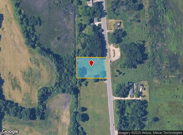
12506 Sheridan Rd, Pleasant Prairie, WI 53158

NEARBY LISTINGS FOR SALE OR LEASE
Property Detail
12506 Sheridan Rd
93-4-123-314-0045
PT OF SE 1/4 SEC 31 T 1 R 23 COM ON W LINE OF SEC 1325.4 FT S OF N LINE OF SD 1/4 SEC S 200 FT E 300.4 FT TO CT OF SHERIDAN R
Residentialacreage
Kenosha
X
Wisconsin
17097C0077L
45
2024
1.20 AC
2024
Kenosha East
002606
Chicago
1,600 SF
Chicago-Naperville-Elgin, IL-IN-WI
DEMOGRAPHICS near 12506 Sheridan Rd
1 Mile
3 Mile
5 Mile
2024 Total Population
2,335
21,501
68,906
2029 Population
2,306
21,293
68,366
Pop Growth 2024-2029
(1.24%)
(0.97%)
(0.78%)
Average Age
44
41
40
2024 Total Households
909
7,909
25,917
HH Growth 2024-2029
(1.43%)
(1.11%)
(0.90%)
Median Household Inc
$87,253
$78,503
$73,482
Avg Household Size
2.50
2.70
2.60
2024 Avg HH Vehicles
2.00
2.00
2.00
Median Home Value
$257,060
$228,682
$204,250
Median Year Built
1978
1977
1972
Nearby Places
Map Layers
Map Styles
 Street
 Aerial
- Restaurants
- Banks
- Shops
- Fitness
- Groceries
PUBLIC TRANSPORTATION
COMMUTER RAIL
Winthrop Harbor Station (Union Pacific North Line - Northeast Illinois Regional Commuter Railroad (Metra))
DRIVE
WALK
Distance
Winthrop Harbor Station (Union Pacific North Line - Northeast Illinois Regional Commuter Railroad (Metra))
3 min
1.3 mi
Zion Station (Union Pacific North Line - Northeast Illinois Regional Commuter Railroad (Metra))
DRIVE
WALK
Distance
Zion Station (Union Pacific North Line - Northeast Illinois Regional Commuter Railroad (Metra))
8 min
3.6 mi
Freight Ports
Port Milwaukee
DRIVE
WALK
Distance
Port Milwaukee
55 min
43.4 mi
Nearby Properties
Address
Land Use
TOTAL SIZE
Lot Size
Zoning
Address
Land Use
TOTAL SIZE
Lot Size
Zoning
1,200 SF
17.69 AC
Address
Land Use
TOTAL SIZE
Lot Size
Zoning
10,656 SF
4.37 AC
Address
Land Use
TOTAL SIZE
Lot Size
Zoning
Address
Land Use
TOTAL SIZE
Lot Size
Zoning
5,023 SF
2.32 AC
Address
Land Use
TOTAL SIZE
Lot Size
Zoning
336.59 AC
Address
Land Use
TOTAL SIZE
Lot Size
Zoning
37,068 SF
1.70 AC
Address
Land Use
TOTAL SIZE
Lot Size
Zoning
48,134 SF
5.01 AC
Address
Land Use
TOTAL SIZE
Lot Size
Zoning
5,056 SF
1.55 AC
Address
Land Use
TOTAL SIZE
Lot Size
Zoning
55,080 SF
2.26 AC
Address
Land Use
TOTAL SIZE
Lot Size
Zoning
449,292 SF
7.15 AC
Address
Land Use
TOTAL SIZE
Lot Size
Zoning
42,297 SF
1.52 AC
Address
Land Use
TOTAL SIZE
Lot Size
Zoning
Address
Land Use
TOTAL SIZE
Lot Size
Zoning
28,365 SF
5.12 AC
Address
Land Use
TOTAL SIZE
Lot Size
Zoning
22,984 SF
1.93 AC
Address
Land Use
TOTAL SIZE
Lot Size
Zoning
1,745 SF
0.66 AC
Address
Land Use
TOTAL SIZE
Lot Size
Zoning
8,208 SF
1.43 AC
Address
Land Use
TOTAL SIZE
Lot Size
Zoning
1.58 AC
Address
Land Use
TOTAL SIZE
Lot Size
Zoning
167.68 AC
Address
Land Use
TOTAL SIZE
Lot Size
Zoning
37.27 AC
Address
Land Use
TOTAL SIZE
Lot Size
Zoning
Address
Land Use
TOTAL SIZE
Lot Size
Zoning
23.71 AC
Address
Land Use
TOTAL SIZE
Lot Size
Zoning
Address
Land Use
TOTAL SIZE
Lot Size
Zoning
23,875 SF
2.27 AC
Address
Land Use
TOTAL SIZE
Lot Size
Zoning
15,576 SF
2.21 AC
Address
Land Use
TOTAL SIZE
Lot Size
Zoning
2,184 SF
0.83 AC
Address
Land Use
TOTAL SIZE
Lot Size
Zoning
1,976 SF
29.55 AC
Address
Land Use
TOTAL SIZE
Lot Size
Zoning
27,400 SF
1.57 AC
Address
Land Use
TOTAL SIZE
Lot Size
Zoning
2,184 SF
0.83 AC
Address
Land Use
TOTAL SIZE
Lot Size
Zoning
2,184 SF
0.83 AC
Address
Land Use
TOTAL SIZE
Lot Size
Zoning
4,028 SF
0.51 AC
The World's #1 Commercial Real Estate Marketplace
Connect with us
© 2025 CoStar Group
The information above has been obtained from sources believed reliable. While we do not doubt its accuracy we have not verified it and make no guarantee, warranty or representation about it. It is your responsibility to independently confirm its accuracy and completeness. Any projections, opinions, assumptions, or estimates used are for example only and do not represent the current or future performance of the property. The value of this transaction to you depends on tax and other factors which should be evaluated by your tax, financial, and legal advisors. You and your advisors should conduct a careful, independent investigation of the property to determine to your satisfaction the suitability of the property for your needs.