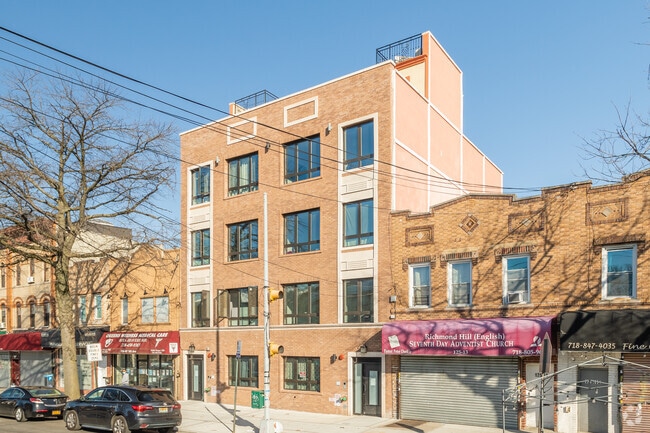
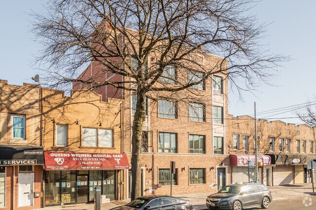
Property Record
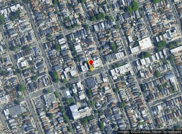
12509 101St Ave, South Richmond Hill, NY 11419
NEARBY LISTINGS FOR SALE OR LEASE
Property Detail
12509 101St Ave
09468-0026
Queens
Multifamilydwelling
New York
X
26
3604970229F
0.04 AC
2024
South Richmond Hill
2025
Long Island (New York)
015400
New York-Jersey City-White Plains, NY-NJ
3,700 SF
DEMOGRAPHICS near 12509 101St Ave
1 Mile
3 Mile
5 Mile
2024 Total Population
93,307
650,676
1,623,273
2029 Population
84,757
603,511
1,505,550
Pop Growth 2024-2029
(9.16%)
(7.25%)
(7.25%)
Average Age
40
41
41
2024 Total Households
26,988
217,657
543,720
HH Growth 2024-2029
(9.58%)
(7.26%)
(7.45%)
Median Household Inc
$76,823
$73,610
$68,174
Avg Household Size
3.20
2.80
2.80
2024 Avg HH Vehicles
1.00
1.00
1.00
Median Home Value
$711,098
$650,490
$665,933
Median Year Built
1947
1951
1952
Nearby Places
- Restaurants
- Banks
- Shops
- Fitness
- Groceries
PUBLIC TRANSPORTATION
TRANSIT/SUBWAY
Ozone Park-Lefferts Boulevard (A - New York MTA Subway (The Subway))
DRIVE
WALK
Distance
Ozone Park-Lefferts Boulevard (A - New York MTA Subway (The Subway))
2 min
13 min
0.6 mi
111 Street (A Line) (A - New York MTA Subway (The Subway))
DRIVE
WALK
Distance
111 Street (A Line) (A - New York MTA Subway (The Subway))
3 min
19 min
1.0 mi
121 Street (J - New York MTA Subway (The Subway), Z - New York MTA Subway (The Subway))
DRIVE
WALK
Distance
121 Street (J - New York MTA Subway (The Subway), Z - New York MTA Subway (The Subway))
3 min
19 min
1.0 mi
COMMUTER RAIL
Jamaica Station (Babylon Branch - Long Island Rail Road, Far Rockaway Branch - Long Island Rail Road, Hempstead Branch - Long Island Rail Road, Long Beach Branch - Long Island Rail Road, Montauk Branch - Long Island Rail Road, Oyster Bay Branch - Long Island Rail Road, Port Jefferson Branch - Long Island Rail Road, Ronkonkoma Branch - Long Island Rail Road, West Hempstead Branch - Long Island Rail Road)
DRIVE
WALK
Distance
Jamaica Station (Babylon Branch - Long Island Rail Road, Far Rockaway Branch - Long Island Rail Road, Hempstead Branch - Long Island Rail Road, Long Beach Branch - Long Island Rail Road, Montauk Branch - Long Island Rail Road, Oyster Bay Branch - Long Island Rail Road, Port Jefferson Branch - Long Island Rail Road, Ronkonkoma Branch - Long Island Rail Road, West Hempstead Branch - Long Island Rail Road)
4 min
1.4 mi
Kew Gardens Station (Babylon Branch - Long Island Rail Road, Hempstead Branch - Long Island Rail Road, Long Beach Branch - Long Island Rail Road, Port Jefferson Branch - Long Island Rail Road)
DRIVE
WALK
Distance
Kew Gardens Station (Babylon Branch - Long Island Rail Road, Hempstead Branch - Long Island Rail Road, Long Beach Branch - Long Island Rail Road, Port Jefferson Branch - Long Island Rail Road)
6 min
1.7 mi
AIRPORT
John F Kennedy International
DRIVE
WALK
Distance
John F Kennedy International
11 min
5.5 mi
LaGuardia
DRIVE
WALK
Distance
LaGuardia
14 min
7.5 mi
Newark Liberty International
DRIVE
WALK
Distance
Newark Liberty International
43 min
27.3 mi
Freight Ports
NY - Red Hook Container Terminal
DRIVE
WALK
Distance
NY - Red Hook Container Terminal
27 min
16.1 mi
Nearby Properties
Address
Land Use
TOTAL SIZE
Lot Size
Zoning
Address
Land Use
TOTAL SIZE
Lot Size
Zoning
4,528,000 SF
94.27 AC
R4
Address
Land Use
TOTAL SIZE
Lot Size
Zoning
1,845,252 SF
172 AC
C8-1
Address
Land Use
TOTAL SIZE
Lot Size
Zoning
1,069,367 SF
14.65 AC
R4
Address
Land Use
TOTAL SIZE
Lot Size
Zoning
54,170 SF
229.57 AC
PARK
Address
Land Use
TOTAL SIZE
Lot Size
Zoning
1,516,458 SF
5.97 AC
R7-1
Address
Land Use
TOTAL SIZE
Lot Size
Zoning
532,011 SF
2.48 AC
R6
Address
Land Use
TOTAL SIZE
Lot Size
Zoning
15,000 SF
255.27 AC
PARK
Address
Land Use
TOTAL SIZE
Lot Size
Zoning
731,247 SF
56.09 AC
R3-2
Address
Land Use
TOTAL SIZE
Lot Size
Zoning
126.85 AC
PARK
Address
Land Use
TOTAL SIZE
Lot Size
Zoning
1,000 SF
210.07 AC
R3-2
Address
Land Use
TOTAL SIZE
Lot Size
Zoning
738,000 SF
1.92 AC
C6-3
Address
Land Use
TOTAL SIZE
Lot Size
Zoning
291,589 SF
1.55 AC
C6-3
Address
Land Use
TOTAL SIZE
Lot Size
Zoning
2,193 SF
94.72 AC
PARK
Address
Land Use
TOTAL SIZE
Lot Size
Zoning
307,038 SF
7.84 AC
M1-1
Address
Land Use
TOTAL SIZE
Lot Size
Zoning
234,452 SF
2.99 AC
R4
Address
Land Use
TOTAL SIZE
Lot Size
Zoning
474,715 SF
1.72 AC
M14R8A
Address
Land Use
TOTAL SIZE
Lot Size
Zoning
490,600 SF
12.01 AC
M1-1
Address
Land Use
TOTAL SIZE
Lot Size
Zoning
320,535 SF
1.52 AC
C4-4A
Address
Land Use
TOTAL SIZE
Lot Size
Zoning
384,249 SF
5.56 AC
R5
Address
Land Use
TOTAL SIZE
Lot Size
Zoning
364,424 SF
C5-3
Address
Land Use
TOTAL SIZE
Lot Size
Zoning
1,136,208 SF
30.25 AC
R5
Address
Land Use
TOTAL SIZE
Lot Size
Zoning
478,384 SF
1.23 AC
C6-3
Address
Land Use
TOTAL SIZE
Lot Size
Zoning
360,000 SF
8.78 AC
R6
Address
Land Use
TOTAL SIZE
Lot Size
Zoning
569,583 SF
2.28 AC
C4-5X
Address
Land Use
TOTAL SIZE
Lot Size
Zoning
230,580 SF
3.41 AC
C8-1
Address
Land Use
TOTAL SIZE
Lot Size
Zoning
460,540 SF
0.69 AC
C6-4
Address
Land Use
TOTAL SIZE
Lot Size
Zoning
535,609 SF
0.82 AC
C6-4
Address
Land Use
TOTAL SIZE
Lot Size
Zoning
192,200 SF
9.70 AC
R4
Address
Land Use
TOTAL SIZE
Lot Size
Zoning
208,952 SF
9.03 AC
M1-1
Address
Land Use
TOTAL SIZE
Lot Size
Zoning
4,279,575 SF
144.16 AC
PARK
The World's #1 Commercial Real Estate Marketplace
Connect with us
© 2025 CoStar Group
The information above has been obtained from sources believed reliable. While we do not doubt its accuracy we have not verified it and make no guarantee, warranty or representation about it. It is your responsibility to independently confirm its accuracy and completeness. Any projections, opinions, assumptions, or estimates used are for example only and do not represent the current or future performance of the property. The value of this transaction to you depends on tax and other factors which should be evaluated by your tax, financial, and legal advisors. You and your advisors should conduct a careful, independent investigation of the property to determine to your satisfaction the suitability of the property for your needs.