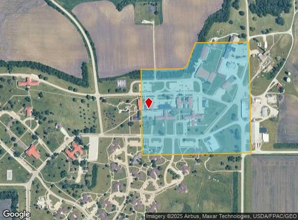
Property Record
1251 340Th St, Woodward, IA 50276

NEARBY LISTINGS FOR SALE OR LEASE
-
-
View all Woodward listings for sale on LoopNet.com
Property Detail
1251 340Th St
088226311490001
SE NE: EX PART PARCEL F
Agriculturalland
Boone
X
Iowa
19015C0450D
36.08 AC
2024
Fort Dodge/Ames
2025
Other Market Areas
050100
Boone, IA
DEMOGRAPHICS near 1251 340Th St
1 Mile
3 Mile
5 Mile
2024 Total Population
170
3,284
5,402
2029 Population
165
3,442
5,671
Pop Growth 2024-2029
(2.94%)
+ 4.81%
+ 4.98%
Average Age
44
41
41
2024 Total Households
61
1,338
2,180
HH Growth 2024-2029
(3.28%)
+ 5.31%
+ 5.37%
Median Household Inc
$95,833
$71,050
$73,301
Avg Household Size
2.60
2.40
2.40
2024 Avg HH Vehicles
3.00
2.00
2.00
Median Home Value
$290,908
$166,550
$172,058
Median Year Built
1960
1963
1965
Nearby Places
Map Layers
Map Styles
 Street
 Aerial
- Restaurants
- Banks
- Shops
- Fitness
- Groceries
PUBLIC TRANSPORTATION
AIRPORT
Des Moines International
DRIVE
WALK
Distance
Des Moines International
51 min
33.5 mi
Freight Ports
Port Milwaukee
DRIVE
WALK
Distance
Port Milwaukee
447 min
397.8 mi
SALE & LEASE HISTORY
LISTING DATE
SALE/LEASE

Apr 03, 2024
For Sale
Nearby Properties
Address
Land Use
TOTAL SIZE
Lot Size
Zoning
Address
Land Use
TOTAL SIZE
Lot Size
Zoning
113,488 SF
2.98 AC
Address
Land Use
TOTAL SIZE
Lot Size
Zoning
6,384 SF
0.49 AC
Address
Land Use
TOTAL SIZE
Lot Size
Zoning
1,360 SF
0.98 AC
Address
Land Use
TOTAL SIZE
Lot Size
Zoning
3,440 SF
1.04 AC
Address
Land Use
TOTAL SIZE
Lot Size
Zoning
Address
Land Use
TOTAL SIZE
Lot Size
Zoning
5,600 SF
0.99 AC
Address
Land Use
TOTAL SIZE
Lot Size
Zoning
9.04 AC
Address
Land Use
TOTAL SIZE
Lot Size
Zoning
1,612 SF
0.79 AC
Address
Land Use
TOTAL SIZE
Lot Size
Zoning
1,656 SF
29 AC
Address
Land Use
TOTAL SIZE
Lot Size
Zoning
3,014 SF
0.33 AC
Address
Land Use
TOTAL SIZE
Lot Size
Zoning
3,434 SF
1.10 AC
Address
Land Use
TOTAL SIZE
Lot Size
Zoning
10,760 SF
3.18 AC
Address
Land Use
TOTAL SIZE
Lot Size
Zoning
4,113 SF
0.32 AC
Address
Land Use
TOTAL SIZE
Lot Size
Zoning
5,070 SF
0.33 AC
Address
Land Use
TOTAL SIZE
Lot Size
Zoning
5.04 AC
Address
Land Use
TOTAL SIZE
Lot Size
Zoning
7,800 SF
0.33 AC
Address
Land Use
TOTAL SIZE
Lot Size
Zoning
2,816 SF
0.08 AC
Address
Land Use
TOTAL SIZE
Lot Size
Zoning
30.50 AC
Address
Land Use
TOTAL SIZE
Lot Size
Zoning
2,380 SF
0.33 AC
Address
Land Use
TOTAL SIZE
Lot Size
Zoning
5,496 SF
0.36 AC
Address
Land Use
TOTAL SIZE
Lot Size
Zoning
900 SF
0.49 AC
Address
Land Use
TOTAL SIZE
Lot Size
Zoning
3,405 SF
0.32 AC
Address
Land Use
TOTAL SIZE
Lot Size
Zoning
3,040 SF
0.16 AC
Address
Land Use
TOTAL SIZE
Lot Size
Zoning
7.99 AC
A-1
Address
Land Use
TOTAL SIZE
Lot Size
Zoning
2,760 SF
0.25 AC
Address
Land Use
TOTAL SIZE
Lot Size
Zoning
15.06 AC
A-1
Address
Land Use
TOTAL SIZE
Lot Size
Zoning
3,440 SF
0.33 AC
Address
Land Use
TOTAL SIZE
Lot Size
Zoning
3,600 SF
1.58 AC
Address
Land Use
TOTAL SIZE
Lot Size
Zoning
3,988 SF
0.13 AC
The World's #1 Commercial Real Estate Marketplace
Connect with us
© 2025 CoStar Group
The information above has been obtained from sources believed reliable. While we do not doubt its accuracy we have not verified it and make no guarantee, warranty or representation about it. It is your responsibility to independently confirm its accuracy and completeness. Any projections, opinions, assumptions, or estimates used are for example only and do not represent the current or future performance of the property. The value of this transaction to you depends on tax and other factors which should be evaluated by your tax, financial, and legal advisors. You and your advisors should conduct a careful, independent investigation of the property to determine to your satisfaction the suitability of the property for your needs.