Property Record
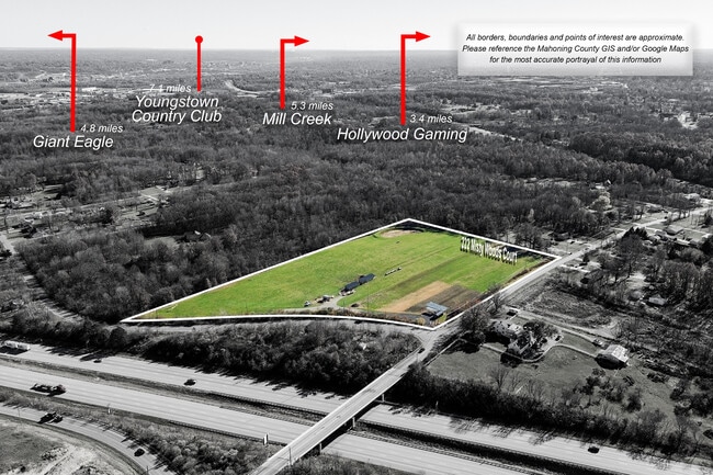
1251 N Four Mile Run Rd, Youngstown, OH 44515


NEARBY LISTINGS FOR SALE OR LEASE
Property Detail
1251 N Four Mile Run Rd
Youngstown/Warren/Boardman
Austintown
Youngstown-Warren-Boardman, OH-PA
GL 2
48-071-0-020.01-0
Mahoning
Agriculturalland
Ohio
2024
2
2024
10.05 AC
812500
Mahoning County
DEMOGRAPHICS near 1251 N Four Mile Run Rd
1 Mile
3 Mile
5 Mile
2024 Total Population
1,721
34,990
105,183
2029 Population
1,699
34,410
103,745
Pop Growth 2024-2029
(1.28%)
(1.66%)
(1.37%)
Average Age
45
42
42
2024 Total Households
686
15,477
46,380
HH Growth 2024-2029
(1.46%)
(1.83%)
(1.49%)
Median Household Inc
$64,368
$45,141
$45,969
Avg Household Size
2.30
2.20
2.20
2024 Avg HH Vehicles
2.00
2.00
2.00
Median Home Value
$152,205
$95,321
$101,407
Median Year Built
1974
1959
1960
Nearby Places
Map Layers
Map Styles
 Street
 Aerial
- Restaurants
- Banks
- Shops
- Fitness
- Groceries
SALE & LEASE HISTORY
LISTING DATE
SALE/LEASE

Nov 30, 2023
For Sale
Nearby Properties
Address
Land Use
TOTAL SIZE
Lot Size
Zoning
Address
Land Use
TOTAL SIZE
Lot Size
Zoning
981,460 SF
74.87 AC
Address
Land Use
TOTAL SIZE
Lot Size
Zoning
178,531 SF
189.16 AC
Address
Land Use
TOTAL SIZE
Lot Size
Zoning
1,582.88 AC
Address
Land Use
TOTAL SIZE
Lot Size
Zoning
188,134 SF
12.60 AC
R1
Address
Land Use
TOTAL SIZE
Lot Size
Zoning
10.30 AC
Address
Land Use
TOTAL SIZE
Lot Size
Zoning
127,210 SF
12.43 AC
R1
Address
Land Use
TOTAL SIZE
Lot Size
Zoning
122,806 SF
9.46 AC
R1
Address
Land Use
TOTAL SIZE
Lot Size
Zoning
6,207 SF
0.88 AC
Address
Land Use
TOTAL SIZE
Lot Size
Zoning
446,250 SF
43.88 AC
Address
Land Use
TOTAL SIZE
Lot Size
Zoning
324,442 SF
54 AC
R1
Address
Land Use
TOTAL SIZE
Lot Size
Zoning
14.92 AC
Address
Land Use
TOTAL SIZE
Lot Size
Zoning
98,609 SF
11.01 AC
Address
Land Use
TOTAL SIZE
Lot Size
Zoning
470,857 SF
18.81 AC
I2
Address
Land Use
TOTAL SIZE
Lot Size
Zoning
89,325 SF
28.74 AC
Address
Land Use
TOTAL SIZE
Lot Size
Zoning
123,472 SF
28.58 AC
R3
Address
Land Use
TOTAL SIZE
Lot Size
Zoning
58,282 SF
24.96 AC
Address
Land Use
TOTAL SIZE
Lot Size
Zoning
70,544 SF
7.62 AC
B2
Address
Land Use
TOTAL SIZE
Lot Size
Zoning
71,678 SF
7.78 AC
Address
Land Use
TOTAL SIZE
Lot Size
Zoning
95,231 SF
37.75 AC
ASER
Address
Land Use
TOTAL SIZE
Lot Size
Zoning
382,202 SF
18.29 AC
I2
Address
Land Use
TOTAL SIZE
Lot Size
Zoning
49,659 SF
19.52 AC
R3
Address
Land Use
TOTAL SIZE
Lot Size
Zoning
23,603 SF
8.87 AC
B2
Address
Land Use
TOTAL SIZE
Lot Size
Zoning
114,617 SF
18.07 AC
B2
Address
Land Use
TOTAL SIZE
Lot Size
Zoning
70,713 SF
7.73 AC
B2
Address
Land Use
TOTAL SIZE
Lot Size
Zoning
5,616 SF
23.43 AC
Address
Land Use
TOTAL SIZE
Lot Size
Zoning
200,160 SF
19.03 AC
Address
Land Use
TOTAL SIZE
Lot Size
Zoning
58,663 SF
24.53 AC
ASER
Address
Land Use
TOTAL SIZE
Lot Size
Zoning
54,969 SF
6.17 AC
Address
Land Use
TOTAL SIZE
Lot Size
Zoning
Address
Land Use
TOTAL SIZE
Lot Size
Zoning
315,482 SF
33.17 AC
I2
The World's #1 Commercial Real Estate Marketplace
Connect with us
© 2025 CoStar Group
The information above has been obtained from sources believed reliable. While we do not doubt its accuracy we have not verified it and make no guarantee, warranty or representation about it. It is your responsibility to independently confirm its accuracy and completeness. Any projections, opinions, assumptions, or estimates used are for example only and do not represent the current or future performance of the property. The value of this transaction to you depends on tax and other factors which should be evaluated by your tax, financial, and legal advisors. You and your advisors should conduct a careful, independent investigation of the property to determine to your satisfaction the suitability of the property for your needs.