Property Record
1251 Edgell Rd, Framingham, MA 01701
NEARBY LISTINGS FOR SALE OR LEASE
-
-
View all Framingham listings for sale on LoopNet.com
Property Detail
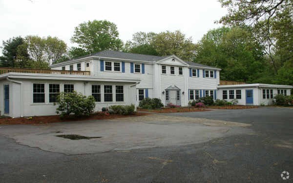
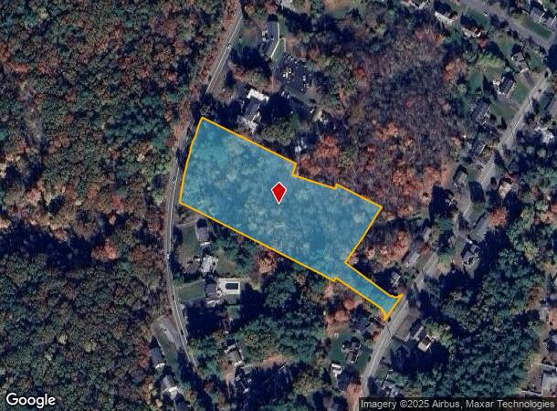
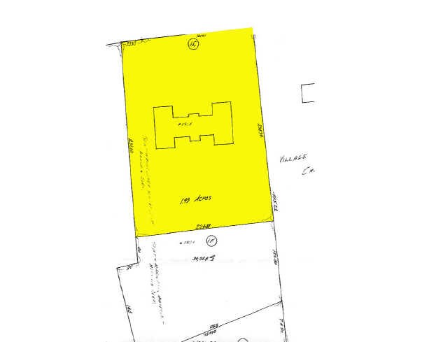
1251 Edgell Rd
FRAM-000016-000029-009867
Middlesex
Religious
Massachusetts
X
9867
25017C0504F
3.92 AC
0
Framingham/Natick
2025
Boston
383904
Boston-Cambridge-Newton, MA-NH
DEMOGRAPHICS near 1251 Edgell Rd
1 Mile
3 Mile
5 Mile
2024 Total Population
4,973
39,182
121,183
2029 Population
4,949
38,766
120,397
Pop Growth 2024-2029
(0.48%)
(1.06%)
(0.65%)
Average Age
46
43
41
2024 Total Households
2,097
14,599
46,579
HH Growth 2024-2029
(0.48%)
(1.15%)
(0.69%)
Median Household Inc
$91,203
$148,638
$114,162
Avg Household Size
2.30
2.60
2.50
2024 Avg HH Vehicles
2.00
2.00
2.00
Median Home Value
$559,682
$654,647
$652,062
Median Year Built
1967
1965
1968
Nearby Places
Map Layers
Map Styles
 Street
 Aerial
- Restaurants
- Banks
- Shops
- Fitness
- Groceries
PUBLIC TRANSPORTATION
COMMUTER RAIL
Framingham (Framingham/Worcester Line - Massachusetts Bay Transportation Authority Commuter Rail (Purple Line))
DRIVE
WALK
Distance
Framingham (Framingham/Worcester Line - Massachusetts Bay Transportation Authority Commuter Rail (Purple Line))
11 min
5.3 mi
Framingham Amtrak (Lake Shore Limited - Amtrak)
DRIVE
WALK
Distance
Framingham Amtrak (Lake Shore Limited - Amtrak)
11 min
5.4 mi
AIRPORT
Worcester Regional
DRIVE
WALK
Distance
Worcester Regional
47 min
26.8 mi
General Edward Lawrence Logan International
DRIVE
WALK
Distance
General Edward Lawrence Logan International
43 min
28.2 mi
Freight Ports
Port of Boston
DRIVE
WALK
Distance
Port of Boston
41 min
26.5 mi
Nearby Properties
Address
Land Use
TOTAL SIZE
Lot Size
Zoning
Address
Land Use
TOTAL SIZE
Lot Size
Zoning
396,002 SF
44.44 AC
R1
Address
Land Use
TOTAL SIZE
Lot Size
Zoning
24.78 AC
LID
Address
Land Use
TOTAL SIZE
Lot Size
Zoning
136,919 SF
13.42 AC
M
Address
Land Use
TOTAL SIZE
Lot Size
Zoning
157.48 AC
LI
Address
Land Use
TOTAL SIZE
Lot Size
Zoning
182,524 SF
3.60 AC
B2
Address
Land Use
TOTAL SIZE
Lot Size
Zoning
231,897 SF
7.90 AC
B
Address
Land Use
TOTAL SIZE
Lot Size
Zoning
182,736 SF
7.30 AC
B2
Address
Land Use
TOTAL SIZE
Lot Size
Zoning
350,935 SF
25.51 AC
M
Address
Land Use
TOTAL SIZE
Lot Size
Zoning
183,338 SF
4.85 AC
B2
Address
Land Use
TOTAL SIZE
Lot Size
Zoning
114,000 SF
31.53 AC
PRD
Address
Land Use
TOTAL SIZE
Lot Size
Zoning
239,454 SF
12.65 AC
R3
Address
Land Use
TOTAL SIZE
Lot Size
Zoning
126,828 SF
8.81 AC
R4
Address
Land Use
TOTAL SIZE
Lot Size
Zoning
162,704 SF
26.50 AC
RESA
Address
Land Use
TOTAL SIZE
Lot Size
Zoning
26.16 AC
LID
Address
Land Use
TOTAL SIZE
Lot Size
Zoning
115,879 SF
0.32 AC
R1
Address
Land Use
TOTAL SIZE
Lot Size
Zoning
68,000 SF
28.13 AC
R3
Address
Land Use
TOTAL SIZE
Lot Size
Zoning
71.89 AC
RR
Address
Land Use
TOTAL SIZE
Lot Size
Zoning
63,174 SF
8.64 AC
R3
Address
Land Use
TOTAL SIZE
Lot Size
Zoning
74,652 SF
6.97 AC
B
Address
Land Use
TOTAL SIZE
Lot Size
Zoning
194,372 SF
35.72 AC
R3
Address
Land Use
TOTAL SIZE
Lot Size
Zoning
75,638 SF
23.51 AC
R3
Address
Land Use
TOTAL SIZE
Lot Size
Zoning
53.75 AC
Address
Land Use
TOTAL SIZE
Lot Size
Zoning
61,500 SF
13.67 AC
R3
Address
Land Use
TOTAL SIZE
Lot Size
Zoning
9.26 AC
LBD
Address
Land Use
TOTAL SIZE
Lot Size
Zoning
60,193 SF
15.67 AC
ID
Address
Land Use
TOTAL SIZE
Lot Size
Zoning
103,554 SF
0.73 AC
R1
Address
Land Use
TOTAL SIZE
Lot Size
Zoning
44,300 SF
16.94 AC
R1
Address
Land Use
TOTAL SIZE
Lot Size
Zoning
63,600 SF
12.75 AC
R3
Address
Land Use
TOTAL SIZE
Lot Size
Zoning
74,133 SF
7.32 AC
ID
Address
Land Use
TOTAL SIZE
Lot Size
Zoning
166,800 SF
8.43 AC
M
The World's #1 Commercial Real Estate Marketplace
Connect with us
© 2026 CoStar Group
The information above has been obtained from sources believed reliable. While we do not doubt its accuracy we have not verified it and make no guarantee, warranty or representation about it. It is your responsibility to independently confirm its accuracy and completeness. Any projections, opinions, assumptions, or estimates used are for example only and do not represent the current or future performance of the property. The value of this transaction to you depends on tax and other factors which should be evaluated by your tax, financial, and legal advisors. You and your advisors should conduct a careful, independent investigation of the property to determine to your satisfaction the suitability of the property for your needs.