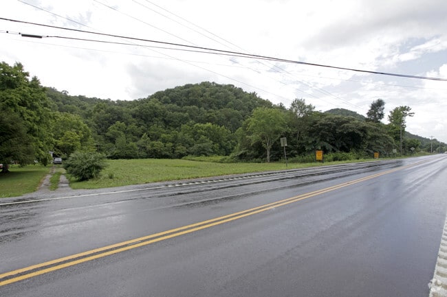
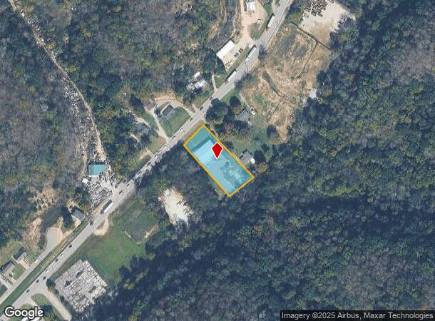
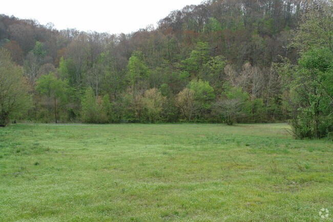
Property Record
1251 New Rader Rd, Goodlettsville, TN 37072
NEARBY LISTINGS FOR SALE OR LEASE
Property Detail
1251 New Rader Rd
Nashville-Davidson--Murfreesboro--Franklin, TN
Henson Prop Sub
118-173.00
PLAT: 18 PAGE: 261 BLOCK: LOT: 5 SUBD: HENSON PROP SUB
Warehouse
Sumner
AE
Tennessee
47165C0264H
5
2024
0.93 AC
2025
Rivergate/Hendersonville
021005
Nashville
4,074 SF
DEMOGRAPHICS near 1251 New Rader Rd
1 Mile
3 Mile
5 Mile
2024 Total Population
533
9,490
32,968
2029 Population
588
10,306
35,683
Pop Growth 2024-2029
+ 10.32%
+ 8.60%
+ 8.24%
Average Age
41
40
41
2024 Total Households
195
3,638
12,306
HH Growth 2024-2029
+ 10.77%
+ 8.52%
+ 8.08%
Median Household Inc
$69,230
$67,886
$81,609
Avg Household Size
2.70
2.60
2.60
2024 Avg HH Vehicles
2.00
2.00
2.00
Median Home Value
$298,999
$283,273
$329,409
Median Year Built
1982
1989
1992
Nearby Places
- Restaurants
- Banks
- Shops
- Fitness
- Groceries
PUBLIC TRANSPORTATION
AIRPORT
Nashville International
DRIVE
WALK
Distance
Nashville International
34 min
26.6 mi
Freight Ports
Port of Mobile
DRIVE
WALK
Distance
Port of Mobile
507 min
464.1 mi
Nearby Properties
Address
Land Use
TOTAL SIZE
Lot Size
Zoning
Address
Land Use
TOTAL SIZE
Lot Size
Zoning
30,000 SF
63.90 AC
Address
Land Use
TOTAL SIZE
Lot Size
Zoning
37,535 SF
5 AC
Address
Land Use
TOTAL SIZE
Lot Size
Zoning
21,000 SF
7.50 AC
Address
Land Use
TOTAL SIZE
Lot Size
Zoning
6,964 SF
7.49 AC
AR2A
Address
Land Use
TOTAL SIZE
Lot Size
Zoning
30,616 SF
10.61 AC
Address
Land Use
TOTAL SIZE
Lot Size
Zoning
6,304 SF
1.37 AC
Address
Land Use
TOTAL SIZE
Lot Size
Zoning
9,500 SF
3.71 AC
Address
Land Use
TOTAL SIZE
Lot Size
Zoning
20,178 SF
1.50 AC
Address
Land Use
TOTAL SIZE
Lot Size
Zoning
7,976 SF
1.25 AC
Address
Land Use
TOTAL SIZE
Lot Size
Zoning
4,081 SF
3.09 AC
Address
Land Use
TOTAL SIZE
Lot Size
Zoning
8,500 SF
10 AC
Address
Land Use
TOTAL SIZE
Lot Size
Zoning
8,316 SF
0.97 AC
Address
Land Use
TOTAL SIZE
Lot Size
Zoning
1,020 SF
3.45 AC
Address
Land Use
TOTAL SIZE
Lot Size
Zoning
15,000 SF
9.20 AC
Address
Land Use
TOTAL SIZE
Lot Size
Zoning
20,190 SF
1.66 AC
Address
Land Use
TOTAL SIZE
Lot Size
Zoning
7,000 SF
1.60 AC
Address
Land Use
TOTAL SIZE
Lot Size
Zoning
5,498 SF
6.15 AC
Address
Land Use
TOTAL SIZE
Lot Size
Zoning
9,432 SF
2.32 AC
Address
Land Use
TOTAL SIZE
Lot Size
Zoning
38.60 AC
Address
Land Use
TOTAL SIZE
Lot Size
Zoning
34,800 SF
1.70 AC
Address
Land Use
TOTAL SIZE
Lot Size
Zoning
10,134 SF
1.09 AC
Address
Land Use
TOTAL SIZE
Lot Size
Zoning
Address
Land Use
TOTAL SIZE
Lot Size
Zoning
15,498 SF
2 AC
Address
Land Use
TOTAL SIZE
Lot Size
Zoning
Address
Land Use
TOTAL SIZE
Lot Size
Zoning
Address
Land Use
TOTAL SIZE
Lot Size
Zoning
Address
Land Use
TOTAL SIZE
Lot Size
Zoning
9,750 SF
7.25 AC
Address
Land Use
TOTAL SIZE
Lot Size
Zoning
15.21 AC
Address
Land Use
TOTAL SIZE
Lot Size
Zoning
5,000 SF
1.83 AC
Address
Land Use
TOTAL SIZE
Lot Size
Zoning
4,560 SF
2 AC
The World's #1 Commercial Real Estate Marketplace
Connect with us
© 2025 CoStar Group
The information above has been obtained from sources believed reliable. While we do not doubt its accuracy we have not verified it and make no guarantee, warranty or representation about it. It is your responsibility to independently confirm its accuracy and completeness. Any projections, opinions, assumptions, or estimates used are for example only and do not represent the current or future performance of the property. The value of this transaction to you depends on tax and other factors which should be evaluated by your tax, financial, and legal advisors. You and your advisors should conduct a careful, independent investigation of the property to determine to your satisfaction the suitability of the property for your needs.