Property Record
1251 Ribaut Rd, Beaufort, SC 29902
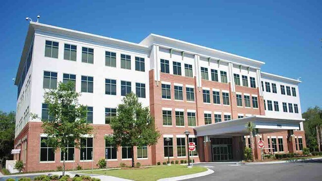

Property Detail
1251 Ribaut Rd
Hilton Head Island-Bluffton-Port Royal, SC
PARCEL A POR LOT 35 SEC 18 1S1W *1/05 ESMT GRANTED DB2082/2112
R120-007-000-0093-0000
Beaufort
Medicalbuilding
South Carolina
6611
35
2025
0.50 AC
2025
Hilton Head/Beaufort
000700
Other Market Areas
4,500 SF
NEARBY LISTINGS FOR SALE OR LEASE
DEMOGRAPHICS near 1251 Ribaut Rd
1 mile
3 mile
5 mile
2025 Total Population
4,622
19,590
43,584
2030 Population
4,810
20,463
45,459
Pop Growth 2025-2030
+ 4.07%
+ 4.46%
+ 4.30%
Average Age
42
42
39
2025 Total Households
2,124
8,549
16,596
HH Growth 2025-2030
+ 4.19%
+ 4.61%
+ 4.59%
Median Household Inc
$83,689
$71,045
$68,654
Avg Household Size
2.10
2.20
2.40
2025 Avg HH Vehicles
2.00
2.00
2.00
Median Home Value
$344,915
$378,260
$348,616
Median Year Built
1985
1986
1993
Nearby Places
Map Layers
Map Styles
 Street
 Aerial
Layers
 Traffic
 Biking
Places
Listings with unknown addresses are not visible on the map
- Restaurants
- Banks
- Shops
- Fitness
- Groceries
PUBLIC TRANSPORTATION
AIRPORT
Hilton Head
Drive
Walk
Distance
Hilton Head
53 min
38.0 mi
Savannah/Hilton Head International
Drive
Walk
Distance
Savannah/Hilton Head International
67 min
49.0 mi
Freight Ports
Georgia Ports - Savannah
Drive
Walk
Distance
Georgia Ports - Savannah
64 min
47.5 mi
Nearby Properties
Address
Land Use
TOTAL SIZE
Lot Size
Zoning
Address
Land Use
TOTAL SIZE
Lot Size
Zoning
361,033 SF
21.89 AC
6611
Address
Land Use
TOTAL SIZE
Lot Size
Zoning
308,567 SF
26.58 AC
Address
Land Use
TOTAL SIZE
Lot Size
Zoning
252,178 SF
19.36 AC
6601
Address
Land Use
TOTAL SIZE
Lot Size
Zoning
215,048 SF
20.78 AC
6101
Address
Land Use
TOTAL SIZE
Lot Size
Zoning
240,395 SF
4.45 AC
6601
Address
Land Use
TOTAL SIZE
Lot Size
Zoning
56,139 SF
6.97 AC
6611
Address
Land Use
TOTAL SIZE
Lot Size
Zoning
101,304 SF
6.47 AC
6611
Address
Land Use
TOTAL SIZE
Lot Size
Zoning
78,168 SF
11 AC
Address
Land Use
TOTAL SIZE
Lot Size
Zoning
75,973 SF
2.05 AC
6611
Address
Land Use
TOTAL SIZE
Lot Size
Zoning
56,043 SF
4.18 AC
6601
Address
Land Use
TOTAL SIZE
Lot Size
Zoning
144,226 SF
41.30 AC
6611
Address
Land Use
TOTAL SIZE
Lot Size
Zoning
116,067 SF
27 AC
6611
Address
Land Use
TOTAL SIZE
Lot Size
Zoning
18,312 SF
47.49 AC
6611
Address
Land Use
TOTAL SIZE
Lot Size
Zoning
87,456 SF
4.76 AC
6611
Address
Land Use
TOTAL SIZE
Lot Size
Zoning
50,800 SF
4.03 AC
6611
Address
Land Use
TOTAL SIZE
Lot Size
Zoning
25,475 SF
4.10 AC
6611
Address
Land Use
TOTAL SIZE
Lot Size
Zoning
87,884 SF
4.16 AC
6611
Address
Land Use
TOTAL SIZE
Lot Size
Zoning
76,552 SF
2.42 AC
6611
Address
Land Use
TOTAL SIZE
Lot Size
Zoning
75,342 SF
10.60 AC
6611
Address
Land Use
TOTAL SIZE
Lot Size
Zoning
134,446 SF
19.90 AC
6611
Address
Land Use
TOTAL SIZE
Lot Size
Zoning
3,304 SF
7.50 AC
6611
Address
Land Use
TOTAL SIZE
Lot Size
Zoning
70,055 SF
10.50 AC
6111
Address
Land Use
TOTAL SIZE
Lot Size
Zoning
57,117 SF
2.03 AC
Address
Land Use
TOTAL SIZE
Lot Size
Zoning
71,309 SF
2.30 AC
6601
Address
Land Use
TOTAL SIZE
Lot Size
Zoning
52,322 SF
6.86 AC
6601
Address
Land Use
TOTAL SIZE
Lot Size
Zoning
113,068 SF
12.55 AC
6611
Address
Land Use
TOTAL SIZE
Lot Size
Zoning
1,088 SF
6.67 AC
9999
Address
Land Use
TOTAL SIZE
Lot Size
Zoning
36,020 SF
3.46 AC
6611
Address
Land Use
TOTAL SIZE
Lot Size
Zoning
32,035 SF
7.39 AC
4201
The World's #1 Commercial Real Estate Marketplace
Connect with us
© 2026 CoStar Group
The information above has been obtained from sources believed reliable. While we do not doubt its accuracy we have not verified it and make no guarantee, warranty or representation about it. It is your responsibility to independently confirm its accuracy and completeness. Any projections, opinions, assumptions, or estimates used are for example only and do not represent the current or future performance of the property. The value of this transaction to you depends on tax and other factors which should be evaluated by your tax, financial, and legal advisors. You and your advisors should conduct a careful, independent investigation of the property to determine to your satisfaction the suitability of the property for your needs.