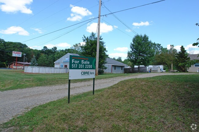
Property Record
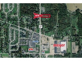
12511 S Us Highway 27, Dewitt, MI 48820
NEARBY LISTINGS FOR SALE OR LEASE
Property Detail
12511 S Us Highway 27
Lansing-East Lansing, MI
Forest Hills Sub
050-220-000-013-00
LOT 14 FOREST HILLS SUB SEC 10 T5NR2W
Retirementnursinghomecombined
Clinton
X
Michigan
26065C0025D
14
0
2.30 AC
2025
Outlying Clinton County
010104
West Michigan
2,828 SF
DEMOGRAPHICS near 12511 S Us Highway 27
1 Mile
3 Mile
5 Mile
2024 Total Population
2,521
15,776
32,337
2029 Population
2,576
16,112
33,063
Pop Growth 2024-2029
+ 2.18%
+ 2.13%
+ 2.25%
Average Age
43
41
41
2024 Total Households
1,006
6,083
12,857
HH Growth 2024-2029
+ 2.19%
+ 2.12%
+ 2.24%
Median Household Inc
$85,779
$89,660
$78,368
Avg Household Size
2.50
2.50
2.50
2024 Avg HH Vehicles
2.00
2.00
2.00
Median Home Value
$252,453
$291,972
$253,615
Median Year Built
1990
1988
1987
Nearby Places
Map Layers
Map Styles
 Street
 Aerial
- Restaurants
- Banks
- Shops
- Fitness
- Groceries
PUBLIC TRANSPORTATION
AIRPORT
Capital Region International
DRIVE
WALK
Distance
Capital Region International
14 min
8.5 mi
Freight Ports
Port of Toledo
DRIVE
WALK
Distance
Port of Toledo
154 min
121.6 mi
Nearby Properties
Address
Land Use
TOTAL SIZE
Lot Size
Zoning
Address
Land Use
TOTAL SIZE
Lot Size
Zoning
4,312 SF
30.47 AC
M3
Address
Land Use
TOTAL SIZE
Lot Size
Zoning
5,180 SF
16.94 AC
M2
Address
Land Use
TOTAL SIZE
Lot Size
Zoning
4,976 SF
6.23 AC
MF-N
Address
Land Use
TOTAL SIZE
Lot Size
Zoning
8,270 SF
13.15 AC
M3
Address
Land Use
TOTAL SIZE
Lot Size
Zoning
20,000 SF
25.53 AC
BC
Address
Land Use
TOTAL SIZE
Lot Size
Zoning
14,276 SF
6.42 AC
M3
Address
Land Use
TOTAL SIZE
Lot Size
Zoning
207,565 SF
11.50 AC
BC
Address
Land Use
TOTAL SIZE
Lot Size
Zoning
10,992 SF
10.43 AC
M3
Address
Land Use
TOTAL SIZE
Lot Size
Zoning
56,579 SF
8.48 AC
BSC
Address
Land Use
TOTAL SIZE
Lot Size
Zoning
4,464 SF
8.29 AC
MF
Address
Land Use
TOTAL SIZE
Lot Size
Zoning
86,211 SF
32.56 AC
BC
Address
Land Use
TOTAL SIZE
Lot Size
Zoning
39,372 SF
5.86 AC
BSC
Address
Land Use
TOTAL SIZE
Lot Size
Zoning
19,000 SF
CB
Address
Land Use
TOTAL SIZE
Lot Size
Zoning
15,000 SF
44.67 AC
A/BC
Address
Land Use
TOTAL SIZE
Lot Size
Zoning
15,576 SF
5.75 AC
M3
Address
Land Use
TOTAL SIZE
Lot Size
Zoning
17,490 SF
3.48 AC
BC
Address
Land Use
TOTAL SIZE
Lot Size
Zoning
22,413 SF
3.32 AC
M4
Address
Land Use
TOTAL SIZE
Lot Size
Zoning
5,536 SF
95.10 AC
PQ
Address
Land Use
TOTAL SIZE
Lot Size
Zoning
24,012 SF
2.31 AC
BC
Address
Land Use
TOTAL SIZE
Lot Size
Zoning
2,640 SF
7.20 AC
BC
Address
Land Use
TOTAL SIZE
Lot Size
Zoning
3,900 SF
2.75 AC
BC
Address
Land Use
TOTAL SIZE
Lot Size
Zoning
12,915 SF
0.95 AC
BL
Address
Land Use
TOTAL SIZE
Lot Size
Zoning
32,906 SF
4.72 AC
BC
Address
Land Use
TOTAL SIZE
Lot Size
Zoning
6,155 SF
4.19 AC
PO
Address
Land Use
TOTAL SIZE
Lot Size
Zoning
1,912 SF
6.61 AC
M3
Address
Land Use
TOTAL SIZE
Lot Size
Zoning
5,126 SF
1.59 AC
BSC
Address
Land Use
TOTAL SIZE
Lot Size
Zoning
10,582 SF
1.43 AC
BC
Address
Land Use
TOTAL SIZE
Lot Size
Zoning
6,144 SF
15.50 AC
BC
Address
Land Use
TOTAL SIZE
Lot Size
Zoning
4,655 SF
1.41 AC
BC
Address
Land Use
TOTAL SIZE
Lot Size
Zoning
20,520 SF
0.88 AC
CB
The World's #1 Commercial Real Estate Marketplace
Connect with us
© 2026 CoStar Group
The information above has been obtained from sources believed reliable. While we do not doubt its accuracy we have not verified it and make no guarantee, warranty or representation about it. It is your responsibility to independently confirm its accuracy and completeness. Any projections, opinions, assumptions, or estimates used are for example only and do not represent the current or future performance of the property. The value of this transaction to you depends on tax and other factors which should be evaluated by your tax, financial, and legal advisors. You and your advisors should conduct a careful, independent investigation of the property to determine to your satisfaction the suitability of the property for your needs.