Property Record
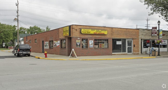
12528 W Hampton Ave, Butler, WI 53007


Property Detail
12528 W Hampton Ave
Milwaukee-Waukesha, WI
LOT 11 BLK 26 NEW BUTLER PT SE1/4 SEC 36 T8N R20E & PT NE1/4 SEC 1 T7N R20E :: DOC #4368840
BV-0144-290
WAUKESHA
Commercialnec
Wisconsin
B and X Area of moderate flood hazard, usually the area between the limits of the 100-year and 500-year floods.
11
0
0.11 AC
2025
NE/Menomonee Falls
200600
Milwaukee/Madison
NEARBY LISTINGS FOR SALE OR LEASE
DEMOGRAPHICS near 12528 W Hampton Ave
1 mile
3 mile
5 mile
2025 Total Population
4,987
74,471
221,194
2030 Population
5,078
75,153
222,532
Pop Growth 2025-2030
+ 1.82%
+ 0.92%
+ 0.60%
Average Age
39
39
39
2025 Total Households
2,248
29,608
88,523
HH Growth 2025-2030
+ 1.73%
+ 0.92%
+ 0.57%
Median Household Inc
$58,965
$75,770
$74,363
Avg Household Size
2.20
2.40
2.40
2025 Avg HH Vehicles
2.00
2.00
2.00
Median Home Value
$254,317
$278,344
$274,181
Median Year Built
1969
1963
1960
Nearby Places
Map Layers
Map Styles
 Street
 Aerial
Layers
 Traffic
 Biking
Places
Listings with unknown addresses are not visible on the map
- Restaurants
- Banks
- Shops
- Fitness
- Groceries
PUBLIC TRANSPORTATION
AIRPORT
General Mitchell International
Drive
Walk
Distance
General Mitchell International
30 min
18.6 mi
Freight Ports
Port Milwaukee
Drive
Walk
Distance
Port Milwaukee
24 min
14.8 mi
SALE & LEASE HISTORY
LISTING DATE
SALE/LEASE

Apr 24, 2019
For Lease
Nearby Properties
Address
Land Use
TOTAL SIZE
Lot Size
Zoning
Address
Land Use
TOTAL SIZE
Lot Size
Zoning
78,185 SF
73.67 AC
M1
Address
Land Use
TOTAL SIZE
Lot Size
Zoning
1.91 AC
Address
Land Use
TOTAL SIZE
Lot Size
Zoning
28,800 SF
3.30 AC
C2
Address
Land Use
TOTAL SIZE
Lot Size
Zoning
18.95 AC
Address
Land Use
TOTAL SIZE
Lot Size
Zoning
56.46 AC
M1
Address
Land Use
TOTAL SIZE
Lot Size
Zoning
21.66 AC
M2
Address
Land Use
TOTAL SIZE
Lot Size
Zoning
26.49 AC
Address
Land Use
TOTAL SIZE
Lot Size
Zoning
102,604 SF
12.67 AC
PUD
Address
Land Use
TOTAL SIZE
Lot Size
Zoning
121,472 SF
8.97 AC
Address
Land Use
TOTAL SIZE
Lot Size
Zoning
2.45 AC
C2
Address
Land Use
TOTAL SIZE
Lot Size
Zoning
222,355 SF
4.32 AC
Address
Land Use
TOTAL SIZE
Lot Size
Zoning
Address
Land Use
TOTAL SIZE
Lot Size
Zoning
387,379 SF
20.25 AC
Address
Land Use
TOTAL SIZE
Lot Size
Zoning
8.03 AC
RM1
Address
Land Use
TOTAL SIZE
Lot Size
Zoning
139,474 SF
6.43 AC
Address
Land Use
TOTAL SIZE
Lot Size
Zoning
16.01 AC
Address
Land Use
TOTAL SIZE
Lot Size
Zoning
Address
Land Use
TOTAL SIZE
Lot Size
Zoning
Address
Land Use
TOTAL SIZE
Lot Size
Zoning
12.73 AC
C2
Address
Land Use
TOTAL SIZE
Lot Size
Zoning
28.28 AC
M2
Address
Land Use
TOTAL SIZE
Lot Size
Zoning
326,619 SF
30.69 AC
PD
Address
Land Use
TOTAL SIZE
Lot Size
Zoning
11.66 AC
C2
Address
Land Use
TOTAL SIZE
Lot Size
Zoning
221,548 SF
11.80 AC
PD
Address
Land Use
TOTAL SIZE
Lot Size
Zoning
358,699 SF
24.97 AC
Address
Land Use
TOTAL SIZE
Lot Size
Zoning
4.94 AC
Address
Land Use
TOTAL SIZE
Lot Size
Zoning
150,000 SF
12.48 AC
IL1
Address
Land Use
TOTAL SIZE
Lot Size
Zoning
18.81 AC
M2
Address
Land Use
TOTAL SIZE
Lot Size
Zoning
225,174 SF
6.68 AC
Address
Land Use
TOTAL SIZE
Lot Size
Zoning
2.21 AC
C2
Address
Land Use
TOTAL SIZE
Lot Size
Zoning
6.75 AC
PUD
The World's #1 Commercial Real Estate Marketplace
Connect with us
© 2026 CoStar Group
The information above has been obtained from sources believed reliable. While we do not doubt its accuracy we have not verified it and make no guarantee, warranty or representation about it. It is your responsibility to independently confirm its accuracy and completeness. Any projections, opinions, assumptions, or estimates used are for example only and do not represent the current or future performance of the property. The value of this transaction to you depends on tax and other factors which should be evaluated by your tax, financial, and legal advisors. You and your advisors should conduct a careful, independent investigation of the property to determine to your satisfaction the suitability of the property for your needs.