Property Record
1255 Bridgestone Pkwy, La Vergne, TN 37086


Property Detail
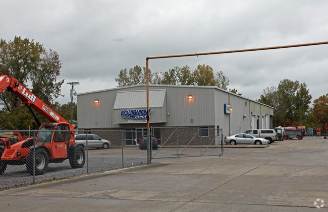
1255 Bridgestone Pkwy
017-042.00-000
RUTHERFORD
Warehouse
Tennessee
AE The base floodplain where base flood elevations are provided. AE Zones are now used on new format FIRMs instead of A1-A30 Zones.
4.75 AC
2025
Southeast
2025
Nashville
040200
Nashville-Davidson--Murfreesboro--Franklin, TN
9,300 SF
NEARBY LISTINGS FOR SALE OR LEASE
DEMOGRAPHICS near 1255 Bridgestone Pkwy
1 mile
3 mile
5 mile
2025 Total Population
1,127
43,757
153,700
2030 Population
1,228
47,021
163,608
Pop Growth 2025-2030
+ 8.96%
+ 7.46%
+ 6.45%
Average Age
38
36
36
2025 Total Households
413
15,295
54,407
HH Growth 2025-2030
+ 8.96%
+ 7.71%
+ 6.60%
Median Household Inc
$87,333
$82,987
$83,053
Avg Household Size
2.70
2.80
2.80
2025 Avg HH Vehicles
2.00
2.00
2.00
Median Home Value
$469,354
$352,361
$378,580
Median Year Built
2008
2005
2002
Nearby Places
Map Layers
Map Styles
 Street
 Aerial
Layers
 Traffic
 Biking
Places
Listings with unknown addresses are not visible on the map
- Restaurants
- Banks
- Shops
- Fitness
- Groceries
PUBLIC TRANSPORTATION
AIRPORT
Nashville International
Drive
Walk
Distance
Nashville International
19 min
11.2 mi
Nearby Properties
Address
Land Use
TOTAL SIZE
Lot Size
Zoning
Address
Land Use
TOTAL SIZE
Lot Size
Zoning
272,894 SF
36.45 AC
MULTI-ZONE
Address
Land Use
TOTAL SIZE
Lot Size
Zoning
28,908 SF
21.55 AC
MULTIZONE
Address
Land Use
TOTAL SIZE
Lot Size
Zoning
367,058 SF
112 AC
Address
Land Use
TOTAL SIZE
Lot Size
Zoning
129,800 SF
73.44 AC
MULTIZONE
Address
Land Use
TOTAL SIZE
Lot Size
Zoning
39,816 SF
39.02 AC
MULTIZONE
Address
Land Use
TOTAL SIZE
Lot Size
Zoning
57,362 SF
31.96 AC
MULTIZONE
Address
Land Use
TOTAL SIZE
Lot Size
Zoning
77,752 SF
13.44 AC
AR2A
Address
Land Use
TOTAL SIZE
Lot Size
Zoning
107,214 SF
13.78 AC
R10
Address
Land Use
TOTAL SIZE
Lot Size
Zoning
12,156 SF
122.05 AC
IR
Address
Land Use
TOTAL SIZE
Lot Size
Zoning
27,734 SF
18.24 AC
RM20
Address
Land Use
TOTAL SIZE
Lot Size
Zoning
18,707 SF
27.42 AC
RM15
Address
Land Use
TOTAL SIZE
Lot Size
Zoning
323,961 SF
27.38 AC
I-2
Address
Land Use
TOTAL SIZE
Lot Size
Zoning
4,709 SF
25.76 AC
RM14
Address
Land Use
TOTAL SIZE
Lot Size
Zoning
30,388 SF
29.41 AC
RM9
Address
Land Use
TOTAL SIZE
Lot Size
Zoning
23,718 SF
15 AC
MULTI-ZONE
Address
Land Use
TOTAL SIZE
Lot Size
Zoning
23,580 SF
34.80 AC
RM9
Address
Land Use
TOTAL SIZE
Lot Size
Zoning
4,974 SF
18.91 AC
C2
Address
Land Use
TOTAL SIZE
Lot Size
Zoning
28,187 SF
14 AC
SP
Address
Land Use
TOTAL SIZE
Lot Size
Zoning
516,516 SF
28.39 AC
MULTIZONE
Address
Land Use
TOTAL SIZE
Lot Size
Zoning
627,900 SF
55.57 AC
IWD
Address
Land Use
TOTAL SIZE
Lot Size
Zoning
200,101 SF
6.04 AC
MULTIZONE
Address
Land Use
TOTAL SIZE
Lot Size
Zoning
526,143 SF
25.75 AC
IR
Address
Land Use
TOTAL SIZE
Lot Size
Zoning
570,000 SF
36.49 AC
IR
Address
Land Use
TOTAL SIZE
Lot Size
Zoning
588,845 SF
72.56 AC
Address
Land Use
TOTAL SIZE
Lot Size
Zoning
512,464 SF
42.43 AC
IR
Address
Land Use
TOTAL SIZE
Lot Size
Zoning
7,784 SF
21.36 AC
MULTIZONE
Address
Land Use
TOTAL SIZE
Lot Size
Zoning
7,720 SF
31.19 AC
IR
Address
Land Use
TOTAL SIZE
Lot Size
Zoning
600,604 SF
47.70 AC
Address
Land Use
TOTAL SIZE
Lot Size
Zoning
603,578 SF
47.11 AC
Address
Land Use
TOTAL SIZE
Lot Size
Zoning
17,085 SF
18.73 AC
R8
The World's #1 Commercial Real Estate Marketplace
Connect with us
© 2026 CoStar Group
The information above has been obtained from sources believed reliable. While we do not doubt its accuracy we have not verified it and make no guarantee, warranty or representation about it. It is your responsibility to independently confirm its accuracy and completeness. Any projections, opinions, assumptions, or estimates used are for example only and do not represent the current or future performance of the property. The value of this transaction to you depends on tax and other factors which should be evaluated by your tax, financial, and legal advisors. You and your advisors should conduct a careful, independent investigation of the property to determine to your satisfaction the suitability of the property for your needs.