Property Record
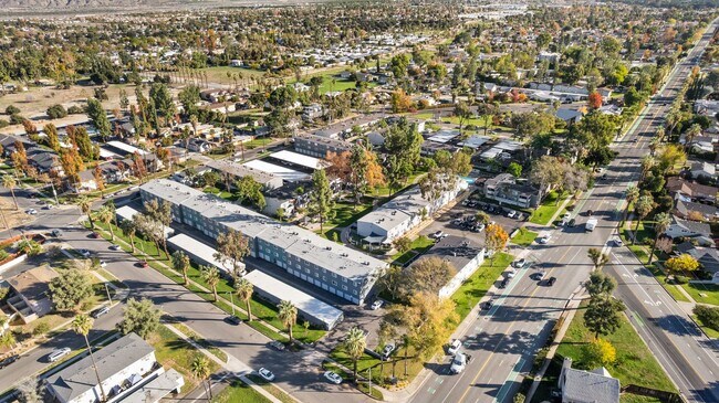
1255 E Citrus Ave, Redlands, CA 92374


Property Detail
1255 E Citrus Ave
Riverside-San Bernardino-Ontario, CA
TRACT 7379 BLOCK 30 TR NO 7379 AND PTN LOT N LUGONIA PARK LYING E OF TR NO 7379 AND PTN LOTS 7 AND 8 MAP OF LOTS 5 THRU 9 BLK 30 REDLANDS SURVEY LYING E OF TR 7379 AND W OF GROVE ST EX STS 7.80 AC M/L
0170-261-04
San Bernardino
Apartment
California
AO River or stream flood hazard areas, and areas with a 1% or greater chance of shallow flooding each year. These areas have a 26% chance of flooding over the life of a 30-year mortgage.
7,8
2025
7.80 AC
2025
North Redlands
008404
Inland Empire (California)
167,130 SF
NEARBY LISTINGS FOR SALE OR LEASE
DEMOGRAPHICS near 1255 E Citrus Ave
1 mile
3 mile
5 mile
2025 Total Population
18,127
80,530
131,041
2030 Population
18,363
81,584
132,898
Pop Growth 2025-2030
+ 1.30%
+ 1.31%
+ 1.42%
Average Age
38
39
39
2025 Total Households
6,311
28,781
45,831
HH Growth 2025-2030
+ 1.58%
+ 1.38%
+ 1.50%
Median Household Inc
$92,124
$100,418
$104,568
Avg Household Size
2.60
2.70
2.70
2025 Avg HH Vehicles
2.00
2.00
2.00
Median Home Value
$596,663
$649,481
$645,453
Median Year Built
1974
1976
1981
Nearby Places
Map Layers
Map Styles
 Street
 Aerial
Layers
 Traffic
 Biking
Places
Listings with unknown addresses are not visible on the map
- Restaurants
- Banks
- Shops
- Fitness
- Groceries
PUBLIC TRANSPORTATION
COMMUTER RAIL
Redlands - University Metrolink Station (Metrolink San Bernardino Line - Metrolink Trains)
Drive
Walk
Distance
Redlands - University Metrolink Station (Metrolink San Bernardino Line - Metrolink Trains)
2 min
9 min
0.5 mi
Redlands - Downtown Metrolink Station (Metrolink San Bernardino Line - Metrolink Trains)
Drive
Walk
Distance
Redlands - Downtown Metrolink Station (Metrolink San Bernardino Line - Metrolink Trains)
4 min
1.7 mi
AIRPORT
Ontario International
Drive
Walk
Distance
Ontario International
33 min
26.2 mi
Freight Ports
Port of Long Beach
Drive
Walk
Distance
Port of Long Beach
91 min
71.6 mi
Nearby Properties
Address
Land Use
TOTAL SIZE
Lot Size
Zoning
Address
Land Use
TOTAL SIZE
Lot Size
Zoning
393,088 SF
25.98 AC
Address
Land Use
TOTAL SIZE
Lot Size
Zoning
445,160 SF
24.11 AC
Address
Land Use
TOTAL SIZE
Lot Size
Zoning
105,803 SF
10.86 AC
Address
Land Use
TOTAL SIZE
Lot Size
Zoning
329,075 SF
10.93 AC
Address
Land Use
TOTAL SIZE
Lot Size
Zoning
56.83 AC
Address
Land Use
TOTAL SIZE
Lot Size
Zoning
777,580 SF
23.13 AC
Address
Land Use
TOTAL SIZE
Lot Size
Zoning
205,555 SF
6.39 AC
Address
Land Use
TOTAL SIZE
Lot Size
Zoning
166,788 SF
11.74 AC
Address
Land Use
TOTAL SIZE
Lot Size
Zoning
221,914 SF
4.50 AC
Address
Land Use
TOTAL SIZE
Lot Size
Zoning
445,160 SF
8.53 AC
Address
Land Use
TOTAL SIZE
Lot Size
Zoning
184,201 SF
6.08 AC
Address
Land Use
TOTAL SIZE
Lot Size
Zoning
112,907 SF
3.59 AC
Address
Land Use
TOTAL SIZE
Lot Size
Zoning
129,025 SF
8.20 AC
Address
Land Use
TOTAL SIZE
Lot Size
Zoning
169,312 SF
10.99 AC
Address
Land Use
TOTAL SIZE
Lot Size
Zoning
153,344 SF
7.30 AC
Address
Land Use
TOTAL SIZE
Lot Size
Zoning
82,356 SF
5.10 AC
RM
Address
Land Use
TOTAL SIZE
Lot Size
Zoning
95,525 SF
4.53 AC
Address
Land Use
TOTAL SIZE
Lot Size
Zoning
153,298 SF
7.27 AC
Address
Land Use
TOTAL SIZE
Lot Size
Zoning
70,627 SF
4.22 AC
Address
Land Use
TOTAL SIZE
Lot Size
Zoning
164,794 SF
1.32 AC
Address
Land Use
TOTAL SIZE
Lot Size
Zoning
89,705 SF
2.78 AC
Address
Land Use
TOTAL SIZE
Lot Size
Zoning
104,067 SF
Address
Land Use
TOTAL SIZE
Lot Size
Zoning
147,280 SF
9.83 AC
Address
Land Use
TOTAL SIZE
Lot Size
Zoning
80,673 SF
0.96 AC
Address
Land Use
TOTAL SIZE
Lot Size
Zoning
81,275 SF
5.56 AC
Address
Land Use
TOTAL SIZE
Lot Size
Zoning
74,207 SF
2.66 AC
Address
Land Use
TOTAL SIZE
Lot Size
Zoning
89,248 SF
4.75 AC
Address
Land Use
TOTAL SIZE
Lot Size
Zoning
123,230 SF
6.33 AC
CGSCP
Address
Land Use
TOTAL SIZE
Lot Size
Zoning
65,400 SF
2.60 AC
Address
Land Use
TOTAL SIZE
Lot Size
Zoning
136,218 SF
12.35 AC
The World's #1 Commercial Real Estate Marketplace
Connect with us
© 2026 CoStar Group
The information above has been obtained from sources believed reliable. While we do not doubt its accuracy we have not verified it and make no guarantee, warranty or representation about it. It is your responsibility to independently confirm its accuracy and completeness. Any projections, opinions, assumptions, or estimates used are for example only and do not represent the current or future performance of the property. The value of this transaction to you depends on tax and other factors which should be evaluated by your tax, financial, and legal advisors. You and your advisors should conduct a careful, independent investigation of the property to determine to your satisfaction the suitability of the property for your needs.