Property Record
1255 N Main St, Vidor, TX 77662

Save to a Folder
{{folder.Name}}
{{folder.ListingIds.length}} Properties
{{folder.ListingIds.length}} Property
Create a New Folder
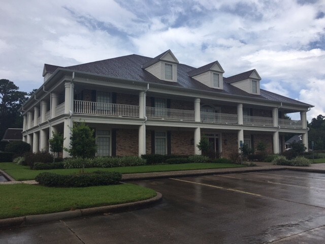
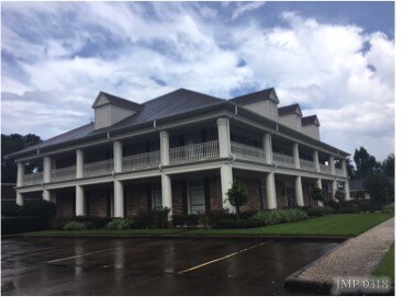
Property Detail
1255 N Main St
Beaumont-Port Arthur, TX
COLBURN DAY (BLK 5,6 MILLER-VIDOR), LOT PART OF 13, ACRES 3.656, LOT PART OF 6,7,&8 BLK 5 MILLER-VIDOR
003104-000195
ORANGE
Taxexempt
Texas
B and X Area of moderate flood hazard, usually the area between the limits of the 100-year and 500-year floods.
13
2025
3.66 AC
2025
Orange County
021700
Beaumont/Port Arthur
6,252 SF
NEARBY LISTINGS FOR SALE OR LEASE
-
-
View all Vidor listings for sale on LoopNet.com
DEMOGRAPHICS near 1255 N Main St
1 mile
3 mile
5 mile
2025 Total Population
5,246
15,358
21,454
2030 Population
5,436
15,839
22,090
Pop Growth 2025-2030
+ 3.62%
+ 3.13%
+ 2.96%
Average Age
39
40
40
2025 Total Households
1,978
5,910
8,199
HH Growth 2025-2030
+ 3.59%
+ 3.13%
+ 2.94%
Median Household Inc
$58,579
$62,639
$64,460
Avg Household Size
2.50
2.50
2.50
2025 Avg HH Vehicles
2.00
2.00
2.00
Median Home Value
$125,405
$137,036
$145,070
Median Year Built
1975
1982
1984
Nearby Places
Map Layers
Map Styles
 Street
 Aerial
Layers
 Traffic
 Biking
Places
Listings with unknown addresses are not visible on the map
- Restaurants
- Banks
- Shops
- Fitness
- Groceries
PUBLIC TRANSPORTATION
COMMUTER RAIL
Beaumont Amtrak (Sunset Limited - Amtrak)
Drive
Walk
Distance
Beaumont Amtrak (Sunset Limited - Amtrak)
14 min
9.8 mi
Freight Ports
Port Beaumont
Drive
Walk
Distance
Port Beaumont
10 min
7.5 mi
SALE & LEASE HISTORY
LISTING DATE
SALE/LEASE

Dec 21, 2017
For Sale
Nearby Properties
Address
Land Use
TOTAL SIZE
Lot Size
Zoning
Address
Land Use
TOTAL SIZE
Lot Size
Zoning
107,684 SF
43.41 AC
Address
Land Use
TOTAL SIZE
Lot Size
Zoning
Address
Land Use
TOTAL SIZE
Lot Size
Zoning
262,985 SF
18.80 AC
Address
Land Use
TOTAL SIZE
Lot Size
Zoning
187,028 SF
25.07 AC
Address
Land Use
TOTAL SIZE
Lot Size
Zoning
91,251 SF
14.74 AC
Address
Land Use
TOTAL SIZE
Lot Size
Zoning
21,950 SF
8.38 AC
Address
Land Use
TOTAL SIZE
Lot Size
Zoning
121,625 SF
20 AC
Address
Land Use
TOTAL SIZE
Lot Size
Zoning
27,344 SF
1.57 AC
Address
Land Use
TOTAL SIZE
Lot Size
Zoning
17,356 SF
2.01 AC
Address
Land Use
TOTAL SIZE
Lot Size
Zoning
46,375 SF
10.49 AC
Address
Land Use
TOTAL SIZE
Lot Size
Zoning
1,976 SF
13.56 AC
Address
Land Use
TOTAL SIZE
Lot Size
Zoning
16,000 SF
2.73 AC
Address
Land Use
TOTAL SIZE
Lot Size
Zoning
110,780 SF
9.32 AC
Address
Land Use
TOTAL SIZE
Lot Size
Zoning
62,892 SF
13.17 AC
Address
Land Use
TOTAL SIZE
Lot Size
Zoning
4,398 SF
0.97 AC
Address
Land Use
TOTAL SIZE
Lot Size
Zoning
8.12 AC
Address
Land Use
TOTAL SIZE
Lot Size
Zoning
35,320 SF
2.87 AC
Address
Land Use
TOTAL SIZE
Lot Size
Zoning
79,704 SF
25.48 AC
Address
Land Use
TOTAL SIZE
Lot Size
Zoning
14,510 SF
1.61 AC
Address
Land Use
TOTAL SIZE
Lot Size
Zoning
23,700 SF
3.99 AC
Address
Land Use
TOTAL SIZE
Lot Size
Zoning
28,344 SF
23.99 AC
Address
Land Use
TOTAL SIZE
Lot Size
Zoning
25,143 SF
1.41 AC
Address
Land Use
TOTAL SIZE
Lot Size
Zoning
19,356 SF
10.03 AC
Address
Land Use
TOTAL SIZE
Lot Size
Zoning
5,675 SF
1.27 AC
Address
Land Use
TOTAL SIZE
Lot Size
Zoning
3.44 AC
Address
Land Use
TOTAL SIZE
Lot Size
Zoning
14,400 SF
1.09 AC
Address
Land Use
TOTAL SIZE
Lot Size
Zoning
1.70 AC
Address
Land Use
TOTAL SIZE
Lot Size
Zoning
20,000 SF
3.45 AC
Address
Land Use
TOTAL SIZE
Lot Size
Zoning
11,626 SF
1.39 AC
Address
Land Use
TOTAL SIZE
Lot Size
Zoning
29,500 SF
3.60 AC
The World's #1 Commercial Real Estate Marketplace
Connect with us
© 2026 CoStar Group
The information above has been obtained from sources believed reliable. While we do not doubt its accuracy we have not verified it and make no guarantee, warranty or representation about it. It is your responsibility to independently confirm its accuracy and completeness. Any projections, opinions, assumptions, or estimates used are for example only and do not represent the current or future performance of the property. The value of this transaction to you depends on tax and other factors which should be evaluated by your tax, financial, and legal advisors. You and your advisors should conduct a careful, independent investigation of the property to determine to your satisfaction the suitability of the property for your needs.