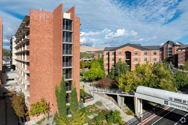
Property Record
1255 N Virginia St, Reno, NV 89503


NEARBY LISTINGS FOR SALE OR LEASE
Property Detail
1255 N Virginia St
007-131-23
_Unspecified
Commercialnec
FR NE4 SW4 SEC 2 TWP 19 RGE 19
X
Washoe
32031C3037G
Nevada
2025
5.16 AC
2026
West University
002500
Reno/Sparks
184,723 SF
Reno, NV
DEMOGRAPHICS near 1255 N Virginia St
1 Mile
3 Mile
5 Mile
2024 Total Population
18,240
129,535
244,545
2029 Population
19,043
136,632
257,360
Pop Growth 2024-2029
+ 4.40%
+ 5.48%
+ 5.24%
Average Age
35
38
39
2024 Total Households
7,592
54,569
99,128
HH Growth 2024-2029
+ 4.50%
+ 5.61%
+ 5.37%
Median Household Inc
$40,083
$52,226
$61,454
Avg Household Size
1.90
2.20
2.30
2024 Avg HH Vehicles
1.00
2.00
2.00
Median Home Value
$418,827
$409,682
$422,167
Median Year Built
1975
1978
1981
Nearby Places
Map Layers
Map Styles
 Street
 Aerial
- Restaurants
- Banks
- Shops
- Fitness
- Groceries
PUBLIC TRANSPORTATION
COMMUTER RAIL
Reno (California Zephyr - Amtrak)
DRIVE
WALK
Distance
Reno (California Zephyr - Amtrak)
3 min
18 min
0.9 mi
AIRPORT
Reno/Tahoe International
DRIVE
WALK
Distance
Reno/Tahoe International
25 min
7.4 mi
Freight Ports
Port of Stockton
DRIVE
WALK
Distance
Port of Stockton
207 min
178.9 mi
Nearby Properties
Address
Land Use
TOTAL SIZE
Lot Size
Zoning
Address
Land Use
TOTAL SIZE
Lot Size
Zoning
120.45 AC
PF
Address
Land Use
TOTAL SIZE
Lot Size
Zoning
2,041,608 SF
28.47 AC
MU
Address
Land Use
TOTAL SIZE
Lot Size
Zoning
1,103,124 SF
138.61 AC
MU
Address
Land Use
TOTAL SIZE
Lot Size
Zoning
1,865,345 SF
2.75 AC
MD-ED
Address
Land Use
TOTAL SIZE
Lot Size
Zoning
1.47 AC
MD-UD
Address
Land Use
TOTAL SIZE
Lot Size
Zoning
1,048,514 SF
1.30 AC
MU
Address
Land Use
TOTAL SIZE
Lot Size
Zoning
391,195 SF
53.65 AC
PF
Address
Land Use
TOTAL SIZE
Lot Size
Zoning
507,606 SF
3.42 AC
MU
Address
Land Use
TOTAL SIZE
Lot Size
Zoning
497,928 SF
3.52 AC
MU
Address
Land Use
TOTAL SIZE
Lot Size
Zoning
645,699 SF
4.53 AC
MU
Address
Land Use
TOTAL SIZE
Lot Size
Zoning
501,541 SF
2.89 AC
MD-ED
Address
Land Use
TOTAL SIZE
Lot Size
Zoning
292,461 SF
1.22 AC
MU
Address
Land Use
TOTAL SIZE
Lot Size
Zoning
294,872 SF
69.02 AC
PF
Address
Land Use
TOTAL SIZE
Lot Size
Zoning
296,048 SF
93.65 AC
PF
Address
Land Use
TOTAL SIZE
Lot Size
Zoning
378,145 SF
27.36 AC
PD
Address
Land Use
TOTAL SIZE
Lot Size
Zoning
460,367 SF
1.52 AC
MD-ED
Address
Land Use
TOTAL SIZE
Lot Size
Zoning
396,810 SF
16.21 AC
PD
Address
Land Use
TOTAL SIZE
Lot Size
Zoning
189,861 SF
1.69 AC
MD-NWQ
Address
Land Use
TOTAL SIZE
Lot Size
Zoning
232,156 SF
1.76 AC
MU
Address
Land Use
TOTAL SIZE
Lot Size
Zoning
460,688 SF
62.55 AC
PF
Address
Land Use
TOTAL SIZE
Lot Size
Zoning
306,626 SF
17.61 AC
MF14 44% /
Address
Land Use
TOTAL SIZE
Lot Size
Zoning
234,478 SF
2.93 AC
MD-ED
Address
Land Use
TOTAL SIZE
Lot Size
Zoning
342,947 SF
8.95 AC
MF30
Address
Land Use
TOTAL SIZE
Lot Size
Zoning
587,380 SF
2.59 AC
MD-ED
Address
Land Use
TOTAL SIZE
Lot Size
Zoning
257,400 SF
2.71 AC
MD-ED
Address
Land Use
TOTAL SIZE
Lot Size
Zoning
434,002 SF
7.64 AC
MD-NWQ
Address
Land Use
TOTAL SIZE
Lot Size
Zoning
194,000 SF
2.24 AC
MD-RD
Address
Land Use
TOTAL SIZE
Lot Size
Zoning
283,243 SF
2.02 AC
MD-UD
Address
Land Use
TOTAL SIZE
Lot Size
Zoning
600 SF
279.66 AC
ME 61% / P
Address
Land Use
TOTAL SIZE
Lot Size
Zoning
304,344 SF
10.24 AC
GC
The World's #1 Commercial Real Estate Marketplace
Connect with us
© 2025 CoStar Group
The information above has been obtained from sources believed reliable. While we do not doubt its accuracy we have not verified it and make no guarantee, warranty or representation about it. It is your responsibility to independently confirm its accuracy and completeness. Any projections, opinions, assumptions, or estimates used are for example only and do not represent the current or future performance of the property. The value of this transaction to you depends on tax and other factors which should be evaluated by your tax, financial, and legal advisors. You and your advisors should conduct a careful, independent investigation of the property to determine to your satisfaction the suitability of the property for your needs.