Property Record
1256 Highway 138 Sw, Riverdale, GA 30296
NEARBY LISTINGS FOR SALE OR LEASE
Property Detail
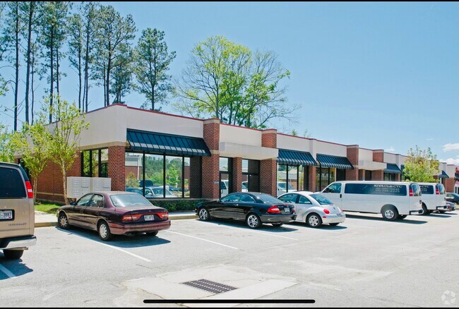
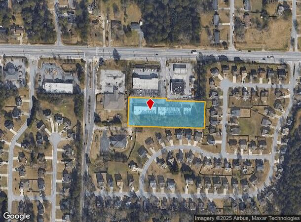
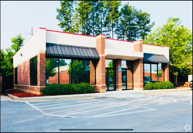
1256 Highway 138 Sw
13-0200B-00B-028
Family Tree Cap Investments L
Stripcommercialcenter
Clayton
X
Georgia
13063C0066F
200
2024
2.49 AC
2024
Riverdale/Jonesboro
040527
Atlanta
7,500 SF
Atlanta-Sandy Springs-Roswell, GA
DEMOGRAPHICS near 1256 Highway 138 Sw
1 Mile
3 Mile
5 Mile
2024 Total Population
9,087
69,196
178,919
2029 Population
9,065
69,266
179,995
Pop Growth 2024-2029
(0.24%)
+ 0.10%
+ 0.60%
Average Age
37
37
36
2024 Total Households
3,265
24,842
65,510
HH Growth 2024-2029
(0.25%)
+ 0.09%
+ 0.54%
Median Household Inc
$48,418
$54,214
$50,297
Avg Household Size
2.70
2.70
2.70
2024 Avg HH Vehicles
2.00
2.00
2.00
Median Home Value
$196,103
$170,259
$170,276
Median Year Built
1992
1986
1984
Nearby Places
- Restaurants
- Banks
- Shops
- Fitness
- Groceries
PUBLIC TRANSPORTATION
AIRPORT
Hartsfield - Jackson Atlanta International
DRIVE
WALK
Distance
Hartsfield - Jackson Atlanta International
18 min
9.0 mi
SALE & LEASE HISTORY
LISTING DATE
SALE/LEASE

Oct 08, 2023
For Sale
Jan 08, 2025
For Lease
Aug 19, 2024
For Sale
Nearby Properties
Address
Land Use
TOTAL SIZE
Lot Size
Zoning
Address
Land Use
TOTAL SIZE
Lot Size
Zoning
196 SF
19.90 AC
C
Address
Land Use
TOTAL SIZE
Lot Size
Zoning
40,472 SF
116.70 AC
HI
Address
Land Use
TOTAL SIZE
Lot Size
Zoning
294 SF
21.17 AC
PUD
Address
Land Use
TOTAL SIZE
Lot Size
Zoning
240 SF
26.94 AC
RM
Address
Land Use
TOTAL SIZE
Lot Size
Zoning
216 SF
24.45 AC
RM
Address
Land Use
TOTAL SIZE
Lot Size
Zoning
316 SF
34.30 AC
RG75
Address
Land Use
TOTAL SIZE
Lot Size
Zoning
424 SF
54.79 AC
RM
Address
Land Use
TOTAL SIZE
Lot Size
Zoning
270 SF
28.02 AC
RM
Address
Land Use
TOTAL SIZE
Lot Size
Zoning
278 SF
18.53 AC
PUD
Address
Land Use
TOTAL SIZE
Lot Size
Zoning
123,000 SF
48 AC
RS110
Address
Land Use
TOTAL SIZE
Lot Size
Zoning
256 SF
25 AC
PUD
Address
Land Use
TOTAL SIZE
Lot Size
Zoning
57.05 AC
GB
Address
Land Use
TOTAL SIZE
Lot Size
Zoning
160 SF
19.95 AC
RM
Address
Land Use
TOTAL SIZE
Lot Size
Zoning
147,540 SF
47.10 AC
C RP
Address
Land Use
TOTAL SIZE
Lot Size
Zoning
481 SF
90.43 AC
RMH
Address
Land Use
TOTAL SIZE
Lot Size
Zoning
224 SF
25 AC
C
Address
Land Use
TOTAL SIZE
Lot Size
Zoning
144 SF
13.65 AC
RM
Address
Land Use
TOTAL SIZE
Lot Size
Zoning
213 SF
16.60 AC
C
Address
Land Use
TOTAL SIZE
Lot Size
Zoning
176 SF
17.67 AC
RM
Address
Land Use
TOTAL SIZE
Lot Size
Zoning
214 SF
20.97 AC
C
Address
Land Use
TOTAL SIZE
Lot Size
Zoning
200 SF
11 AC
C
Address
Land Use
TOTAL SIZE
Lot Size
Zoning
108,738 SF
28.31 AC
C
Address
Land Use
TOTAL SIZE
Lot Size
Zoning
203,067 SF
18 AC
C
Address
Land Use
TOTAL SIZE
Lot Size
Zoning
114 SF
27.60 AC
RM
Address
Land Use
TOTAL SIZE
Lot Size
Zoning
138,822 SF
15.49 AC
C
Address
Land Use
TOTAL SIZE
Lot Size
Zoning
192,012 SF
16.93 AC
C
Address
Land Use
TOTAL SIZE
Lot Size
Zoning
141,792 SF
18.50 AC
RS110
Address
Land Use
TOTAL SIZE
Lot Size
Zoning
86,781 SF
16 AC
RS110
Address
Land Use
TOTAL SIZE
Lot Size
Zoning
138,852 SF
6.72 AC
C CH
Address
Land Use
TOTAL SIZE
Lot Size
Zoning
105,795 SF
13.55 AC
C
The World's #1 Commercial Real Estate Marketplace
Connect with us
© 2025 CoStar Group
The information above has been obtained from sources believed reliable. While we do not doubt its accuracy we have not verified it and make no guarantee, warranty or representation about it. It is your responsibility to independently confirm its accuracy and completeness. Any projections, opinions, assumptions, or estimates used are for example only and do not represent the current or future performance of the property. The value of this transaction to you depends on tax and other factors which should be evaluated by your tax, financial, and legal advisors. You and your advisors should conduct a careful, independent investigation of the property to determine to your satisfaction the suitability of the property for your needs.