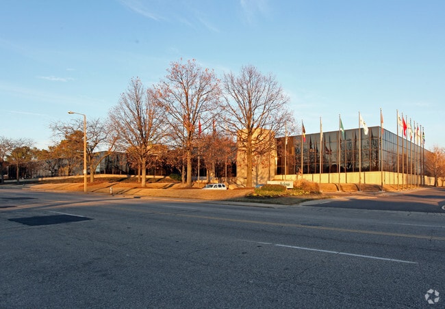
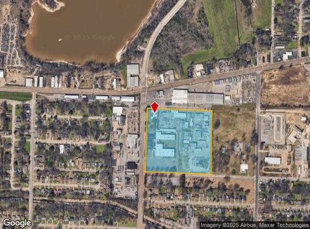
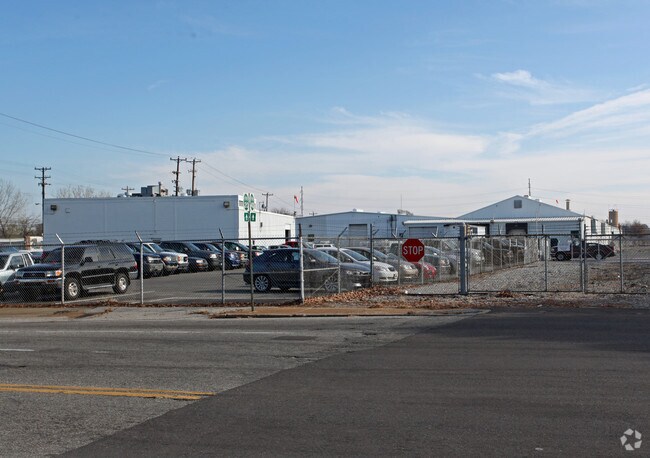
Property Record
1256 N Mclean Blvd, Memphis, TN 38108
NEARBY LISTINGS FOR SALE OR LEASE
Property Detail
1256 N Mclean Blvd
Memphis, TN-MS-AR
Union Land & Improvement Co
04-1018-0-0005C
ES MCLEAN BLVD COR HUNTER (NE) LOT CONT: 16
Foodprocessing
Shelby
X
Tennessee
47157C0290F
9
2024
15.41 AC
2025
Northwest
000700
Memphis
229,514 SF
DEMOGRAPHICS near 1256 N Mclean Blvd
1 Mile
3 Mile
5 Mile
2024 Total Population
11,331
81,451
222,503
2029 Population
11,414
82,320
223,237
Pop Growth 2024-2029
+ 0.73%
+ 1.07%
+ 0.33%
Average Age
40
38
37
2024 Total Households
4,844
35,418
95,325
HH Growth 2024-2029
+ 0.58%
+ 0.89%
+ 0.22%
Median Household Inc
$28,953
$38,154
$41,301
Avg Household Size
2.30
2.20
2.20
2024 Avg HH Vehicles
1.00
1.00
1.00
Median Home Value
$90,414
$163,617
$162,978
Median Year Built
1952
1957
1959
Nearby Places
Map Layers
Map Styles
 Street
 Aerial
- Restaurants
- Banks
- Shops
- Fitness
- Groceries
PUBLIC TRANSPORTATION
COMMUTER RAIL
Central Station (Riverfront Loop - Memphis Area Transit Authority Trolley (MataTrolley))
DRIVE
WALK
Distance
Central Station (Riverfront Loop - Memphis Area Transit Authority Trolley (MataTrolley))
10 min
5.7 mi
AIRPORT
Memphis International
DRIVE
WALK
Distance
Memphis International
16 min
9.8 mi
Freight Ports
Port of Shreveport
DRIVE
WALK
Distance
Port of Shreveport
402 min
371.9 mi
Nearby Properties
Address
Land Use
TOTAL SIZE
Lot Size
Zoning
Address
Land Use
TOTAL SIZE
Lot Size
Zoning
409,950 SF
5.16 AC
CMP-1
Address
Land Use
TOTAL SIZE
Lot Size
Zoning
660,788 SF
8.28 AC
CMP-1
Address
Land Use
TOTAL SIZE
Lot Size
Zoning
61,983 SF
3.95 AC
U
Address
Land Use
TOTAL SIZE
Lot Size
Zoning
413,375 SF
33.87 AC
U
Address
Land Use
TOTAL SIZE
Lot Size
Zoning
300,225 SF
9.61 AC
U
Address
Land Use
TOTAL SIZE
Lot Size
Zoning
138,093 SF
7.05 AC
EMP
Address
Land Use
TOTAL SIZE
Lot Size
Zoning
516,768 SF
6.11 AC
CMP-1
Address
Land Use
TOTAL SIZE
Lot Size
Zoning
115,053 SF
4.63 AC
CMU-1
Address
Land Use
TOTAL SIZE
Lot Size
Zoning
2,137 SF
346 AC
R-15
Address
Land Use
TOTAL SIZE
Lot Size
Zoning
43,779 SF
2.11 AC
RU-3
Address
Land Use
TOTAL SIZE
Lot Size
Zoning
82,064 SF
3.53 AC
CMP-1
Address
Land Use
TOTAL SIZE
Lot Size
Zoning
99,732 SF
1.08 AC
CMU-3
Address
Land Use
TOTAL SIZE
Lot Size
Zoning
100,246 SF
0.93 AC
CMU-3
Address
Land Use
TOTAL SIZE
Lot Size
Zoning
33,391 SF
1.26 AC
CMU-1
Address
Land Use
TOTAL SIZE
Lot Size
Zoning
87,504 SF
0.88 AC
CMU-3
Address
Land Use
TOTAL SIZE
Lot Size
Zoning
222,671 SF
8.77 AC
EMP
Address
Land Use
TOTAL SIZE
Lot Size
Zoning
53,088 SF
1.51 AC
CMU-3
Address
Land Use
TOTAL SIZE
Lot Size
Zoning
38,348 SF
1.74 AC
RW
Address
Land Use
TOTAL SIZE
Lot Size
Zoning
120.15 AC
RU-1
Address
Land Use
TOTAL SIZE
Lot Size
Zoning
1,913,224 SF
78.98 AC
IH
Address
Land Use
TOTAL SIZE
Lot Size
Zoning
96 AC
R-10
Address
Land Use
TOTAL SIZE
Lot Size
Zoning
17,438 SF
25.84 AC
RU-3
Address
Land Use
TOTAL SIZE
Lot Size
Zoning
96,963 SF
2.13 AC
MU
Address
Land Use
TOTAL SIZE
Lot Size
Zoning
66,580 SF
3.75 AC
RU-3
Address
Land Use
TOTAL SIZE
Lot Size
Zoning
192,674 SF
1.97 AC
IH
Address
Land Use
TOTAL SIZE
Lot Size
Zoning
46,612 SF
2.86 AC
CMU-3
Address
Land Use
TOTAL SIZE
Lot Size
Zoning
699,184 SF
19.67 AC
IH
Address
Land Use
TOTAL SIZE
Lot Size
Zoning
40,270 SF
2 AC
Address
Land Use
TOTAL SIZE
Lot Size
Zoning
66,728 SF
346 AC
RS-15
Address
Land Use
TOTAL SIZE
Lot Size
Zoning
40,695 SF
1.24 AC
MU
The World's #1 Commercial Real Estate Marketplace
Connect with us
© 2026 CoStar Group
The information above has been obtained from sources believed reliable. While we do not doubt its accuracy we have not verified it and make no guarantee, warranty or representation about it. It is your responsibility to independently confirm its accuracy and completeness. Any projections, opinions, assumptions, or estimates used are for example only and do not represent the current or future performance of the property. The value of this transaction to you depends on tax and other factors which should be evaluated by your tax, financial, and legal advisors. You and your advisors should conduct a careful, independent investigation of the property to determine to your satisfaction the suitability of the property for your needs.