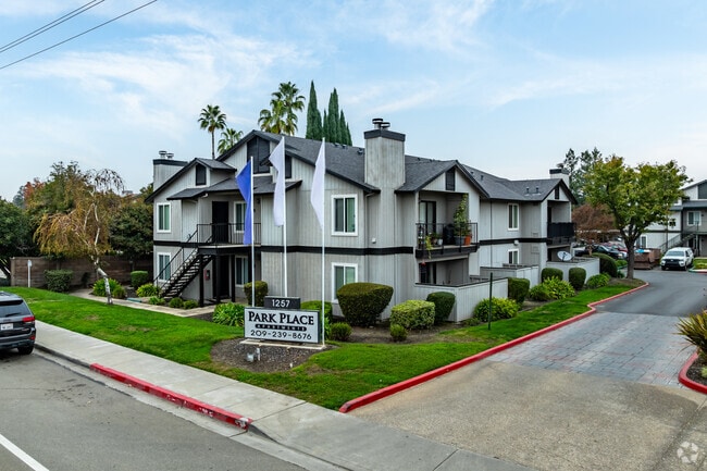
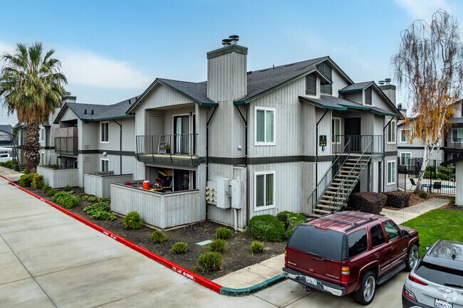
Property Record
1257 Crom St, Manteca, CA 95337

Property Detail
1257 Crom St
Stockton-Lodi, CA
REDRAW 870929 FR ORIG APN 199070277
200-020-06
San Joaquin
Apartment
California
B and X Area of moderate flood hazard, usually the area between the limits of the 100-year and 500-year floods.
a
2025
5.38 AC
2025
West Manteca
005123
Stockton/Modesto
102,404 SF
NEARBY LISTINGS FOR SALE OR LEASE
-
-
View all Manteca listings for sale on LoopNet.com
DEMOGRAPHICS near 1257 Crom St
1 mile
3 mile
5 mile
2025 Total Population
23,437
97,778
132,138
2030 Population
24,506
102,965
139,894
Pop Growth 2025-2030
+ 4.56%
+ 5.30%
+ 5.87%
Average Age
38
39
38
2025 Total Households
7,580
31,335
40,765
HH Growth 2025-2030
+ 4.72%
+ 5.34%
+ 5.85%
Median Household Inc
$81,149
$93,619
$98,980
Avg Household Size
3.00
3.10
3.20
2025 Avg HH Vehicles
2.00
2.00
2.00
Median Home Value
$529,432
$631,474
$660,224
Median Year Built
1982
1992
1998
Nearby Places
Map Layers
Map Styles
 Street
 Aerial
Transit
 Traffic
 Biking
Places
Listings with unknown addresses are not visible on the map
- Restaurants
- Banks
- Shops
- Fitness
- Groceries
PUBLIC TRANSPORTATION
COMMUTER RAIL
Lathrop Station (ACE Train - Altamont Corridor Express)
Drive
Walk
Distance
Lathrop Station (ACE Train - Altamont Corridor Express)
6 min
2.4 mi
AIRPORT
Stockton Metro
Drive
Walk
Distance
Stockton Metro
14 min
7.1 mi
Freight Ports
Port of Stockton
Drive
Walk
Distance
Port of Stockton
22 min
15.2 mi
Nearby Properties
Address
Land Use
TOTAL SIZE
Lot Size
Zoning
Address
Land Use
TOTAL SIZE
Lot Size
Zoning
510,086 SF
28.72 AC
Address
Land Use
TOTAL SIZE
Lot Size
Zoning
832,994 SF
106.05 AC
Address
Land Use
TOTAL SIZE
Lot Size
Zoning
870,294 SF
48.64 AC
Address
Land Use
TOTAL SIZE
Lot Size
Zoning
622,959 SF
31.75 AC
IW
Address
Land Use
TOTAL SIZE
Lot Size
Zoning
649,693 SF
35.59 AC
Address
Land Use
TOTAL SIZE
Lot Size
Zoning
26,118 SF
10.80 AC
Address
Land Use
TOTAL SIZE
Lot Size
Zoning
552,450 SF
27.84 AC
Address
Land Use
TOTAL SIZE
Lot Size
Zoning
81.08 AC
Address
Land Use
TOTAL SIZE
Lot Size
Zoning
610,025 SF
26.34 AC
C2
Address
Land Use
TOTAL SIZE
Lot Size
Zoning
565,580 SF
56.99 AC
Address
Land Use
TOTAL SIZE
Lot Size
Zoning
21,924 SF
9.27 AC
Address
Land Use
TOTAL SIZE
Lot Size
Zoning
381,555 SF
19.04 AC
CC
Address
Land Use
TOTAL SIZE
Lot Size
Zoning
456,465 SF
20.62 AC
Address
Land Use
TOTAL SIZE
Lot Size
Zoning
350,415 SF
17.45 AC
Address
Land Use
TOTAL SIZE
Lot Size
Zoning
8,840 SF
7.51 AC
Address
Land Use
TOTAL SIZE
Lot Size
Zoning
16.02 AC
Address
Land Use
TOTAL SIZE
Lot Size
Zoning
390,443 SF
17.40 AC
Address
Land Use
TOTAL SIZE
Lot Size
Zoning
374,976 SF
15.18 AC
Address
Land Use
TOTAL SIZE
Lot Size
Zoning
286,072 SF
19.41 AC
Address
Land Use
TOTAL SIZE
Lot Size
Zoning
106,576 SF
6.85 AC
Address
Land Use
TOTAL SIZE
Lot Size
Zoning
10,000 SF
15.18 AC
Address
Land Use
TOTAL SIZE
Lot Size
Zoning
19,912 SF
6.49 AC
C1
Address
Land Use
TOTAL SIZE
Lot Size
Zoning
440,490 SF
19.39 AC
Address
Land Use
TOTAL SIZE
Lot Size
Zoning
608,500 SF
31.59 AC
Address
Land Use
TOTAL SIZE
Lot Size
Zoning
82,329 SF
5.96 AC
Address
Land Use
TOTAL SIZE
Lot Size
Zoning
175,025 SF
9.06 AC
Address
Land Use
TOTAL SIZE
Lot Size
Zoning
7.89 AC
Address
Land Use
TOTAL SIZE
Lot Size
Zoning
404,657 SF
24.89 AC
AG40
Address
Land Use
TOTAL SIZE
Lot Size
Zoning
17.25 AC
GC
Address
Land Use
TOTAL SIZE
Lot Size
Zoning
10.05 AC
The World's #1 Commercial Real Estate Marketplace
Connect with us
© 2026 CoStar Group
The information above has been obtained from sources believed reliable. While we do not doubt its accuracy we have not verified it and make no guarantee, warranty or representation about it. It is your responsibility to independently confirm its accuracy and completeness. Any projections, opinions, assumptions, or estimates used are for example only and do not represent the current or future performance of the property. The value of this transaction to you depends on tax and other factors which should be evaluated by your tax, financial, and legal advisors. You and your advisors should conduct a careful, independent investigation of the property to determine to your satisfaction the suitability of the property for your needs.