Property Record
1258 Bayshore Blvd, Dunedin, FL 34698
NEARBY LISTINGS FOR SALE OR LEASE
Property Detail
1258 Bayshore Blvd
Tampa-St. Petersburg-Clearwater, FL
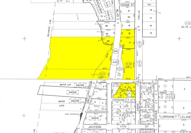
Malones, L.H. Sub
27-28-15-54612-000-0170
MALONES, L.H. SUB LOTS 17 & 18 LESS RD R/W ON W TOGETHER WITH THAT PART OF GOVT LOT 1 LYING WITHIN NW 1/4 OF SEC 27-28-15 DESC AS PART OF THE L.B. SKINER & MISS BRUCE TRACTS BOUNDED ON N BY SD LOT 17 & BOUNDED ON E BY FORMER RR R/W & BOUNDED ON S BY
Parkplaygroundpicnicarea
Pinellas
AE
Florida
12103C0068H
17
0
4.04 AC
2025
North Pinellas
027108
Tampa/St Petersburg
DEMOGRAPHICS near 1258 Bayshore Blvd
1 Mile
3 Mile
5 Mile
2024 Total Population
8,705
64,955
168,650
2029 Population
8,900
65,362
169,511
Pop Growth 2024-2029
+ 2.24%
+ 0.63%
+ 0.51%
Average Age
54
49
48
2024 Total Households
4,552
30,991
77,244
HH Growth 2024-2029
+ 2.31%
+ 0.51%
+ 0.47%
Median Household Inc
$50,246
$57,265
$58,091
Avg Household Size
1.80
2.00
2.10
2024 Avg HH Vehicles
1.00
2.00
2.00
Median Home Value
$255,689
$292,392
$294,477
Median Year Built
1969
1975
1977
Nearby Places
Map Layers
Map Styles
 Street
 Aerial
- Restaurants
- Banks
- Shops
- Fitness
- Groceries
PUBLIC TRANSPORTATION
AIRPORT
St Pete-Clearwater International
DRIVE
WALK
Distance
St Pete-Clearwater International
33 min
17.3 mi
Tampa International
DRIVE
WALK
Distance
Tampa International
36 min
21.5 mi
Freight Ports
Port of Tampa Bay
DRIVE
WALK
Distance
Port of Tampa Bay
50 min
29.9 mi
Nearby Properties
Address
Land Use
TOTAL SIZE
Lot Size
Zoning
Address
Land Use
TOTAL SIZE
Lot Size
Zoning
675,202 SF
43.24 AC
Address
Land Use
TOTAL SIZE
Lot Size
Zoning
167,201 SF
63.11 AC
AE
Address
Land Use
TOTAL SIZE
Lot Size
Zoning
406,729 SF
29.79 AC
CP1
Address
Land Use
TOTAL SIZE
Lot Size
Zoning
412,099 SF
49.21 AC
Address
Land Use
TOTAL SIZE
Lot Size
Zoning
278,505 SF
38.67 AC
Address
Land Use
TOTAL SIZE
Lot Size
Zoning
362,238 SF
13.80 AC
Address
Land Use
TOTAL SIZE
Lot Size
Zoning
4,250 SF
235.09 AC
Address
Land Use
TOTAL SIZE
Lot Size
Zoning
117,024 SF
56.52 AC
Address
Land Use
TOTAL SIZE
Lot Size
Zoning
241,170 SF
17.23 AC
Address
Land Use
TOTAL SIZE
Lot Size
Zoning
151,730 SF
49.66 AC
Address
Land Use
TOTAL SIZE
Lot Size
Zoning
191,375 SF
13.58 AC
AE
Address
Land Use
TOTAL SIZE
Lot Size
Zoning
250,113 SF
39.50 AC
Address
Land Use
TOTAL SIZE
Lot Size
Zoning
196,808 SF
12.70 AC
Address
Land Use
TOTAL SIZE
Lot Size
Zoning
7,504 SF
1.71 AC
Address
Land Use
TOTAL SIZE
Lot Size
Zoning
1.51 AC
Address
Land Use
TOTAL SIZE
Lot Size
Zoning
220,640 SF
9.02 AC
Address
Land Use
TOTAL SIZE
Lot Size
Zoning
201,208 SF
2.16 AC
Address
Land Use
TOTAL SIZE
Lot Size
Zoning
228,493 SF
21.21 AC
Address
Land Use
TOTAL SIZE
Lot Size
Zoning
173,160 SF
5.39 AC
Address
Land Use
TOTAL SIZE
Lot Size
Zoning
107,766 SF
25.15 AC
Address
Land Use
TOTAL SIZE
Lot Size
Zoning
158,400 SF
9.80 AC
Address
Land Use
TOTAL SIZE
Lot Size
Zoning
396,841 SF
9.73 AC
Address
Land Use
TOTAL SIZE
Lot Size
Zoning
415,593 SF
29.66 AC
Address
Land Use
TOTAL SIZE
Lot Size
Zoning
6,296 SF
1.03 AC
Address
Land Use
TOTAL SIZE
Lot Size
Zoning
116,557 SF
12.57 AC
R4
Address
Land Use
TOTAL SIZE
Lot Size
Zoning
76,848 SF
12.60 AC
AE
Address
Land Use
TOTAL SIZE
Lot Size
Zoning
148,043 SF
13.55 AC
Address
Land Use
TOTAL SIZE
Lot Size
Zoning
94,971 SF
11.53 AC
RPD10
Address
Land Use
TOTAL SIZE
Lot Size
Zoning
4,714 SF
0.79 AC
Address
Land Use
TOTAL SIZE
Lot Size
Zoning
90,791 SF
6.92 AC
The World's #1 Commercial Real Estate Marketplace
Connect with us
© 2025 CoStar Group
The information above has been obtained from sources believed reliable. While we do not doubt its accuracy we have not verified it and make no guarantee, warranty or representation about it. It is your responsibility to independently confirm its accuracy and completeness. Any projections, opinions, assumptions, or estimates used are for example only and do not represent the current or future performance of the property. The value of this transaction to you depends on tax and other factors which should be evaluated by your tax, financial, and legal advisors. You and your advisors should conduct a careful, independent investigation of the property to determine to your satisfaction the suitability of the property for your needs.