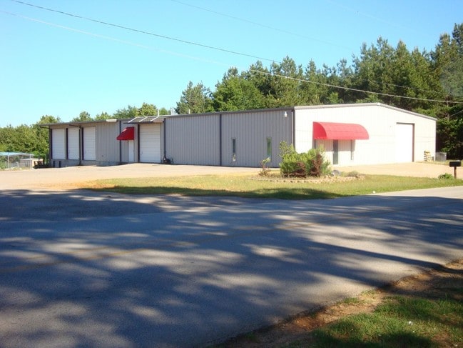
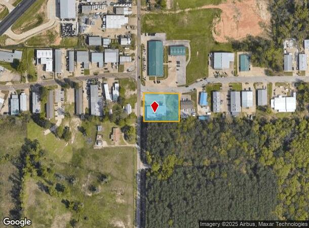
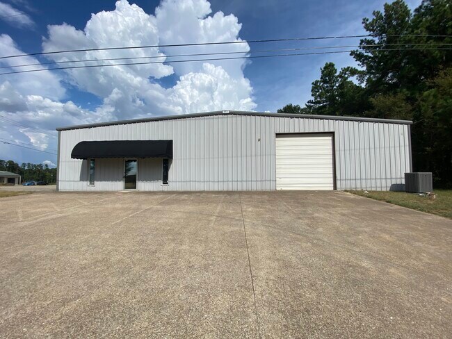
Property Record
12587 County Road 192, Tyler, TX 75703
NEARBY LISTINGS FOR SALE OR LEASE
Property Detail
12587 County Road 192
1-00000-0030-00-033070
A0030 O Anderson
Publicstorage
ABST A0030 O ANDERSONTRACT 33G
X
Smith
48423C0365D
Texas
2024
0.99 AC
2025
Tyler & Longview
001917
Other Market Areas
9,375 SF
Tyler, TX
DEMOGRAPHICS near 12587 County Road 192
1 Mile
3 Mile
5 Mile
2024 Total Population
976
37,068
104,096
2029 Population
1,072
40,263
113,075
Pop Growth 2024-2029
+ 9.84%
+ 8.62%
+ 8.63%
Average Age
41
41
39
2024 Total Households
428
16,291
41,176
HH Growth 2024-2029
+ 9.11%
+ 8.06%
+ 8.08%
Median Household Inc
$45,357
$62,951
$61,152
Avg Household Size
2.10
2.20
2.40
2024 Avg HH Vehicles
2.00
2.00
2.00
Median Home Value
$171,764
$246,854
$206,000
Median Year Built
1998
1987
1981
Nearby Places
Map Layers
Map Styles
 Street
 Aerial
- Restaurants
- Banks
- Shops
- Fitness
- Groceries
PUBLIC TRANSPORTATION
AIRPORT
Tyler Pounds Regional
DRIVE
WALK
Distance
Tyler Pounds Regional
17 min
9.2 mi
SALE & LEASE HISTORY
LISTING DATE
SALE/LEASE

Sep 25, 2016
For Lease
Aug 27, 2024
For Lease
Nearby Properties
Address
Land Use
TOTAL SIZE
Lot Size
Zoning
Address
Land Use
TOTAL SIZE
Lot Size
Zoning
18.37 AC
R1A
Address
Land Use
TOTAL SIZE
Lot Size
Zoning
403,396 SF
45.40 AC
C4
Address
Land Use
TOTAL SIZE
Lot Size
Zoning
11,332 SF
22.07 AC
PMF
Address
Land Use
TOTAL SIZE
Lot Size
Zoning
24.83 AC
Address
Land Use
TOTAL SIZE
Lot Size
Zoning
29.58 AC
Address
Land Use
TOTAL SIZE
Lot Size
Zoning
234,762 SF
16.68 AC
Address
Land Use
TOTAL SIZE
Lot Size
Zoning
5,068 SF
18.35 AC
RMF
Address
Land Use
TOTAL SIZE
Lot Size
Zoning
84,560 SF
15.70 AC
M1
Address
Land Use
TOTAL SIZE
Lot Size
Zoning
4,333 SF
13.32 AC
Address
Land Use
TOTAL SIZE
Lot Size
Zoning
3,149 SF
16.15 AC
RMF
Address
Land Use
TOTAL SIZE
Lot Size
Zoning
4,349 SF
33.26 AC
RMF
Address
Land Use
TOTAL SIZE
Lot Size
Zoning
237,916 SF
11.17 AC
PMF
Address
Land Use
TOTAL SIZE
Lot Size
Zoning
66.86 AC
R1A
Address
Land Use
TOTAL SIZE
Lot Size
Zoning
10.51 AC
Address
Land Use
TOTAL SIZE
Lot Size
Zoning
88,964 SF
11.33 AC
Address
Land Use
TOTAL SIZE
Lot Size
Zoning
1,867 SF
13.63 AC
RMF
Address
Land Use
TOTAL SIZE
Lot Size
Zoning
3,968 SF
12.04 AC
RMF
Address
Land Use
TOTAL SIZE
Lot Size
Zoning
126.94 AC
Address
Land Use
TOTAL SIZE
Lot Size
Zoning
3,538 SF
9.51 AC
RMF
Address
Land Use
TOTAL SIZE
Lot Size
Zoning
90,410 SF
4.94 AC
Address
Land Use
TOTAL SIZE
Lot Size
Zoning
3,806 SF
18.86 AC
RMF
Address
Land Use
TOTAL SIZE
Lot Size
Zoning
3,477 SF
9.56 AC
RMF
Address
Land Use
TOTAL SIZE
Lot Size
Zoning
2,936 SF
9.66 AC
RMF
Address
Land Use
TOTAL SIZE
Lot Size
Zoning
52,557 SF
11.44 AC
RMF
Address
Land Use
TOTAL SIZE
Lot Size
Zoning
17,912 SF
9.06 AC
RMF
Address
Land Use
TOTAL SIZE
Lot Size
Zoning
40,960 SF
8.90 AC
RMF
Address
Land Use
TOTAL SIZE
Lot Size
Zoning
105,407 SF
6.14 AC
C4
Address
Land Use
TOTAL SIZE
Lot Size
Zoning
34,758 SF
9.76 AC
Address
Land Use
TOTAL SIZE
Lot Size
Zoning
37,254 SF
9.52 AC
C1
Address
Land Use
TOTAL SIZE
Lot Size
Zoning
15,400 SF
4.41 AC
RMF
The World's #1 Commercial Real Estate Marketplace
Connect with us
© 2025 CoStar Group
The information above has been obtained from sources believed reliable. While we do not doubt its accuracy we have not verified it and make no guarantee, warranty or representation about it. It is your responsibility to independently confirm its accuracy and completeness. Any projections, opinions, assumptions, or estimates used are for example only and do not represent the current or future performance of the property. The value of this transaction to you depends on tax and other factors which should be evaluated by your tax, financial, and legal advisors. You and your advisors should conduct a careful, independent investigation of the property to determine to your satisfaction the suitability of the property for your needs.