Property Record
1259 Furukawa Way, Santa Maria, CA 93458


NEARBY LISTINGS FOR SALE OR LEASE
Property Detail
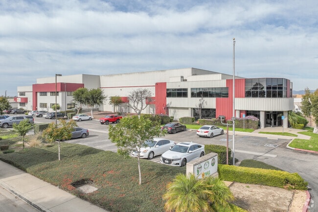
1259 Furukawa Way
Santa Maria-Santa Barbara, CA
Furukawa Industrial Park
117-630-012
Santa Barbara
Foodprocessing
California
X
2
06079C1905F
4.86 AC
2024
North SB County
2025
Santa Barbara/Sta Maria/Goleta
002410
DEMOGRAPHICS near 1259 Furukawa Way
1 Mile
3 Mile
5 Mile
2024 Total Population
19,146
97,457
126,933
2029 Population
19,116
96,731
125,783
Pop Growth 2024-2029
(0.16%)
(0.74%)
(0.91%)
Average Age
29
33
35
2024 Total Households
4,598
25,398
34,855
HH Growth 2024-2029
(0.17%)
(0.81%)
(1.00%)
Median Household Inc
$60,511
$72,127
$78,141
Avg Household Size
4.00
3.60
3.50
2024 Avg HH Vehicles
2.00
2.00
2.00
Median Home Value
$432,143
$413,232
$437,361
Median Year Built
1984
1978
1979
Nearby Places
Map Layers
Map Styles
 Street
 Aerial
- Restaurants
- Banks
- Shops
- Fitness
- Groceries
PUBLIC TRANSPORTATION
COMMUTER RAIL
Guadalupe Amtrak Station (Pacific Surfliner - Amtrak)
DRIVE
WALK
Distance
Guadalupe Amtrak Station (Pacific Surfliner - Amtrak)
14 min
8.2 mi
AIRPORT
San Luis County Regional
DRIVE
WALK
Distance
San Luis County Regional
41 min
27.5 mi
Freight Ports
The Port of Hueneme
DRIVE
WALK
Distance
The Port of Hueneme
137 min
103.3 mi
SALE & LEASE HISTORY
LISTING DATE
SALE/LEASE

Sep 08, 2017
For Lease
Nearby Properties
Address
Land Use
TOTAL SIZE
Lot Size
Zoning
Address
Land Use
TOTAL SIZE
Lot Size
Zoning
Address
Land Use
TOTAL SIZE
Lot Size
Zoning
211.15 AC
Address
Land Use
TOTAL SIZE
Lot Size
Zoning
49.99 AC
Address
Land Use
TOTAL SIZE
Lot Size
Zoning
14.45 AC
Address
Land Use
TOTAL SIZE
Lot Size
Zoning
146.75 AC
Address
Land Use
TOTAL SIZE
Lot Size
Zoning
6.35 AC
Address
Land Use
TOTAL SIZE
Lot Size
Zoning
9.46 AC
Address
Land Use
TOTAL SIZE
Lot Size
Zoning
18.19 AC
Address
Land Use
TOTAL SIZE
Lot Size
Zoning
Address
Land Use
TOTAL SIZE
Lot Size
Zoning
9.50 AC
Address
Land Use
TOTAL SIZE
Lot Size
Zoning
17.71 AC
Address
Land Use
TOTAL SIZE
Lot Size
Zoning
Address
Land Use
TOTAL SIZE
Lot Size
Zoning
Address
Land Use
TOTAL SIZE
Lot Size
Zoning
21.09 AC
Address
Land Use
TOTAL SIZE
Lot Size
Zoning
10.75 AC
Address
Land Use
TOTAL SIZE
Lot Size
Zoning
6.36 AC
Address
Land Use
TOTAL SIZE
Lot Size
Zoning
10.81 AC
Address
Land Use
TOTAL SIZE
Lot Size
Zoning
6.17 AC
Address
Land Use
TOTAL SIZE
Lot Size
Zoning
45.32 AC
Address
Land Use
TOTAL SIZE
Lot Size
Zoning
13.76 AC
Address
Land Use
TOTAL SIZE
Lot Size
Zoning
Address
Land Use
TOTAL SIZE
Lot Size
Zoning
Address
Land Use
TOTAL SIZE
Lot Size
Zoning
4.40 AC
Address
Land Use
TOTAL SIZE
Lot Size
Zoning
Address
Land Use
TOTAL SIZE
Lot Size
Zoning
27.05 AC
Address
Land Use
TOTAL SIZE
Lot Size
Zoning
Address
Land Use
TOTAL SIZE
Lot Size
Zoning
6.11 AC
Address
Land Use
TOTAL SIZE
Lot Size
Zoning
2.81 AC
Address
Land Use
TOTAL SIZE
Lot Size
Zoning
The World's #1 Commercial Real Estate Marketplace
Connect with us
© 2026 CoStar Group
The information above has been obtained from sources believed reliable. While we do not doubt its accuracy we have not verified it and make no guarantee, warranty or representation about it. It is your responsibility to independently confirm its accuracy and completeness. Any projections, opinions, assumptions, or estimates used are for example only and do not represent the current or future performance of the property. The value of this transaction to you depends on tax and other factors which should be evaluated by your tax, financial, and legal advisors. You and your advisors should conduct a careful, independent investigation of the property to determine to your satisfaction the suitability of the property for your needs.