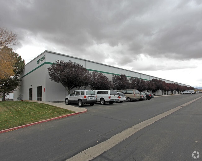
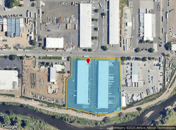
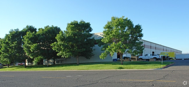
Property Record
1259 Spice Islands Dr, Sparks, NV 89431

NEARBY LISTINGS FOR SALE OR LEASE
Property Detail
1259 Spice Islands Dr
Reno, NV
_Unspecified
034-152-19
PM 546 FR LT 4 RS 2041 LT 2
Industrialgeneral
Washoe
AE
Nevada
32031C3063G
4
2025
7.11 AC
2026
Sparks
003111
Reno/Sparks
101,100 SF
DEMOGRAPHICS near 1259 Spice Islands Dr
1 Mile
3 Mile
5 Mile
2024 Total Population
449
51,656
176,574
2029 Population
464
54,414
186,058
Pop Growth 2024-2029
+ 3.34%
+ 5.34%
+ 5.37%
Average Age
39
40
39
2024 Total Households
104
21,161
71,853
HH Growth 2024-2029
+ 2.88%
+ 5.74%
+ 5.59%
Median Household Inc
$62,045
$67,661
$58,444
Avg Household Size
2.30
2.40
2.40
2024 Avg HH Vehicles
2.00
2.00
2.00
Median Home Value
$350,000
$390,080
$380,684
Median Year Built
1978
1981
1981
Nearby Places
Map Layers
Map Styles
 Street
 Aerial
- Restaurants
- Banks
- Shops
- Fitness
- Groceries
PUBLIC TRANSPORTATION
COMMUTER RAIL
Reno (California Zephyr - Amtrak)
DRIVE
WALK
Distance
Reno (California Zephyr - Amtrak)
13 min
7.0 mi
AIRPORT
Reno/Tahoe International
DRIVE
WALK
Distance
Reno/Tahoe International
29 min
8.0 mi
Freight Ports
Port of Stockton
DRIVE
WALK
Distance
Port of Stockton
216 min
185.1 mi
SALE & LEASE HISTORY
LISTING DATE
SALE/LEASE

Oct 29, 2025
For Lease
Jun 24, 2019
For Lease
Jan 24, 2023
For Lease
Dec 14, 2020
For Lease
Aug 01, 2022
For Lease
Nearby Properties
Address
Land Use
TOTAL SIZE
Lot Size
Zoning
Address
Land Use
TOTAL SIZE
Lot Size
Zoning
762,384 SF
1,131.28 AC
MA
Address
Land Use
TOTAL SIZE
Lot Size
Zoning
385,812 SF
16.47 AC
NUD
Address
Land Use
TOTAL SIZE
Lot Size
Zoning
991,800 SF
51.03 AC
PD
Address
Land Use
TOTAL SIZE
Lot Size
Zoning
6,641 SF
247.42 AC
PF
Address
Land Use
TOTAL SIZE
Lot Size
Zoning
296,048 SF
93.65 AC
PF
Address
Land Use
TOTAL SIZE
Lot Size
Zoning
356,160 SF
12.05 AC
MUD
Address
Land Use
TOTAL SIZE
Lot Size
Zoning
347,564 SF
10.23 AC
MUD
Address
Land Use
TOTAL SIZE
Lot Size
Zoning
365,962 SF
3.54 AC
PD
Address
Land Use
TOTAL SIZE
Lot Size
Zoning
617,081 SF
2.62 AC
MUD
Address
Land Use
TOTAL SIZE
Lot Size
Zoning
366,641 SF
37.91 AC
MA
Address
Land Use
TOTAL SIZE
Lot Size
Zoning
622,628 SF
2.91 AC
MUD
Address
Land Use
TOTAL SIZE
Lot Size
Zoning
79,748 SF
8.98 AC
NUD
Address
Land Use
TOTAL SIZE
Lot Size
Zoning
232,481 SF
9.45 AC
PD
Address
Land Use
TOTAL SIZE
Lot Size
Zoning
273,101 SF
15.96 AC
MF-3/PUD
Address
Land Use
TOTAL SIZE
Lot Size
Zoning
150,712 SF
16.90 AC
PO
Address
Land Use
TOTAL SIZE
Lot Size
Zoning
34,503 SF
30.82 AC
PF
Address
Land Use
TOTAL SIZE
Lot Size
Zoning
242,907 SF
4.18 AC
NUD
Address
Land Use
TOTAL SIZE
Lot Size
Zoning
203,367 SF
1 AC
MUD
Address
Land Use
TOTAL SIZE
Lot Size
Zoning
378.16 AC
GR
Address
Land Use
TOTAL SIZE
Lot Size
Zoning
1,269,958 SF
54.19 AC
I
Address
Land Use
TOTAL SIZE
Lot Size
Zoning
396,497 SF
20.80 AC
PD
Address
Land Use
TOTAL SIZE
Lot Size
Zoning
146,586 SF
2.94 AC
IC
Address
Land Use
TOTAL SIZE
Lot Size
Zoning
381,852 SF
18.60 AC
GC
Address
Land Use
TOTAL SIZE
Lot Size
Zoning
622,571 SF
25.69 AC
I
Address
Land Use
TOTAL SIZE
Lot Size
Zoning
133,992 SF
19.86 AC
TC
Address
Land Use
TOTAL SIZE
Lot Size
Zoning
84,778 SF
42.67 AC
MA
Address
Land Use
TOTAL SIZE
Lot Size
Zoning
136,331 SF
0.93 AC
MUD
Address
Land Use
TOTAL SIZE
Lot Size
Zoning
270,772 SF
32.96 AC
I
Address
Land Use
TOTAL SIZE
Lot Size
Zoning
344,784 SF
18.13 AC
GC
Address
Land Use
TOTAL SIZE
Lot Size
Zoning
173,181 SF
9.37 AC
IC
The World's #1 Commercial Real Estate Marketplace
Connect with us
© 2026 CoStar Group
The information above has been obtained from sources believed reliable. While we do not doubt its accuracy we have not verified it and make no guarantee, warranty or representation about it. It is your responsibility to independently confirm its accuracy and completeness. Any projections, opinions, assumptions, or estimates used are for example only and do not represent the current or future performance of the property. The value of this transaction to you depends on tax and other factors which should be evaluated by your tax, financial, and legal advisors. You and your advisors should conduct a careful, independent investigation of the property to determine to your satisfaction the suitability of the property for your needs.