Property Record
1259 Wolcott Rd, Wolcott, CT 06716
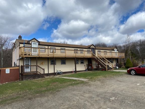

This Property Is For Sale
Property Detail
1259 Wolcott Rd
WOLC-000119-000003-000004B
Naugatuck Vly
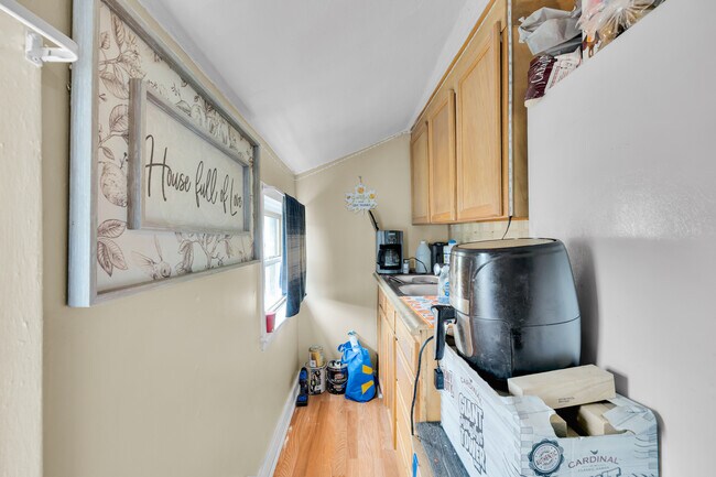
Apartmenthouse5plusunits
Connecticut
GC
4b
B and X Area of moderate flood hazard, usually the area between the limits of the 100-year and 500-year floods.
1.37 AC
2025
Waterbury
2025
Westchester/So Connecticut
361300
New Haven, CT
3,281 SF
NEARBY LISTINGS FOR SALE OR LEASE
-
-
View all Wolcott listings for sale on LoopNet.com
DEMOGRAPHICS near 1259 Wolcott Rd
1 mile
3 mile
5 mile
2025 Total Population
2,319
20,220
111,046
2030 Population
2,382
20,788
113,819
Pop Growth 2025-2030
+ 2.72%
+ 2.81%
+ 2.50%
Average Age
44
43
41
2025 Total Households
836
7,631
44,645
HH Growth 2025-2030
+ 2.63%
+ 2.78%
+ 2.52%
Median Household Inc
$106,707
$111,790
$79,159
Avg Household Size
2.60
2.60
2.40
2025 Avg HH Vehicles
2.00
2.00
2.00
Median Home Value
$332,558
$315,953
$279,749
Median Year Built
1980
1974
1967
Nearby Places
Map Layers
Map Styles
 Street
 Aerial
Layers
 Traffic
 Biking
Places
Listings with unknown addresses are not visible on the map
- Restaurants
- Banks
- Shops
- Fitness
- Groceries
PUBLIC TRANSPORTATION
COMMUTER RAIL
Waterbury Station (New Haven Line - Metro-North Commuter Railroad Company (Metro-North))
Drive
Walk
Distance
Waterbury Station (New Haven Line - Metro-North Commuter Railroad Company (Metro-North))
14 min
7.5 mi
AIRPORT
Tweed/New Haven
Drive
Walk
Distance
Tweed/New Haven
50 min
31.5 mi
Bradley International
Drive
Walk
Distance
Bradley International
63 min
35.5 mi
Nearby Properties
Address
Land Use
TOTAL SIZE
Lot Size
Zoning
Address
Land Use
TOTAL SIZE
Lot Size
Zoning
171,826 SF
36.60 AC
R-15
Address
Land Use
TOTAL SIZE
Lot Size
Zoning
50 AC
R-40
Address
Land Use
TOTAL SIZE
Lot Size
Zoning
63,101 SF
15.50 AC
R-25
Address
Land Use
TOTAL SIZE
Lot Size
Zoning
85,155 SF
29.20 AC
R-30
Address
Land Use
TOTAL SIZE
Lot Size
Zoning
52,542 SF
6.82 AC
R-30
Address
Land Use
TOTAL SIZE
Lot Size
Zoning
11,166 SF
32.09 AC
BG
Address
Land Use
TOTAL SIZE
Lot Size
Zoning
149.84 AC
R-80
Address
Land Use
TOTAL SIZE
Lot Size
Zoning
17.44 AC
GC
Address
Land Use
TOTAL SIZE
Lot Size
Zoning
32.75 AC
R-40
Address
Land Use
TOTAL SIZE
Lot Size
Zoning
14,400 SF
31.70 AC
BG
Address
Land Use
TOTAL SIZE
Lot Size
Zoning
11.31 AC
GC
Address
Land Use
TOTAL SIZE
Lot Size
Zoning
6.50 AC
R-30
Address
Land Use
TOTAL SIZE
Lot Size
Zoning
1,703 SF
119.10 AC
R-40
Address
Land Use
TOTAL SIZE
Lot Size
Zoning
6.36 AC
R-30
Address
Land Use
TOTAL SIZE
Lot Size
Zoning
3,216 SF
6.61 AC
R-30
Address
Land Use
TOTAL SIZE
Lot Size
Zoning
33,786 SF
36.56 AC
EDD-2
Address
Land Use
TOTAL SIZE
Lot Size
Zoning
1.82 AC
R-25
Address
Land Use
TOTAL SIZE
Lot Size
Zoning
475.63 AC
R-30
Address
Land Use
TOTAL SIZE
Lot Size
Zoning
11,342 SF
3.07 AC
GC
Address
Land Use
TOTAL SIZE
Lot Size
Zoning
10.54 AC
R-130
Address
Land Use
TOTAL SIZE
Lot Size
Zoning
1,168.98 AC
R-130
Address
Land Use
TOTAL SIZE
Lot Size
Zoning
11,895 SF
1.32 AC
R-30
Address
Land Use
TOTAL SIZE
Lot Size
Zoning
8 AC
R-30
Address
Land Use
TOTAL SIZE
Lot Size
Zoning
13,416 SF
0.82 AC
R-40
Address
Land Use
TOTAL SIZE
Lot Size
Zoning
3.86 AC
GC
Address
Land Use
TOTAL SIZE
Lot Size
Zoning
982.47 AC
R-130
Address
Land Use
TOTAL SIZE
Lot Size
Zoning
38,810 SF
5.25 AC
IND
Address
Land Use
TOTAL SIZE
Lot Size
Zoning
2.11 AC
GC
Address
Land Use
TOTAL SIZE
Lot Size
Zoning
8,796 SF
0.86 AC
GC
Address
Land Use
TOTAL SIZE
Lot Size
Zoning
4.38 AC
GC
The World's #1 Commercial Real Estate Marketplace
Connect with us
© 2026 CoStar Group
The information above has been obtained from sources believed reliable. While we do not doubt its accuracy we have not verified it and make no guarantee, warranty or representation about it. It is your responsibility to independently confirm its accuracy and completeness. Any projections, opinions, assumptions, or estimates used are for example only and do not represent the current or future performance of the property. The value of this transaction to you depends on tax and other factors which should be evaluated by your tax, financial, and legal advisors. You and your advisors should conduct a careful, independent investigation of the property to determine to your satisfaction the suitability of the property for your needs.