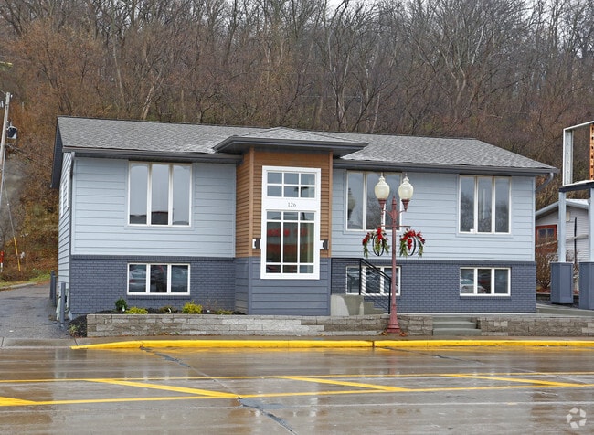
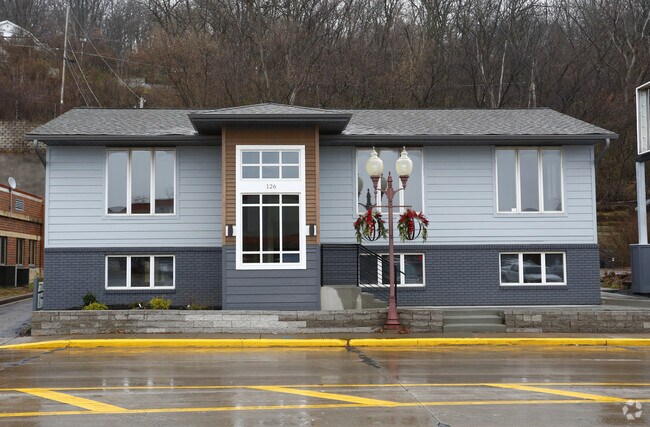
Property Record
126 2Nd St, Hudson, WI 54016

NEARBY LISTINGS FOR SALE OR LEASE
Property Detail
126 2Nd St
Minneapolis-St. Paul-Bloomington, MN-WI
Ranchwood
236-1498-02-000
HUDSON ASSESSORS OUTLOT PLAT; BEING OL 199 & S 1/2 VAC KINNICKINNIC ST LYG N OL 199, OL 196 EXC E 108 FT & ALL OF OL 200 &
Commercialnec
St Croix
X
Wisconsin
27163C0357E
199-201
2025
0.46 AC
2024
St Croix County
120201
Minneapolis/St Paul
2,664 SF
DEMOGRAPHICS near 126 2Nd St
1 Mile
3 Mile
5 Mile
2024 Total Population
4,704
25,116
42,423
2029 Population
5,050
27,054
45,798
Pop Growth 2024-2029
+ 7.36%
+ 7.72%
+ 7.96%
Average Age
41
42
42
2024 Total Households
2,028
10,218
16,855
HH Growth 2024-2029
+ 7.40%
+ 7.77%
+ 8.02%
Median Household Inc
$64,050
$102,682
$109,541
Avg Household Size
2.30
2.40
2.50
2024 Avg HH Vehicles
2.00
2.00
2.00
Median Home Value
$317,977
$354,392
$380,758
Median Year Built
1955
1990
1991
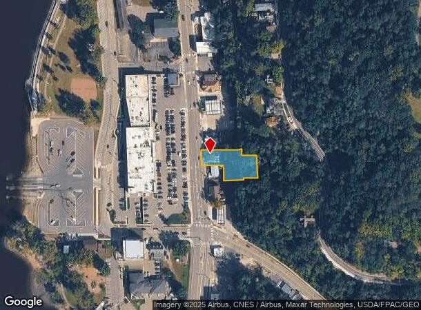
Nearby Places
Map Layers
Map Styles
 Street
 Aerial
- Restaurants
- Banks
- Shops
- Fitness
- Groceries
PUBLIC TRANSPORTATION
AIRPORT
Minneapolis-St Paul International/Wold-Chamberlain
DRIVE
WALK
Distance
Minneapolis-St Paul International/Wold-Chamberlain
30 min
28.9 mi
Freight Ports
Port of Shreveport
DRIVE
WALK
Distance
Port of Shreveport
1 min
873.0 mi
SALE & LEASE HISTORY
LISTING DATE
SALE/LEASE

Oct 06, 2016
For Lease
Apr 21, 2018
For Sale
Nearby Properties
Address
Land Use
TOTAL SIZE
Lot Size
Zoning
Address
Land Use
TOTAL SIZE
Lot Size
Zoning
10.90 AC
Address
Land Use
TOTAL SIZE
Lot Size
Zoning
3.78 AC
Address
Land Use
TOTAL SIZE
Lot Size
Zoning
7.66 AC
Address
Land Use
TOTAL SIZE
Lot Size
Zoning
124,739 SF
10.26 AC
B-2
Address
Land Use
TOTAL SIZE
Lot Size
Zoning
12,271 SF
8.56 AC
B-2
Address
Land Use
TOTAL SIZE
Lot Size
Zoning
2.51 AC
Address
Land Use
TOTAL SIZE
Lot Size
Zoning
100,892 SF
11.32 AC
I-1
Address
Land Use
TOTAL SIZE
Lot Size
Zoning
66,516 SF
5 AC
PRD-2
Address
Land Use
TOTAL SIZE
Lot Size
Zoning
0.90 AC
Address
Land Use
TOTAL SIZE
Lot Size
Zoning
63,024 SF
4.70 AC
Address
Land Use
TOTAL SIZE
Lot Size
Zoning
20,845 SF
4.01 AC
B-2
Address
Land Use
TOTAL SIZE
Lot Size
Zoning
20,456 SF
13.93 AC
B-2
Address
Land Use
TOTAL SIZE
Lot Size
Zoning
92,971 SF
9.56 AC
B-2
Address
Land Use
TOTAL SIZE
Lot Size
Zoning
23,461 SF
9.30 AC
Address
Land Use
TOTAL SIZE
Lot Size
Zoning
28,805 SF
1.67 AC
B-2
Address
Land Use
TOTAL SIZE
Lot Size
Zoning
12,612 SF
4 AC
RM-1
Address
Land Use
TOTAL SIZE
Lot Size
Zoning
86,279 SF
8.46 AC
B-2
Address
Land Use
TOTAL SIZE
Lot Size
Zoning
41,976 SF
2.43 AC
B-2
Address
Land Use
TOTAL SIZE
Lot Size
Zoning
580 SF
1.72 AC
B-2
Address
Land Use
TOTAL SIZE
Lot Size
Zoning
55,072 SF
6.33 AC
B-2
Address
Land Use
TOTAL SIZE
Lot Size
Zoning
18,848 SF
4.41 AC
RM-1
Address
Land Use
TOTAL SIZE
Lot Size
Zoning
Address
Land Use
TOTAL SIZE
Lot Size
Zoning
25,272 SF
3.60 AC
RM-1
Address
Land Use
TOTAL SIZE
Lot Size
Zoning
11,576 SF
3.86 AC
B-2
Address
Land Use
TOTAL SIZE
Lot Size
Zoning
22,788 SF
3.38 AC
Address
Land Use
TOTAL SIZE
Lot Size
Zoning
34,676 SF
2.96 AC
Address
Land Use
TOTAL SIZE
Lot Size
Zoning
18,160 SF
3.38 AC
OFC
Address
Land Use
TOTAL SIZE
Lot Size
Zoning
27,601 SF
3.21 AC
B-2
Address
Land Use
TOTAL SIZE
Lot Size
Zoning
23,955 SF
1.69 AC
B-2
Address
Land Use
TOTAL SIZE
Lot Size
Zoning
13,780 SF
1.62 AC
B-2
The World's #1 Commercial Real Estate Marketplace
Connect with us
© 2026 CoStar Group
The information above has been obtained from sources believed reliable. While we do not doubt its accuracy we have not verified it and make no guarantee, warranty or representation about it. It is your responsibility to independently confirm its accuracy and completeness. Any projections, opinions, assumptions, or estimates used are for example only and do not represent the current or future performance of the property. The value of this transaction to you depends on tax and other factors which should be evaluated by your tax, financial, and legal advisors. You and your advisors should conduct a careful, independent investigation of the property to determine to your satisfaction the suitability of the property for your needs.