Property Record
126 E Flying K Rd, Loxley, AL 36551


NEARBY LISTINGS FOR SALE OR LEASE
Property Detail
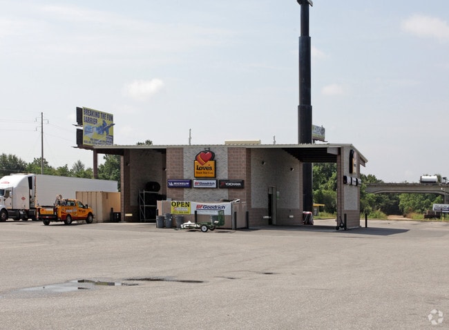
126 E Flying K Rd
33-08-34-0-000-017.000
Southport Un Gulf Shores
Conveniencestore
350'(S) X 650'(S) IRR FM NE COR SW1/4 RUN W 30'(S), TH S 20' (S) TO POB CONT TH S 640'(S), TH W 250'(S), TH NW 650'(S), T H E
X
Baldwin
01003C0544M
Alabama
2024
4.40 AC
2024
Baldwin County
010400
Mobile
8,830 SF
Daphne-Fairhope-Foley, AL
DEMOGRAPHICS near 126 E Flying K Rd
1 Mile
3 Mile
5 Mile
2024 Total Population
56
3,826
14,331
2029 Population
64
4,347
16,282
Pop Growth 2024-2029
+ 14.29%
+ 13.62%
+ 13.61%
Average Age
40
39
37
2024 Total Households
20
1,293
5,013
HH Growth 2024-2029
+ 15.00%
+ 12.99%
+ 13.05%
Median Household Inc
$55,999
$56,016
$62,500
Avg Household Size
2.40
2.60
2.70
2024 Avg HH Vehicles
2.00
2.00
2.00
Median Home Value
$183,333
$198,746
$202,620
Median Year Built
1990
1989
2000
Nearby Places
Map Layers
Map Styles
 Street
 Aerial
- Restaurants
- Banks
- Shops
- Fitness
- Groceries
PUBLIC TRANSPORTATION
AIRPORT
Mobile International
DRIVE
WALK
Distance
Mobile International
30 min
22.4 mi
Mobile Regional
DRIVE
WALK
Distance
Mobile Regional
52 min
32.1 mi
Pensacola International
DRIVE
WALK
Distance
Pensacola International
51 min
40.4 mi
Freight Ports
Port of Mobile
DRIVE
WALK
Distance
Port of Mobile
23 min
18.4 mi
Nearby Properties
Address
Land Use
TOTAL SIZE
Lot Size
Zoning
Address
Land Use
TOTAL SIZE
Lot Size
Zoning
583,381 SF
147 AC
Address
Land Use
TOTAL SIZE
Lot Size
Zoning
178,238 SF
15 AC
Address
Land Use
TOTAL SIZE
Lot Size
Zoning
827,037 SF
106 AC
Address
Land Use
TOTAL SIZE
Lot Size
Zoning
146,762 SF
14 AC
Address
Land Use
TOTAL SIZE
Lot Size
Zoning
234,545 SF
12.20 AC
Address
Land Use
TOTAL SIZE
Lot Size
Zoning
125,294 SF
7 AC
Address
Land Use
TOTAL SIZE
Lot Size
Zoning
26,040 SF
15 AC
Address
Land Use
TOTAL SIZE
Lot Size
Zoning
66,448 SF
8 AC
Address
Land Use
TOTAL SIZE
Lot Size
Zoning
81,447 SF
6.30 AC
Address
Land Use
TOTAL SIZE
Lot Size
Zoning
180,333 SF
7.60 AC
Address
Land Use
TOTAL SIZE
Lot Size
Zoning
144,122 SF
7.60 AC
Address
Land Use
TOTAL SIZE
Lot Size
Zoning
146,751 SF
7.10 AC
Address
Land Use
TOTAL SIZE
Lot Size
Zoning
163,200 SF
7.40 AC
Address
Land Use
TOTAL SIZE
Lot Size
Zoning
144,111 SF
6.90 AC
Address
Land Use
TOTAL SIZE
Lot Size
Zoning
174,174 SF
7 AC
Address
Land Use
TOTAL SIZE
Lot Size
Zoning
48,343 SF
3 AC
Address
Land Use
TOTAL SIZE
Lot Size
Zoning
4,613 SF
6.40 AC
Address
Land Use
TOTAL SIZE
Lot Size
Zoning
39,082 SF
1.67 AC
Address
Land Use
TOTAL SIZE
Lot Size
Zoning
42,423 SF
2.95 AC
Address
Land Use
TOTAL SIZE
Lot Size
Zoning
24,920 SF
5.10 AC
Address
Land Use
TOTAL SIZE
Lot Size
Zoning
6,148 SF
1.12 AC
Address
Land Use
TOTAL SIZE
Lot Size
Zoning
20,000 SF
4.60 AC
Address
Land Use
TOTAL SIZE
Lot Size
Zoning
17,000 SF
6.90 AC
Address
Land Use
TOTAL SIZE
Lot Size
Zoning
6.60 AC
Address
Land Use
TOTAL SIZE
Lot Size
Zoning
73,949 SF
3 AC
Address
Land Use
TOTAL SIZE
Lot Size
Zoning
17,021 SF
0.81 AC
Address
Land Use
TOTAL SIZE
Lot Size
Zoning
18,053 SF
4 AC
Address
Land Use
TOTAL SIZE
Lot Size
Zoning
5,334 SF
2.51 AC
Address
Land Use
TOTAL SIZE
Lot Size
Zoning
24,640 SF
2.20 AC
The World's #1 Commercial Real Estate Marketplace
Connect with us
© 2025 CoStar Group
The information above has been obtained from sources believed reliable. While we do not doubt its accuracy we have not verified it and make no guarantee, warranty or representation about it. It is your responsibility to independently confirm its accuracy and completeness. Any projections, opinions, assumptions, or estimates used are for example only and do not represent the current or future performance of the property. The value of this transaction to you depends on tax and other factors which should be evaluated by your tax, financial, and legal advisors. You and your advisors should conduct a careful, independent investigation of the property to determine to your satisfaction the suitability of the property for your needs.